U.S. flag

An official website of the United States government

Here’s how you know

Dot gov

Official websites use .gov
A .gov website belongs to an official government organization in the United States.

HTTPS

Secure .gov websites use HTTPS
A lock (LockA locked padlock) or https:// means you’ve safely connected to the .gov website. Share sensitive information only on official, secure websites.

    • Environmental Topics
    • Air
    • Bed Bugs
    • Cancer
    • Chemicals, Toxics, and Pesticide
    • Emergency Response
    • Environmental Information by Location
    • Health
    • Land, Waste, and Cleanup
    • Lead
    • Mold
    • Radon
    • Research
    • Science Topics
    • Water Topics
    • A-Z Topic Index
    • Laws & Regulations
    • By Business Sector
    • By Topic
    • Compliance
    • Enforcement
    • Laws and Executive Orders
    • Regulations
    • Report a Violation
    • Environmental Violations
    • Fraud, Waste or Abuse
    • About EPA
    • Our Mission and What We Do
    • Headquarters Offices
    • Regional Offices
    • Labs and Research Centers
    • Planning, Budget, and Results
    • Organization Chart
    • EPA History

Breadcrumb

  1. Home
  2. Hydrologic Modeling Community of Practice

Better Assessment Science Integrating Point and Non-point Sources (BASINS)

This model is being distributed, maintained and actively supported by EPA.

Highlights
  • BASINS Home
  • What's Different about BASINS 4.5?
  • Framework and Features
  • User Information and Guidance
  • Download and Installation
  • Meteorological Data
  • Metadata
  • Model Plugins

On this page:

  • Introduction
  • Why Use BASINS?
  • Contact BASINS Support Team
  • Citation

Introduction

Better Assessment Science Integrating Point and Nonpoint Sources (BASINS) is a multipurpose environmental analysis system designed to help regional, state, and local agencies perform watershed- and water quality-based studies.

It was developed by the U.S. Environmental Protection Agency to assist in watershed management and TMDL development by integrating environmental data, analysis tools, and watershed and water quality models.

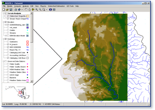
A geographic information system (GIS) provides the integrating framework for BASINS. GIS organizes spatial information so it can be displayed as maps, tables, or graphics. GIS allows the user to analyze landscape information and display relationships among data. Through the use of GIS, BASINS has the flexibility to display and integrate a wide range of information (e.g., land use, point source discharges, and water supply withdrawals) at a scale chosen by the user.

Why Use BASINS?

BASINS makes watershed and water quality studies easier by bringing together key data and analytical components in one tool. BASINS allows users to efficiently access national environmental information, incorporate local site-specific data, apply assessment and planning tools, and run a variety of proven, robust nonpoint loading and water quality models. BASINS is a useful tool for those interested in watershed management, development of total maximum daily loads (TMDLs), coastal zone management, nonpoint source programs, water quality modeling, and National Pollutant Discharge Elimination System (NDPES) permitting.

Screen shot of analysis data
Screen image of analysis in BASINS

Contact BASINS Support Team

For questions about BASINS, please contact Glenn Fernandez (fernandez.glenn@epa.gov).


Citation

The preferred citation for BASINS is:

  • US EPA (2019). BASINS 4.5 (Better Assessment Science Integrating point & Non-point Sources) Modeling Framework. Center for Environmental Measurement and Modeling, Office of Research and Development, Environmental Protection Agency, RTP, North Carolina. BASINS Core Manual. Accessed day month year.

Hydrologic Modeling Community of Practice

  • Modeling Products
  • Groundwater Models
  • Surface Water Models
  • Food Chain Models
  • Multimedia Models
  • Data Provisioning and Modeling Tools
  • Information Sources
    • About This Website
    • Frequent Questions
    • Related Links
    • Distribution and Support Policy
Contact Us About Community of Practice
Contact Us to ask a question, provide feedback, or report a problem.
Last updated on April 23, 2025
  • Assistance
  • Spanish
  • Arabic
  • Chinese (simplified)
  • Chinese (traditional)
  • French
  • Haitian Creole
  • Korean
  • Portuguese
  • Russian
  • Tagalog
  • Vietnamese
United States Environmental Protection Agency

Discover.

  • Accessibility Statement
  • Budget & Performance
  • Contracting
  • EPA www Web Snapshot
  • Grants
  • No FEAR Act Data
  • Plain Writing
  • Privacy
  • Privacy and Security Notice

Connect.

  • Data
  • Inspector General
  • Jobs
  • Newsroom
  • Regulations.gov
  • Subscribe
  • USA.gov
  • White House

Ask.

  • Contact EPA
  • EPA Disclaimers
  • Hotlines
  • FOIA Requests
  • Frequent Questions
  • Site Feedback

Follow.