Alabama Sinkhole Locations
This information is intended to be used in conjunction with US EPA’s Endangered Species Protection Bulletins in Bulletins Live! Two (Bulletins Live! Two -- View the Bulletins | US EPA) for malathion applications to agricultural crops.
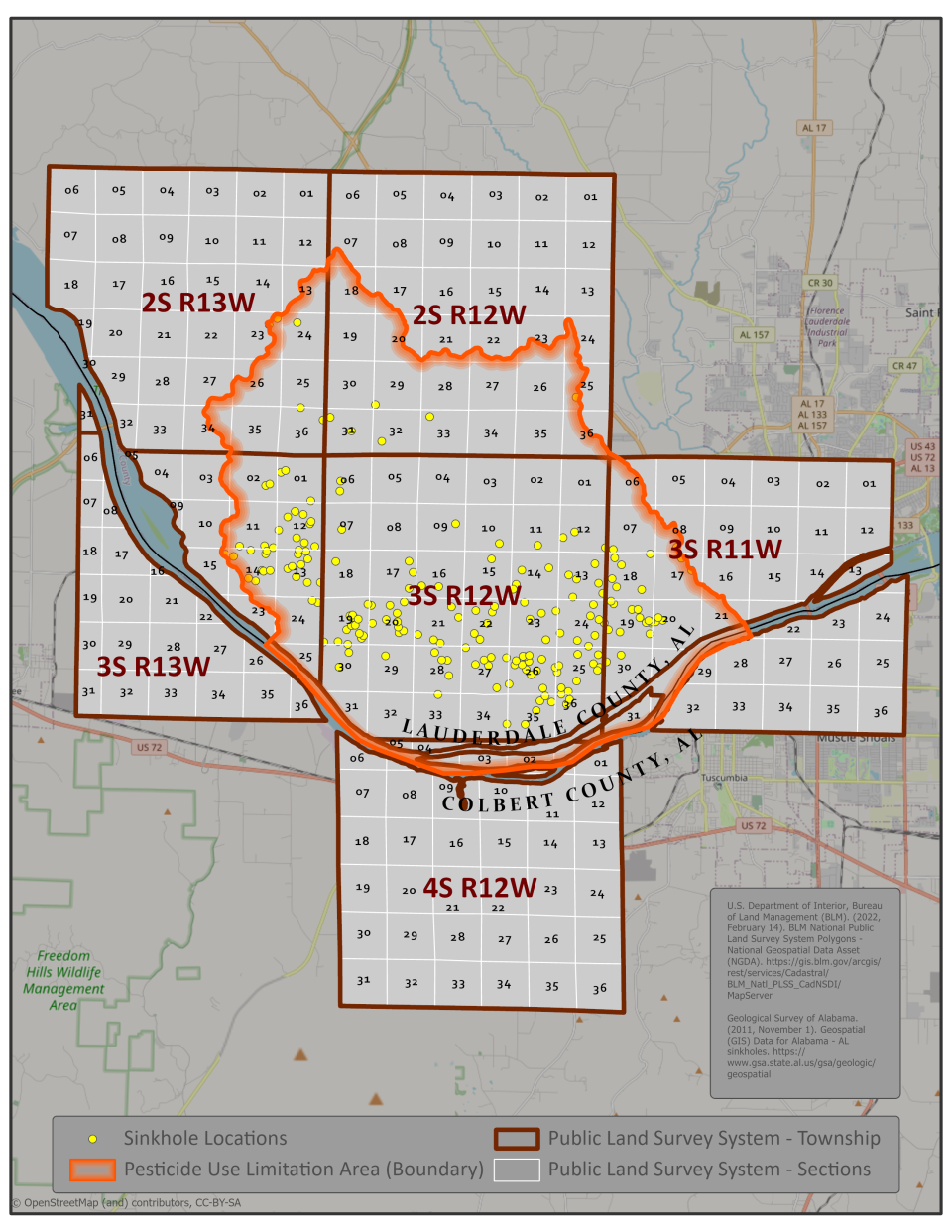
Applicator instructions: on the image below, identify the Public Land Survey System (PLSS) township and section(s) within the Pesticide Use Limitation Area (PULA) in which you intend to apply. Locate your township and sections in the tables below and use the links to open maps displaying the location of sinkholes in the township and sections. Each map displays a ¼ township and can help orient where sinkholes are in relation to pesticide application sites to ensure pesticide use limitations are properly followed. Note that some of the ¼ township maps are wholly within the PULA and therefore the orange PULA outer boundary may not be visible on every ¼ township map. If the township and section in which you intend apply does not have a linked map (i.e., table row indicates “No Map; No Sinkholes” for the township and section(s)), there are no sinkholes in the section and therefore no additional use limitations for this pesticide are needed.
| Township | Sections | Link to Sinkhole Map (1/4 township) |
|---|---|---|
| 2S R12W | 01-03,10-15 | No Map; No Sinkholes |
| 2S R12W | 04-09,16-18 | No Map; No Sinkholes |
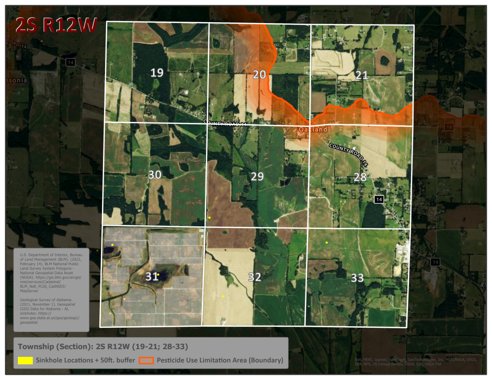
| 2S R12W | 19-21,28-33 | Alabama Township 2SR12W 19-21, 28-33 |
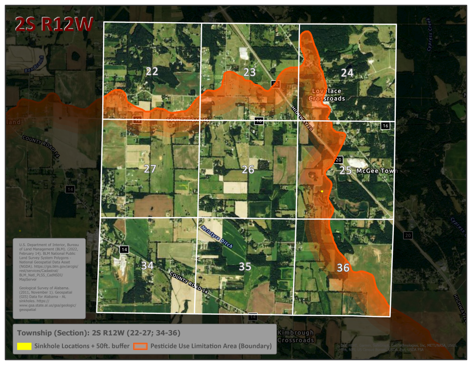
| 2S R12W | 22-27,34-36 | Alabama Township 2SR12W 22-27, 34-36 |
| 4S R12W | 01-03,10-15 | No Map; No Sinkholes |
| 4S R12W | 04-09, 16-18 | No Map; No Sinkholes |
| 4S R12W | 19-21,28-33 | No Map; No Sinkholes |
| 4S R12W | 22-27,34-36 | No Map; No Sinkholes |
| 2S R13W | 01-03,10-15 | No Map; No Sinkholes |
| 2S R13W | 04-09, 16-18 | No Map; No Sinkholes |
| 2S R13W | 19-21,28-33 | No Map; No Sinkholes |
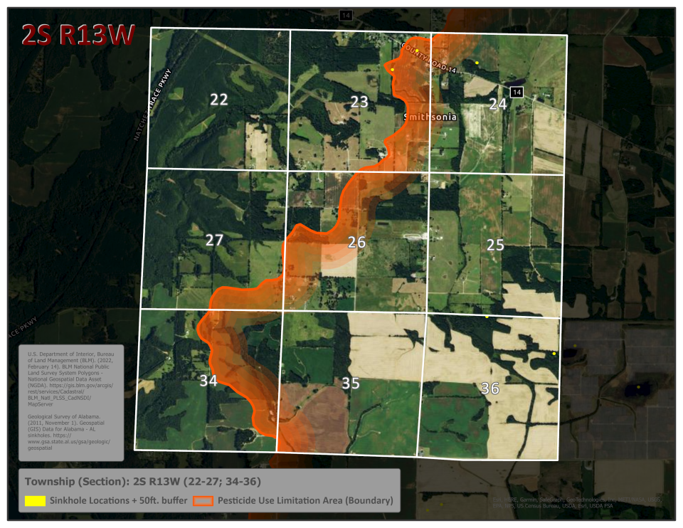
| 2S R13W | 22-27,34-36 | Alabama Township 2SR13W 22-27, 34-36 |
| 3S R11W | 01-03,10-15 | No Map; No Sinkholes |
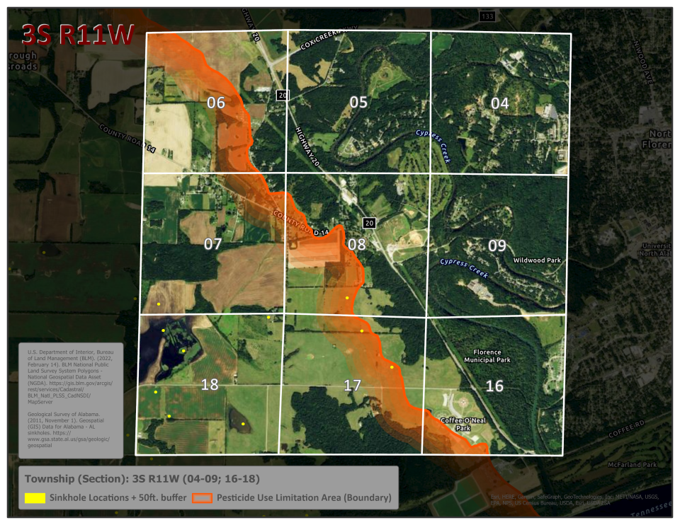
| 3S R11W | 04-09,16-18 | Alabama Township 3SR11W 04-09, 16-18 |
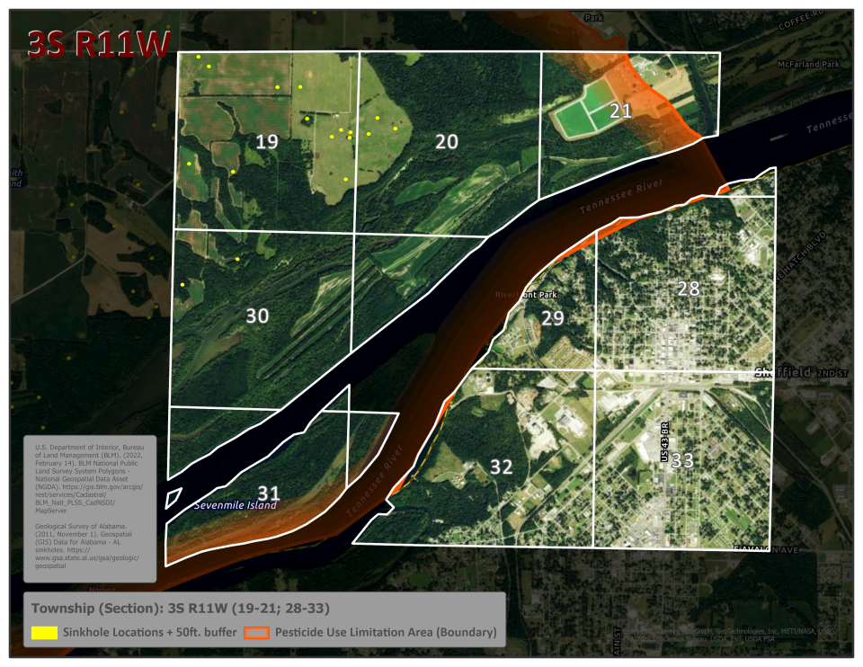
| 3S R11W | 19-21,28-33 | Alabama Township 3SR11W 19-21, 28-33 |
| 3S R11W | 22-27,34-36 | No Map; No Sinkholes |
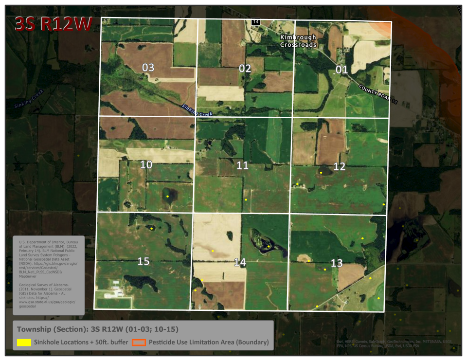
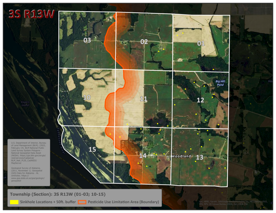
| 3S R12W | 01-03,10-15 | Alabama Township 3SR12W 01-03, 10-15 |
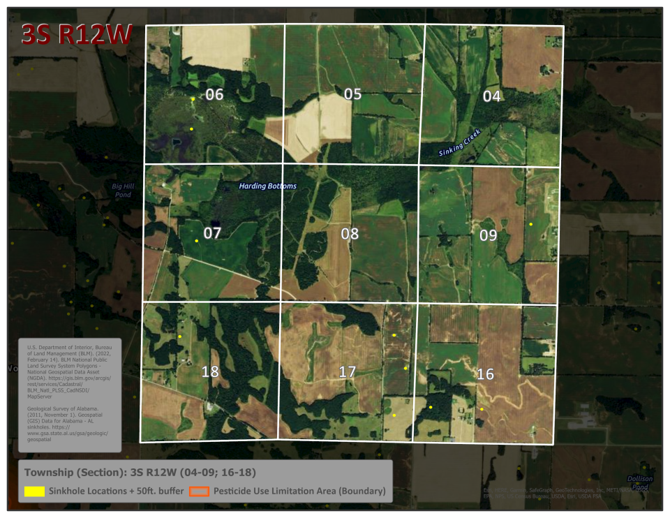
| 3S R12W | 04-09,16-18 | Alabama Township 3SR12W 04-09, 16-18 |
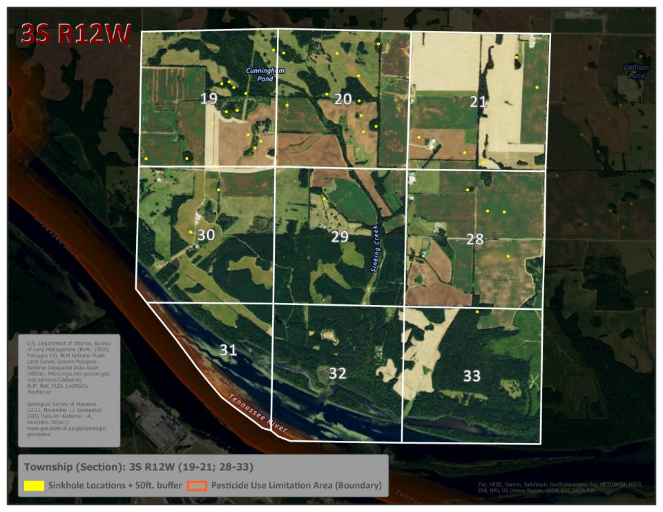
| 3S R12W | 19-21,28-33 | Alabama Township 3SR12W 19-21, 28-33 |
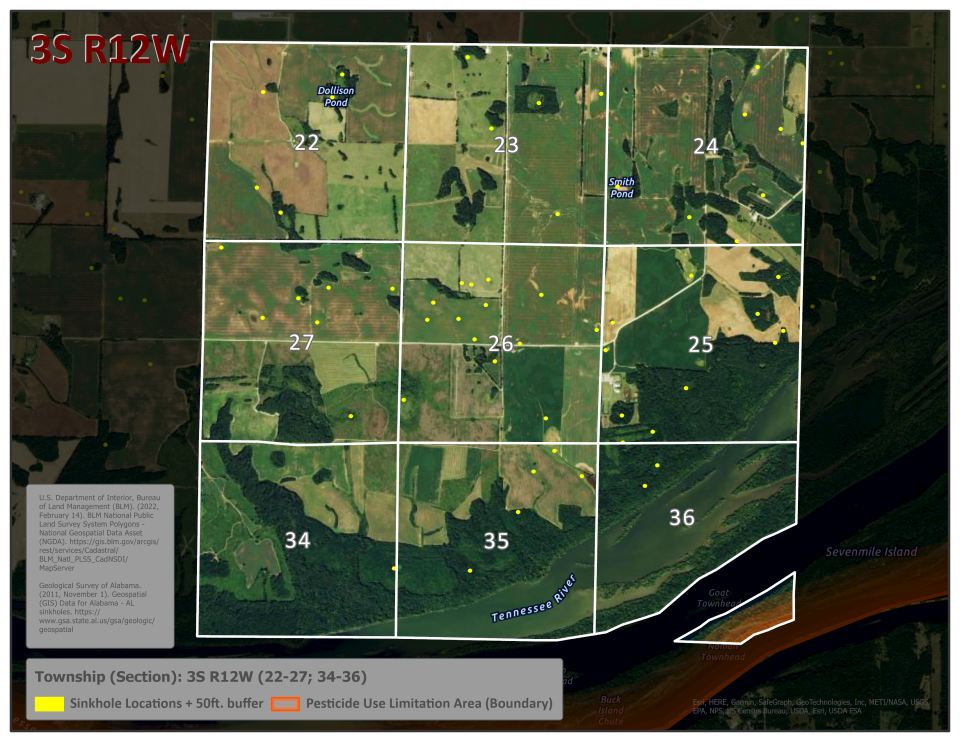
| 3S R12W | 22-27,34-36 | Alabama Township 3SR12W 22-27, 34-36 |
| 3S R13W | 01-03,10-15 | Alabama Township 3SR13W 01-03, 10-15 |
| 3S R13W | 04-09,16-18 | No Map; No Sinkholes |
| 3S R13W | 19-21,28-33 | No Map; No Sinkholes |
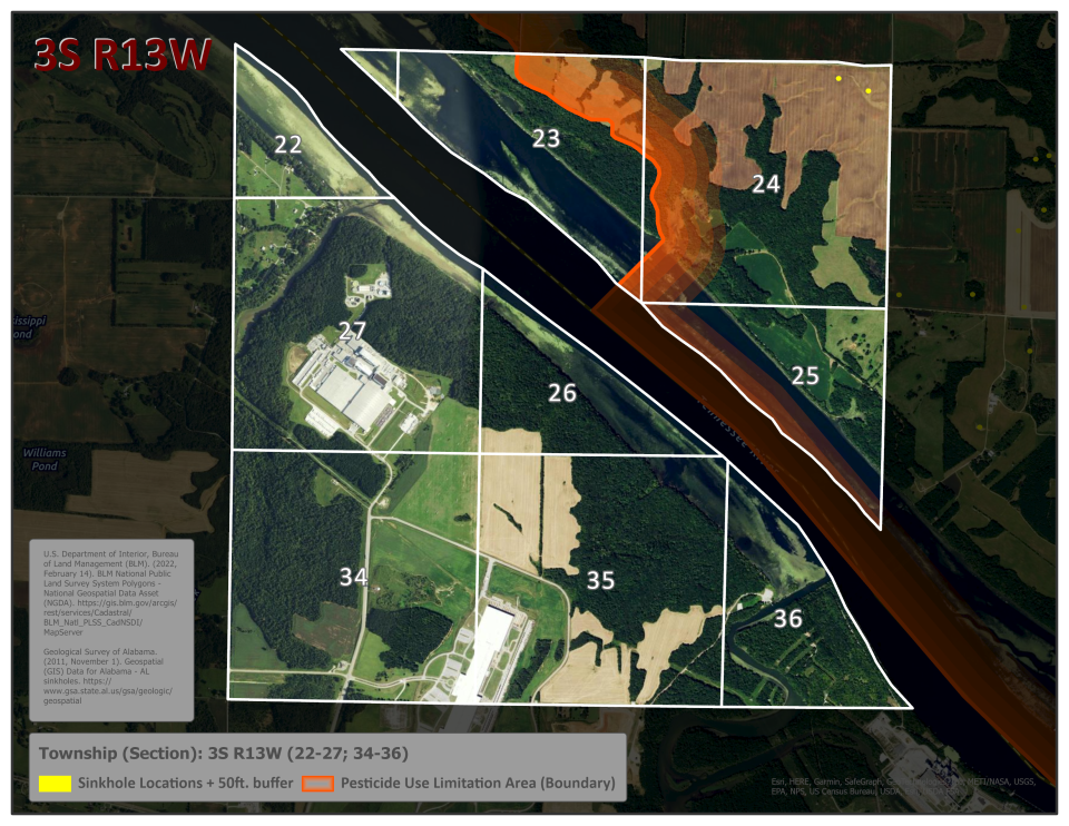
| 3S R13W | 22-27,34-36 | Alabama Township 3SR13W 22-27, 34-36 |
Township and section information obtained from the US Department of the Interior BLM National PLSS National Geospatial Data Asset (BLM Natl PLSS Public Land Survey System Polygons - National Geospatial Data Asset (NGDA) - data.doi.gov). The location of sinkholes obtained from the Geological Survey of Alabama sinkhole points (GSA/OGB (state.al.us)).
Click here to open a pdf document with all ¼ township sinkhole maps within this PULA: BLT Alabama Township Maps All Sinkholes in PULA (pdf) .
Alabama Township 2SR12W 19-21, 28-33
Alabama Township 2SR12W 22-27, 34-36
Alabama Township 2SR13W 22-27, 34-36
Alabama Township 3SR11W 04-09, 16-18
Alabama Township 3SR11W 19-21, 28-33
Alabama Township 3SR12W 01-03, 10-15
Alabama Township 3SR12W 04-09, 16-18
Alabama Township 3SR12W 19-21, 28-33
Alabama Township 3SR12W 22-27, 34-36
Alabama Township 3SR13W 01-03, 10-15
Alabama Township 3SR13W 22-27, 34-36