
Ashtabula River AOC - Delisted
Gerardo Caballero Manriquez
(caballeromanriquez.gerardo@epa.gov)
312-353-1739
The Ashtabula River AOC was delisted in 2021.
Latest News
EPA Removes Ohio’s Ashtabula River from Binational List of Areas of Concern on the Great Lakes
Overview
Beginning in the early 1800s, the lower Ashtabula River was widened and deepened to accommodate commercial shipping and shipbuilding. The shoreline was hardened to accommodate the growing industries. Today almost no natural riverbank habitat remains in the lower portion of the river. In the mid-1900s, chemical companies began operation along the Ashtabula River. Over time, the area became contaminated with mercury, chromium, lead, and zinc, as well as polychlorinated biphenyls, polycyclic aromatic hydrocarbons, chlorinated benzene compounds, chlorinated ethenes, hexachlorobutadiene, uranium, radium, and thorium. Fields Brook, a tributary that enters the river in the AOC, was designated as a Superfund site in 1983. The Fields Brook Superfund site was a large source of contamination to the AOC. Due to this pollution and habitat loss, the Ashtabula River was designated as an AOC under the 1987 Great Lakes Water Quality Agreement.
All BUIs have been removed from the Ashtabula River AOC. It is delisted.
Ashtabula River AOC Delisting Report (pdf)
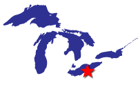
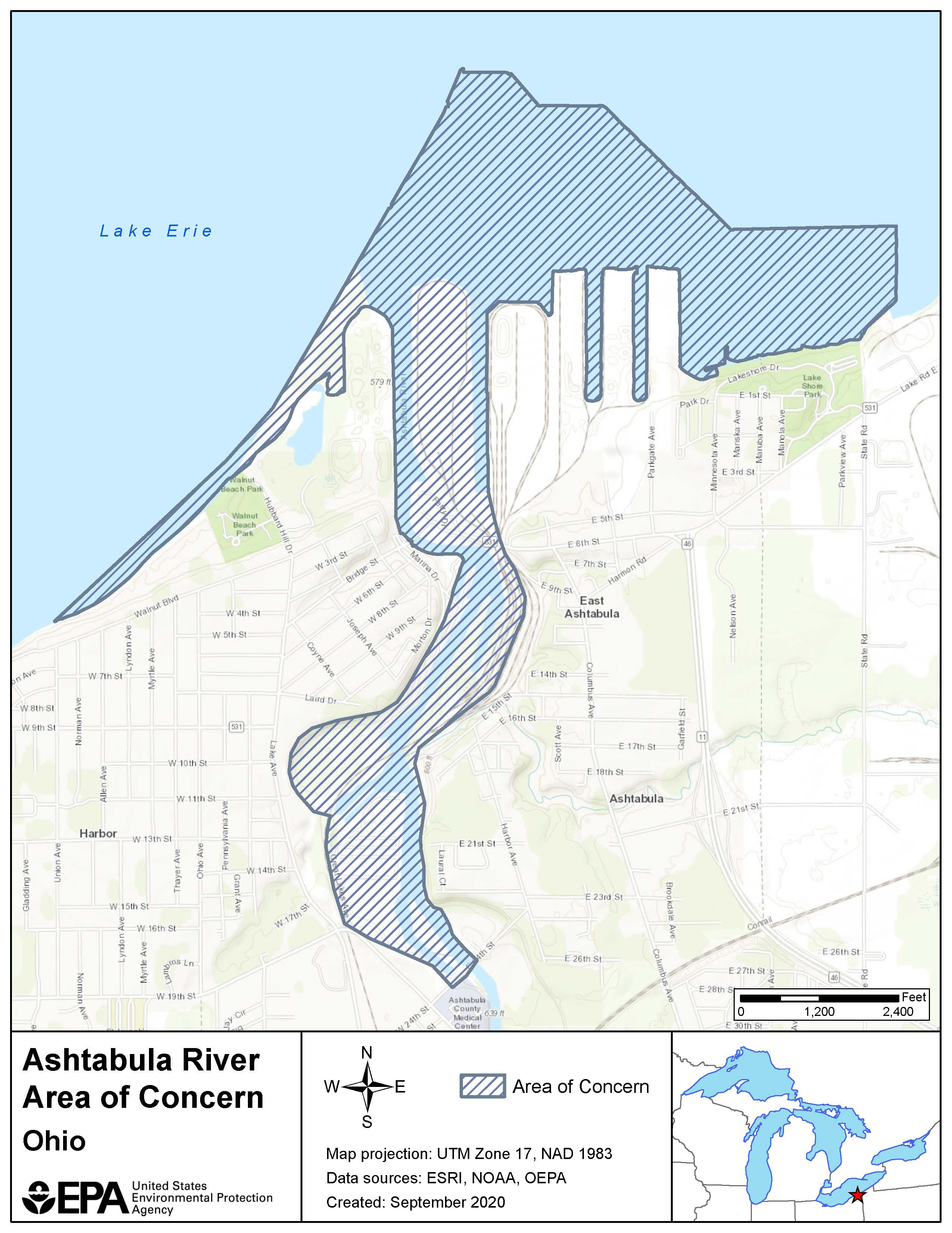
The Ashtabula River AOC encompassed the lower 2.32 miles of the Ashtabula River main stem, from the 24th Street Bridge in the City of Ashtabula to the mouth at Lake Erie; the Outer Harbor, within the east and west shore arms in Lake Erie; and the near Lake Erie shoreline from Walnut Beach, west of the river mouth, to Lakeshore Park Beach, east of the river mouth.
Beneficial Use Impairments
The International Joint Commission originally identified 14 potential Beneficial Use Impairments, which represent different types of significant environmental degradation. Of the 14 possible, six BUIs were identified for the Ashtabula River AOC. All six BUIs have been removed and the AOC is delisted as of 2021. The delisting process included the development of a Delisting Report, an invitation to tribes to consult on the delisting recommendation, and a review by the International Joint Commission and the public.
The list below shows when each BUI was removed.
- Restrictions on Fish and Wildlife Consumption (PDF) - Removed 2014
- Degradation of Fish and Wildlife Populations (PDF) - Removed 2014
- Loss of Fish and Wildlife Habitat (PDF) - Removed 2014
- Degradation of Benthos (PDF) - Removed 2018
- Restrictions on Dredging Activities - Removed 2020
- Fish Tumors or Other Deformities (PDF) - Removed 2019
- General information about BUIs: Beneficial Use Impairments for the Great Lakes AOCs
- BUI removal criteria are set locally.
Remediation and Restoration Work
In 1988, the Ashtabula River Remedial Action Plan Advisory Council was formed, and in 1991, Ohio EPA published the first RAP. A RAP develops a plan to cleanup and restore an AOC. In 2003, remediation actions at the nearby Fields Brook Superfund site, considered to be the main source of contamination to the AOC, were completed. More recently, all AOC remediation and restoration projects or management actions have been completed in the Ashtabula River AOC.
- Documents on Restoring Ashtabula River AOC
- Remediation and Restoration Projects for Ashtabula River AOC
Remediation and Restoration Projects
Remediation Project Highlight: 5 ½ Slip Restoration Effort
A habitat restoration and enhancement plan for the Ashtabula River AOC determined that the 5 ½ Slip and Peninsula had the highest priority for habitat improvement. The 5 ½ Slip property is an 11-acre peninsula centrally located within the AOC and is owned by Norfolk Southern Railway Company. Between 2009 and 2014, funding from a Natural Resource Damage Assessment (NRDA) settlement, the Great Lakes Legacy Act, and the Great Lakes Restoration Initiative was used to restore 3840 linear feet of shoreline and 3.6 acres of upland habitat on the peninsula. Restoration efforts included the creation of approximately 2500 feet of underwater fish shelves, which consisted of tiers of sand, gravel, and aquatic vegetation. The shelves provide shelter for fish to feed and reproduce.
Habitat restoration efforts at this site positively impacted the whole AOC. Post-project monitoring showed significant improvements in fish health and populations. The success of the fish shelves and other habitat improvements were the key to the removal of two BUIs in the Ashtabula River AOC: Degradation of Fish and Wildlife Populations and Loss of Fish and Wildlife Habitat.
Remediation Project Highlight: Ashtabula River Sediment Cleanup
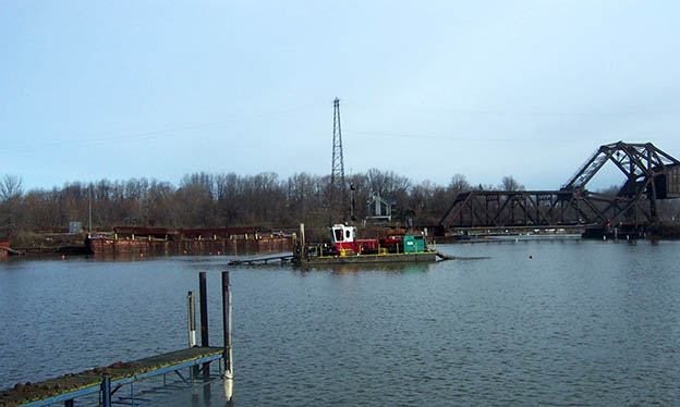
From 2006 to 2007, a GLLA project removed 497,000 cubic yards of polluted sediment from the Ashtabula River. A total of 14,000 pounds of PCBs were dredged from the river, along with low-level radioactive materials, heavy metals, and other pollutants.
To get rid of the polluted sediment, project partners used hydraulic dredging to suction the sediment and remove it from the river. The sediment was moved offsite through a pipeline to a newly created Confined Disposal Facility where it could be processed and contained safely. A sand cover was placed over the dredged areas in select locations to provide a clean sediment surface layer in the river.
The $57.6 million project was funded by the GLLA and the Ashtabula City Port Authority, with additional contributions from the Ohio EPA and the Ashtabula River Cooperation Group II, a group of private companies. This was the first project to be funded by a consortium of industries as cost-share partners. Fourteen industry partners make up the Ashtabula River Cooperation Group II.
This cleanup project not only removed contamination from the food chain, it also provided sufficient water depth for commercial and recreational boating on the Ashtabula River.
Executive Summary of the Remedy Effectiveness Assessment (pdf)
Partners
- U.S. Army Corps of Engineers- Buffalo District
- U.S. Fish and Wildlife Service
- City of Ashtabula Port Authority
- Ohio Environmental Protection Agency
- Ohio Lake Erie Commission
Other Partners for the Ashtabula River
- Ashtabula River Cooperation Group II
- Remedial Action Plan Advisory Council