
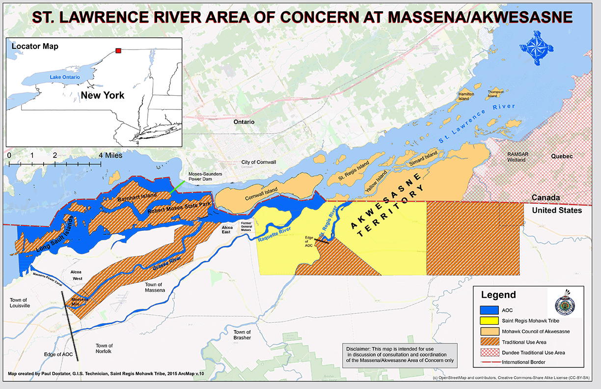
St. Lawrence River AOC at Massena/Akwesasne Boundary Map
The St. Lawrence River at Massena/Akwesasne AOC includes the New York State (NYS) waters of the St. Lawrence River upstream of the Canadian boundary to the Massena public water supply intake; the Grasse River from the mouth upstream to the breached dam in the Village of Massena; the Raquette River from the mouth upstream to the NYS Route 420 bridge; and, the St. Regis River from the mouth upstream to NYS Route 37 bridge at Akwesasne, NY. An adjacent area of special interest is the St. Lawrence River AOC at Cornwall/Akwesasne. It includes the non-U.S. waters from the Moses-Saunders Power Dam to the eastern outlet of Lake St. Francis, including provinces of Ontario and Quebec in Canada and Mohawk Council of Akwesasne territory.
More on the St. Lawrence River AOC
The following files are available for download for the St. Lawrence River AOC at Massena/Akwesasne: