
Waukegan Harbor AOC Boundary Map
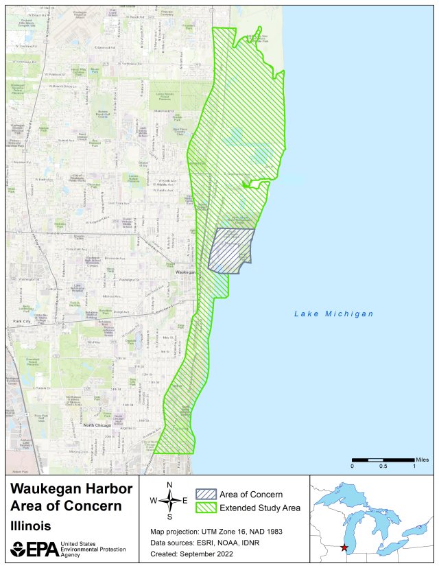
The originally designated Waukegan Harbor AOC is bounded by:
- Government Pier to the south
- Canadian National Railway to the west
- North Ditch to the north
- Lake Michigan shoreline to the east
The Extended Study Area is bound by:
- Dead River in Illinois Beach State Park to the north
- Bluff line parallel to Sheridan Road to the west
- South boundary of the former U.S. Steel Property at 22nd St. in
- North Chicago to the south
- Nearshore waters of Lake Michigan to the east
The following files are available for download for the Waukegan Harbor AOC:
Waukegan Harbor AOC Shapefile (zip)
Waukegan Harbor AOC Boundary Map (kmz)