
Maumee AOC

Leah Medley
(medley.leah@epa.gov)
312-886-1307
On this page:
Latest News
Toledo students help with restoration project in the Maumee AOC
Overview
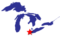
Located in northwest Ohio, the Maumee Area of Concern (AOC) is comprised of 787 square miles, including several watersheds draining to Lake Erie, making it one of the largest AOCs in the United States.
The Maumee AOC has been the site of industrial and municipal development for almost two centuries. For years unregulated waste disposal, industrial contamination from old dumps, contaminated industrial sites, combined sewer overflows and disposal of dredged materials has led to contamination entering the water. The specific contaminants of concern include polychlorinated biphenyls (PCBs), heavy metals and polycyclic aromatic hydrocarbons (PAHs). For example, in the Ottawa river, high levels of PCBs and other contaminants resulted in a no-contact advisory for over 25 years. Some areas, such as the Toussaint Wildlife Area, were historically wetlands, but more than 90% of the wetlands in Northwest Ohio have been lost due to human activities.
Beneficial Use Impairments
Beneficial Use Impairments, or BUIs, are designations given by the International Joint Commission for an AOC. They recognize various examples of significant environmental degradation. As restoration and cleanup projects make progress, monitoring is conducted at the site to determine the level of recovery in environmental health. If sufficient recovery is reached, BUIs can be designated as “removed.”
Originally, the Maumee AOC had 10 BUIs. One BUI, Added Costs to Industry or Agriculture, was removed in 2015. The remaining BUIs, listed below, are impairing waterways that ultimately flow into Lake Erie. Ongoing work within the AOC will address these remaining BUIs, and ultimately lead to their removal.
- Restrictions on Fish and Wildlife Consumption (pdf) Removed August 2022
- Degradation of Fish and Wildlife Populations
- Fish Tumors or Other Deformities
- Degradation of Benthos
- Restrictions on Dredging Activities - Removed August 2024
- Eutrophication or Undesirable Algae
- Beach Closings
- Degradation of Aesthetics - Removed July 2023
- Added Costs to Agriculture or Industry - Removed September 2015
- Loss of Fish and Wildlife Habitat
General information about BUIs: Beneficial Use Impairments for the Great Lakes AOCs
Partners for Clean Streams, in cooperation with the Ohio Environmental Protection Agency, created the Maumee AOC Data Management and Delisting System for tracking and visualizing remediation work to support removal of BUIs.
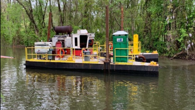
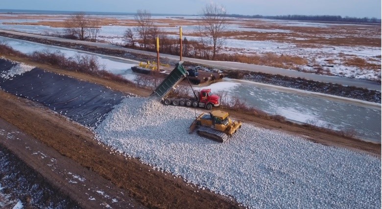
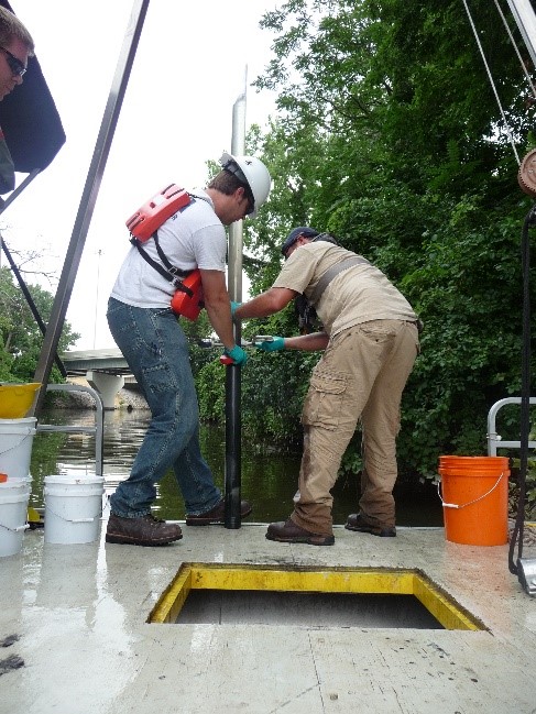
EPA has continually worked with federal, state, and local partners to execute remediation and restoration work in the area to address the existing beneficial use impairments. Efforts towards contaminated sediment remediation and habitat restoration have made significant progress, but there is still much work left to do. There have been two Great Lakes Legacy Act (GLLA) sediment contamination cleanup projects completed within the Maumee AOC, the Ottawa River and Otter Creek projects. Potential future GLLA projects include Swan Creek and the Lower Maumee River. The success of these projects will continue to improve plant and animal populations, help remove BUIs, and contribute to the eventual delisting of the AOC. As the AOC progresses towards delisting, the City of Toledo and the surrounding area will continue to see ecological benefits of a healthy environment and the likely economic benefits that result from an accessible, healthy waterfront. Because of these efforts, those who live in the area have the potential to see an improved overall quality of life tied to restored local natural resources. Highlighted below are a few examples of the many restoration and remediation projects.
-
Completed Project Highlights
Remediation and restoration project accomplishments.
-
Table of Projects
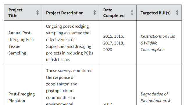
Remediation and restoration project table.
-
Restoration Documents
Remediation and restoration documents.
Restoration Project Highlight: Howard Marsh
Howard Marsh Metropark is a 987-acre property owned by Metroparks Toledo near the Lake Erie Shore in Lucas County. Formerly a coastal marsh, the area was drained and converted into agricultural land more than 75 years ago. Beginning in 2018, Phase 1 converted 732-acres of the property back into wetland habitat including a hydrological connection from the wetland to Lake Erie that enabled enhanced fish passage. Howard Marsh also filters runoff water before it reaches Lake Erie and provides spawning habitat for fish and stopover habitat for birds. The over $8 million Phase 1 project was completed in collaboration through a regional partnership with Ducks Unlimited, Metroparks Toledo, the Ohio Division of Wildlife and Great Lakes Restoration Initiative (GLRI) funding from National Oceanic and Atmospheric Administration (NOAA). Phase 2 of restoration restored and connected the remaining 255 acres of the property. It was completed Spring 2022.
Restoration at this site will contribute to the removal of the Loss of Fish & Wildlife BUI.
Feasibility Study Highlight: Lower Maumee River and Swan Creek
EPA entered into a Great Lakes Legacy Act Project Agreement with Ohio EPA to perform Focused Feasibility Studies (FFS) in the Maumee Area of Concern, Toledo Ohio. The FFSs will evaluate remedial alternatives to address contaminated sediments in the Lower Maumee River and in Swan Creek, a tributary to the Maumee River. The Lower Maumee River FFS was completed in September 2023 and the Swan Creek FFS is expected to be completed in 2024.
Partners
- National Oceanic and Atmospheric Administration
- U.S. Army Corps of Engineers
- U.S. Fish and Wildlife Service
- U.S. Forest Service
- U.S. Geological Survey
- Ohio Lake Erie Commission
- Partners for Clean Streams
- Maumee AOC Advisory Committee
- Great Lakes Commission: Maumee River
- City of Toledo
- Ducks Unlimited
- Lucas County
- The Nature Conservancy
- Ohio Department of Natural Resources
- Ohio EPA
- University of Toledo
- Bowling Green State University