
Caminada Headland Back Barrier Marsh Creation Project
The EPA-sponsored Caminada Headland Back Barrier Marsh Creation (BA-171) project is currently under construction. Working with the Louisiana Coastal Protection and Restoration Authority (CPRA), we will construct approximately 900 acres of coastal habitat in southeast Louisiana. Construction began in June 2020 and dredging was completed in October 2022.
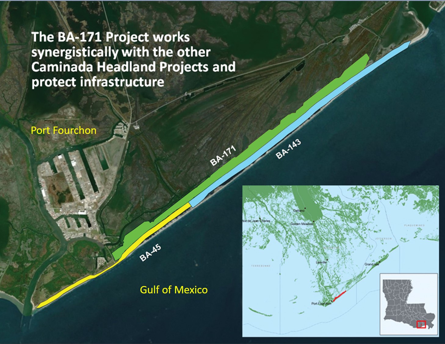
This project not only constructs vital coastal wetlands but works synergistically with the State of Louisiana’s recently constructed Caminada beach and dune project. These restoration projects protect the local community, including nearby Port Fourchon and Highway 1. Port Fourchon is a hub of oil shipping in the northern Gulf of America, and Highway 1 is the only hurricane evacuation route for Grand Isle and other local Louisiana communities.
The Caminada Headland Back Barrier Marsh Creation project is located south of Louisiana Highway 1 between Belle Pass and Caminada Pass and stretches from the area in and around Bay Champagne to the west of Elmer’s Island along the headland. It is along the Louisiana coastline in Lafourche and Jefferson Parishes.
The project area is defined by Highway 1 to the north, Belle Pass to the west, Caminada Pass and Elmer’s Island to the east, and Caminada Headland to the south.
Shoreline Erosion and Land Loss

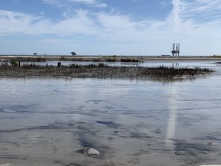
The Caminada Headland has experienced extensive shoreline erosion and land loss to marsh, wetland, beach and dune habitats.
Wetland loss is due largely to storm impacts causing breaching along the headland. As the beach and dune continue to migrate landward, overwash sediments are lost into newly formed open water areas and land loss rates are exacerbated.
Storm overtopping and breaching, saltwater intrusion, wind and wave induced erosion, sea level rise, and subsidence at Caminada are causing some of the highest shoreline retreat rates in Louisiana.
Historically, this rate has been 40 feet per year. Between 2006 and 2011, rates increased to 80 feet per year near Bay Champagne and 110 feet per year near Bayou Moreau.
Restoration
Restoration of the Caminada Headland is occurring incrementally and through synergistic, collaborative efforts.
The CWPPRA Task Force approved construction funds for BA-171 in 2017. With CWPPRA Task Force approval in April 2019, the project footprint was expanded to include Caminada Headland Back Barrier Marsh Creation, Increment II (BA 193), a project from Priority Project List 25. Construction bids were opened January 2020. When construction bids exceeded the approved CWPPRA construction budget, the CWPPRA Task Force approved an additional $3M. In addition, the Louisiana Department of Natural Resources beneficial use program contributed $3M more in funding, adding 169 acres onto the eastern end of the project footprint and enabling the State of Louisiana to award the construction contract.
- Project Design
CPRA engineers use topographic and bathymetric surveys and field information to analyze the existing project area. A suitable borrow area for fill materials is identified by taking Gulf of Mexico sediment samples and analyzing them for their physical characteristics. Soil samples are also taken from within the project fill area to estimate the required fill quantities and to design temporary earthen containment dikes to contain the sediment slurry dredged from the Gulf of America. These projects would not be possible without the cooperation of private landowners.
- Construction
Heavy equipment referred to as marsh buggies builds up earthen containment dikes prior to dredging. A large hydraulic cutterhead dredge is towed to the Gulf of America borrow site. Pipes are laid from the dredge onto the shoreline and into the project location.
The dredge excavates material from the bottom of the Gulf of America and pumps it into the project fill area confined by the containment dikes. The excess water is decanted leaving behind sediments and creating marsh. Barrier island vegetation is strategically planted to retain sediments as needed and foster natural colonization.
Construction of the earthen containment dikes began in June 2020. Dredging began in the summer of 2022 and was completed in October 2022. Next steps include vegetative plantings on the newly formed marsh platform in early Spring 2023.
Benefits
- Approximately 900 acres of valuable coastal habitat
- Works synergistically with the State of Louisiana sponsored Caminada beach and dune restoration projects completed in 2015 and 2016
- Provides a platform for the beach and dune sediments to roll onto instead of being lost into deep water
The project also protects the local community against storm surge and flooding, including nearby Port Fourchon which supplies nearly 20 percent of the nation’s oil and gas. There are many pipelines and oil and gas infrastructure in the project area including the Louisiana Offshore Oil Platform (LOOP). The LOOP is an essential energy transport hub, receiving and storing crude oil for delivery to the nation’s refineries. Coastal wetlands are the first line of defense against storm surge and a key factor in making communities and vital infrastructure more resilient to storms. The Caminada Headland protects Highway 1, which provides critical access to the nation's energy, fisheries, and tourism sectors.
Partners
EPA is proud to be the CWPPRA federal sponsor of the Caminada Headland Back Barrier Marsh Creation project. We would like to thank our project partners including CPRA, Edward Wisner Donation Trust of New Orleans, Louisiana, and the Caillouet Land Corporation.
Learn more about CWPPRA. Learn about other EPA-Sponsored CWPPRA Projects.