
StreamCat Dataset
On this page:
Access StreamCat Data | StreamCat Documentation | Data Structure | Feedback
The FTP server has been retired and StreamCat data is now available through api.epa.gov
StreamCat's REST API has moved to api.epa.gov/StreamCat see StreamCat's Swagger Documentation for details.
You can now only access data via the map tool, table tool, StreamCat R Package, and REST API. See Access StreamCat Data for more information
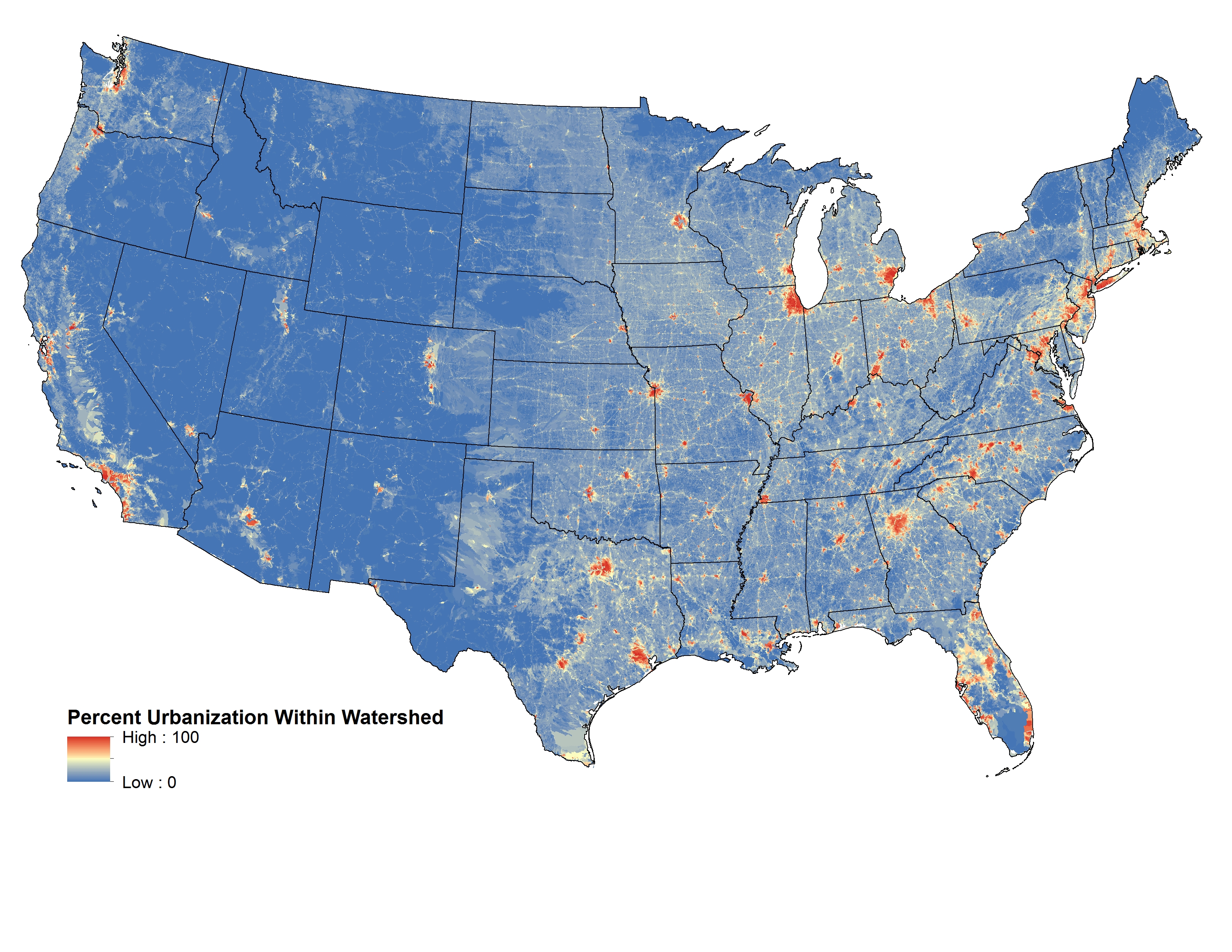
StreamCat currently contains over 600 metrics that include local catchment (Cat), watershed (Ws), and other special metrics. The special metrics were derived through modeling or by combining other StreamCat metrics. These variables include predicted water temperature, predicted biological condition, and the indexes of catchment and watershed integrity. See Geospatial Framework and Terms below for definitions of catchment and watershed as used with the StreamCat Dataset.
These metrics are available for ~2.65 million stream segments and their associated catchments across the conterminous US. StreamCat metrics represent both natural (e.g., soils and geology) and anthropogenic (e.g, urban areas and agriculture) landscape information.
Access StreamCat Data
- Data by Individual Catchments via Map Interface
- Data by Regions, States, Counties via Menu Interface
- R Programming Interface
Data via EPA WATERS Watershed Characterization Service
- This is a service providing an HTML report or JSON object listing both standard NHDPlus and StreamCat metrics for a given COMID provided by the user. See HTML Examples in link above, and simply pass a COMID of interest to end of the URL (i.e. pComID=4795168).
StreamCat Documentation
- A detailed description of the StreamCat Dataset and its development is now available in the Journal of the American Water Resources Association.
- The Read Me page provides additional detail and important information on how to access and use the StreamCat Dataset.
- StreamCat Swagger Documentation.
- The Variable List provides a description of available watershed metrics.
- Metadata
- Information on the steps we followed to acquire geospatial layers to develop the StreamCat Dataset, any manipulations done to those data, and quality assurance steps can be found in Data Processing and Quality Assurance.
- The StreamCat GitHub page has the latest working versions of StreamCat code and a brief description of each script we used to develop the StreamCat Dataset, including examples of tables used to control the processing of StreamCat with.
- Publications that have referenced StreamCat.
- Updates to the StreamCat dataset will be reported on the StreamCat Updates page.
Data Structure
Data are distributed by US State or NHDPlusV2 Hydrologic Region (see Read Me for additional details). Within States or HydroRegions, data are distributed by major data source (e.g., STATSGO Soils, National Land Cover Database).

Citation
Please include the following citation in any publication or presentation including StreamCat data:
Hill, Ryan A., Marc H. Weber, Scott G. Leibowitz, Anthony R. Olsen, and Darren J. Thornbrugh, 2016. The Stream-Catchment (StreamCat) Dataset: A Database of Watershed Metrics for the Conterminous United States. Journal of the American Water Resources Association (JAWRA) 52:120-128. DOI: 10.1111/1752-1688.12372.
Feedback
We welcome any feedback on StreamCat - email weber.marc@epa.gov.
Disclaimer
Although these data have been processed successfully on a computer system at the United States Environmental Protection Agency (EPA), no warranty expressed or implied is made regarding the accuracy or utility of the data on any other system or for general or scientific purposes, nor shall the act of distribution constitute any such warranty. It is also strongly recommended that careful attention be paid to the contents of the metadata file associated with these data to evaluate data set limitations, restrictions, or intended use. The EPA shall not be held liable for improper or incorrect use of the data described and/or contained herein.