
EPA Cleanups: Communities around New Bedford Harbor
-
General Information
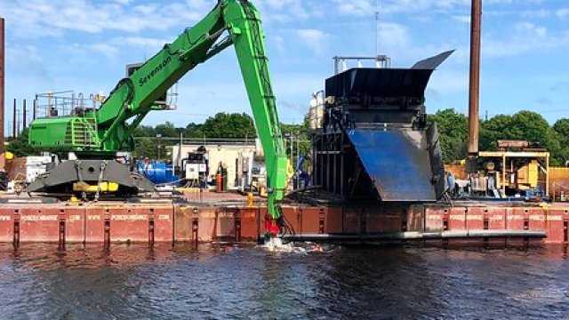
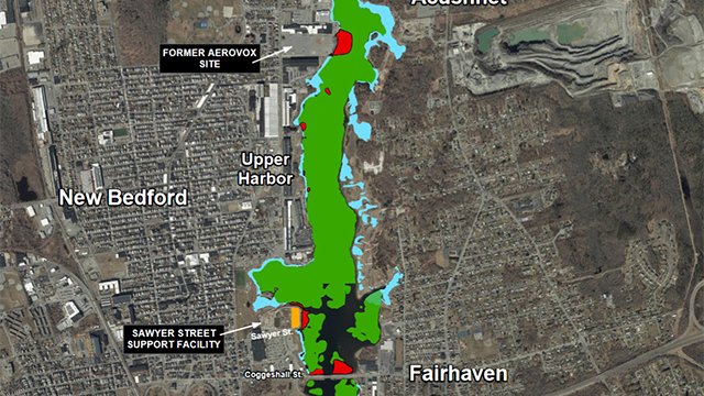
Find information about the New Bedford Harbor Site's history, cleanup activities, and upcoming work.
-
Harbor Cleanup Plans and Data
EPA database for the extensive monitoring program conducted in the New Bedford Harbor.
-
Seafood Monitoring

Seafood consumptions recommendations for fish and shellfish based on MA regulations and EPA recommendations.
Popular Documents and Resources
- EPA Seafood Consumption Advisory Signage Map
- Publicly Available Documents Collection
- Site Fact Sheets and Community Updates
- Seafood Monitoring Reports
- Massachusetts Department of Public Health Consumption Advisories
- Cleanup Documents