
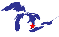
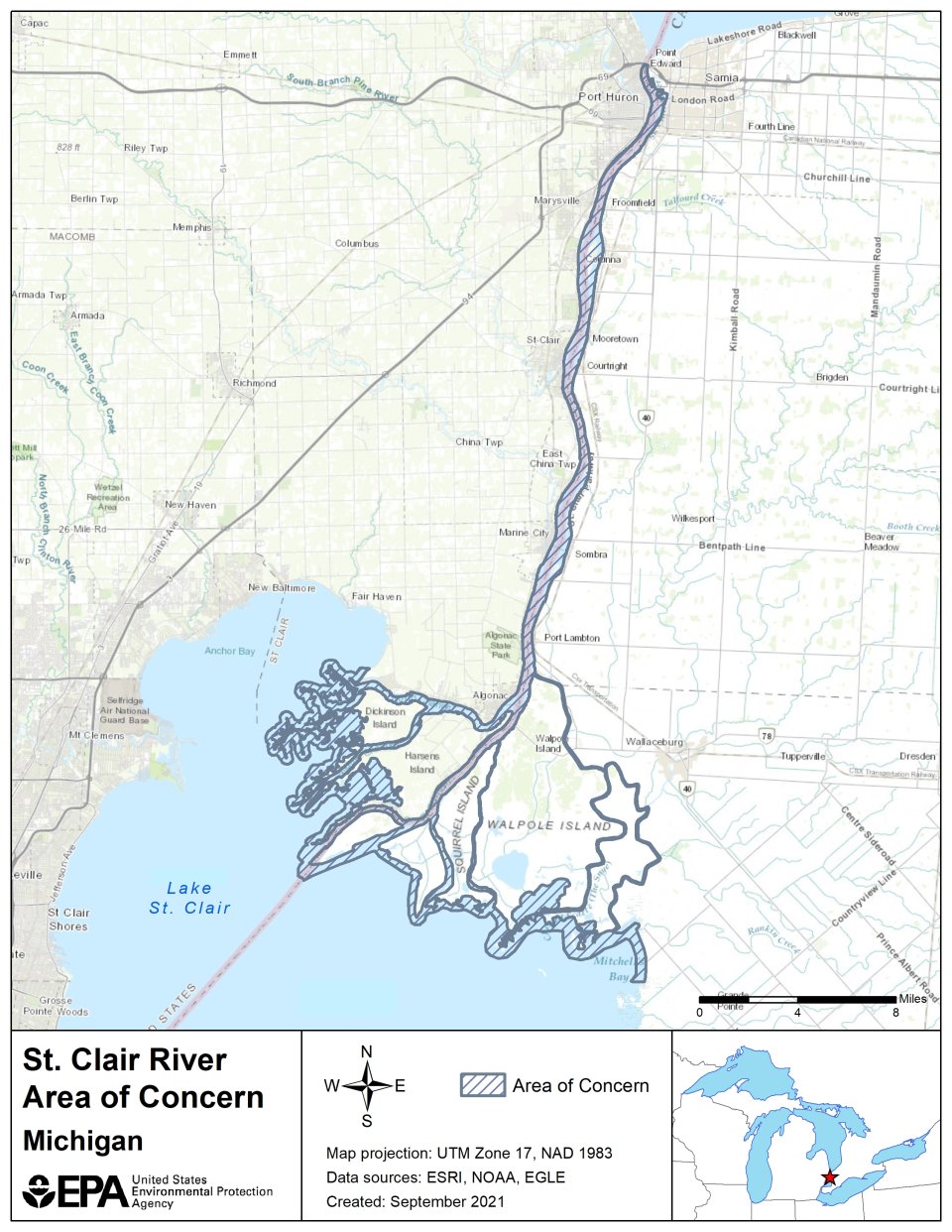
St. Clair River AOC
Trent Henry
(henry.trent@epa.gov)
312-886-5031
Overview
The St. Clair River AOC is a binational AOC, sharing a border with Canada. The boundary of the AOC includes the entire river from the Blue Water Bridge (connecting Sarnia, Ontario, and Port Huron, Mich.) to the southern tip of Seaway Island, Ontario, west to St. John’s Marsh in Michigan, and east to include the north shore of Mitchell’s Bay on Lake St. Clair.
The St. Clair River was originally identified as an AOC due to contamination in the river and sediment including heavy metals, toxic organics, and E. Coli bacteria. These contaminants led tainted fish flavor and fish consumption advisories. They also led to beach closings, further limiting recreational opportunities available to the public in the AOC. Additionally, industrial, navigational, urban, and agricultural developments in the AOC had resulted in the degradation of tributary, wetland, river, shoreline, and benthic habitat. This decreased in healthy habitat available for native fish and wildlife populations.
Beneficial Use Impairments
Beneficial Use Impairments (BUIs) are designations created by the International Joint Commission (IJC), representing different types of significant environmental degradation. Of 14 possible BUIs identified by the IJC, 10 BUIs were identified in the United States side of the St. Clair River AOC. The removal of BUIs is a good indication the environment is positively responding to the remediation and restoration work. Thanks to long-running efforts through the St. Clair River Binational Public Advisory Committee and other stakeholders, many BUIs have successfully been removed. Once all BUIs have been removed, the process of delisting the AOC can begin.
- Restrictions on fish and wildlife consumption
- Tainting of fish and wildlife flavor – Removed November 2009
- Restrictions on drinking water consumption, or taste and odor
- Beach closings – Removed May 2016
- Degradation of aesthetics – Removed July 2012
- Bird or animal deformities or reproduction problems – Removed 2017
- Added costs to agriculture or industry – Removed June 2012
- Degradation of benthos – Removed November 2014
- Restriction on dredging activities – Removed March 2011
- Loss of fish and wildlife habitat – Removed September 2017
General information about BUIs: Beneficial Use Impairments for the Great Lakes AOCs
Remediation and Restoration Work
The St. Clair River is one of 11 AOCs that has finished all on-the-ground work and is designated as ‘Management Actions complete’. GLRI provided $21 million in funding for 10 habitat restoration projects that covered 13 locations across the AOC. These projects took place from 2012-2014 and involved restoration for in-water, benthic, shoreline, wetland, and upland habitats.
Projects aimed to increase healthy habitat for fish populations and benthic invertebrates involved installing three fish spawning reefs, anchoring trees to the streambank, removing 2,200 feet of failing steel seawall, and reconnecting the river’s floodplain and wetlands. New wetlands were also created in an area that was previously designated as a Brownfield. One habitat project used strategic dredging to remove 35,000 cubic yards from three miles of the Krispin Blueway, reshaping the drain to allow for increased waterflow and provide habitat for turtle, bird, fish, and insect populations. These projects also led to increase fish passage in the AOC.
Shoreline restoration projects involved the creation of in-river breakwaters and the placement of riparian cobble substrate and woody structures. Invasive species were treated and removed from shoreline and nearshore areas and native trees, shrubs, and wildflowers were planted. Approximately one mile of shoreline was successfully restored.
Restoration projects also helped increase recreation opportunities at the St. Clair River. A new recreational path that bisects the AOC’s wetlands was installed, as was a new boardwalk along the river. Increased fish habitat also allows anglers better fishing opportunities.
- Documents on Restoring the St. Clair River AOC
- Remediation and Restoration Projects for the St. Clair River AOC
- St. Clair River AOC Remedial Action Plan 2008 Update (319 KB)
- For more information on restoration projects, see the St. Clair River Habitat Restoration Fact Sheet
Restoration Project Highlight: Cottrellville Township Shoreline Restoration
In 2015 a habitat restoration project in the St. Clair River AOC was completed within the riverbank or riparian areas and along 500 linear feet of river shoreline.
Before restoration, the Cottrellville shoreline had an extensive near-shore shelf with little habitat.
The project objectives of this restoration achieved:
- improved native vegetation and riparian buffer;
- improved fish, macroinvertebrate, and amphibian diversity/population;
- erosion reduction;
- improved stability of the shoreline to enhance the shallow water and near shore habitat; and
- wetlands establishment.
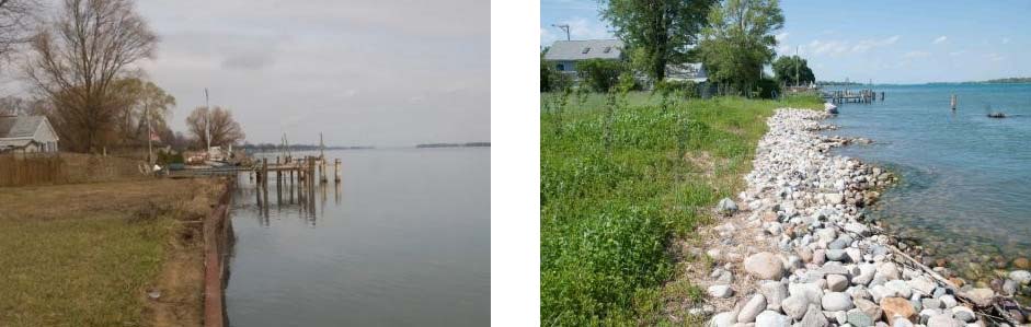
Targeted BUI:
Loss of Fish and Wildlife Habitat
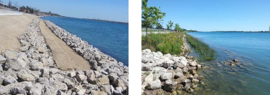
Restoration Project Highlight: Marysville Living Shoreline Restoration
This shoreline project removed and replaced a total of 1,885 feet of vertical steel seawall, creating a more resilient and natural shoreline and providing fish and wildlife habitat restoration. It helped advance the removal of the Loss of Fish and Wildlife Habitat BUI in the St. Clair River Area of Concern.
This project reestablished vital fish and wildlife habitat along the St. Clair River. Newly planted wetland vegetation established a “living shoreline” that provides spawning and nursery habitat for Great Lakes fish. Emergent wetland and upland prairie vegetation will benefit birds and other wildlife. In addition, the upgrades made to the adjacent public walkway and boardwalk improved fishing and recreational access for the community and visitors.
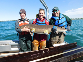
Restoration Project Highlight: St. Clair River Spawning Reef
Growing to lengths of 7 feet and weighing up to 300 pounds, the Lake Sturgeon is the largest fish in the Great Lakes. They are classified as threatened or endangered in seven of the eight Great Lakes states.
The St. Clair River is home to the largest remaining Great Lakes spawning populations of Lake Sturgeon. Many of the natural limestone reefs and rocky areas that served as spawning grounds were destroyed in the St. Clair River during construction of shipping channels. To increase Lake Sturgeon, Whitefish and Walleye populations, a series of river-bottom rock structures suitable for spawning were constructed. Between 2004 and 2015, more than 6 acres of spawning habitat were created at three locations in U.S. waters of the St. Clair River.
Helping to determine current Sturgeon populations, capture-release tagging studies are performed. During a tagging study, scientists record the sex, length, and weight of each fish caught. In addition to a fin tag, an electronic tag implant is attached. The scientists also harvest a section of the fin ray to determine aging and genetics. Before releasing back into the wild, blood is occasionally taken for contaminants research.
Targeted BUI:
Loss of Fish and Wildlife Habitat