U.S. flag

An official website of the United States government

Here’s how you know

Dot gov

Official websites use .gov
A .gov website belongs to an official government organization in the United States.

HTTPS

Secure .gov websites use HTTPS
A lock (LockA locked padlock) or https:// means you’ve safely connected to the .gov website. Share sensitive information only on official, secure websites.

    • Environmental Topics
    • Air
    • Bed Bugs
    • Cancer
    • Chemicals, Toxics, and Pesticide
    • Emergency Response
    • Environmental Information by Location
    • Health
    • Land, Waste, and Cleanup
    • Lead
    • Mold
    • Radon
    • Research
    • Science Topics
    • Water Topics
    • A-Z Topic Index
    • Laws & Regulations
    • By Business Sector
    • By Topic
    • Compliance
    • Enforcement
    • Laws and Executive Orders
    • Regulations
    • Report a Violation
    • Environmental Violations
    • Fraud, Waste or Abuse
    • About EPA
    • Our Mission and What We Do
    • Headquarters Offices
    • Regional Offices
    • Labs and Research Centers
    • Planning, Budget, and Results
    • Organization Chart
    • EPA History

Breadcrumb

  1. Home
  2. National Aquatic Resource Surveys

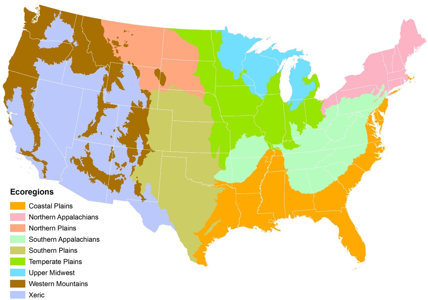
Ecoregional Results - National Rivers and Streams Assessment 2018-19

For each ecoregion, the National Rivers and Streams Assessment 2018-19 assessed information on a number of important indicators . 

To highlight key findings from each ecoregion, the user can examine and compare results across condition categories for:

  • biological condition based on benthic macroinvertebrates
  • key stressors
  • changes in river and stream condition between the 2013-14 and 2018-19 report*

Results for the "good" category for all indicators are also presented in a graphical format to allow users to examine and compare results more fully across this category. 

Additional ecoregion-level results are available on our interactive NRSA Dashboard, including information on individual indicators across all four condition categories. General descriptions of the ecoregions are available on the NARS Ecoregions page.

  • Coastal Plains
  • Northern Appalachians
  • Northern Plains
  • Southern Appalachians
  • Southern Plains
  • Temperate Plains
  • Upper Midwest
  • Western Mountains
  • Xeric
Ecoregional Map of the Conterminous United States

National Aquatic Resource Surveys

  • Background
    • Indicators
    • Manuals
    • Map of Sampled Sites
  • NARS Data
    • Journal Articles
    • Applying the Data
    • LakeCat
    • StreamCat
  • National Coastal Condition Assessment
  • National Lakes Assessment
  • National Rivers and Streams Assessment
  • National Wetland Condition Assessment
  • Outreach Materials
Contact Us about National Aquatic Resource Surveys
Contact Us to ask a question, provide feedback, or report a problem.
Last updated on November 27, 2024
  • Assistance
  • Spanish
  • Arabic
  • Chinese (simplified)
  • Chinese (traditional)
  • French
  • Haitian Creole
  • Korean
  • Portuguese
  • Russian
  • Tagalog
  • Vietnamese
United States Environmental Protection Agency

Discover.

  • Accessibility Statement
  • Budget & Performance
  • Contracting
  • EPA www Web Snapshot
  • Grants
  • No FEAR Act Data
  • Plain Writing
  • Privacy
  • Privacy and Security Notice

Connect.

  • Data
  • Inspector General
  • Jobs
  • Newsroom
  • Regulations.gov
  • Subscribe
  • USA.gov
  • White House

Ask.

  • Contact EPA
  • EPA Disclaimers
  • Hotlines
  • FOIA Requests
  • Frequent Questions
  • Site Feedback

Follow.