
Superfund Sites in Reuse in Nebraska
If you are having trouble viewing the map in your browser, click the 'View larger map' link below
10TH STREET SITE
The 444-acre 10th Street Site Superfund site is in Columbus, Nebraska. Sampling by the state in 1983 found contaminants in city water supply wells. Further studies identified three dry-cleaning facilities as the source of soil contamination. EPA added the site to the National Priorities List in 1990. A 2003 city ordinance banned the use of private groundwater wells in the area of contamination. The remedy consisted of an air sparging/soil vapor extraction system to address a source area and a groundwater extraction and treatment system that were operational and functional in 2004. EPA put vapor mitigation systems in nine residential and commercial buildings affected by contaminated vapors from groundwater. All three dry-cleaning facilities have been demolished. EPA dug up contaminated soil and replaced it with clean soil. Institutional controls restrict land use. These former source areas will be returned to the city of Columbus for future use. Residential and commercial areas above the area of groundwater contamination remain in continued use.
Last updated October 2025
As of December 2025, EPA did not have economic data related to on-site businesses, or economic data were not applicable due to site use. For additional information click here.
For more information:
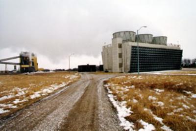
BRUNO CO-OP ASSOCIATION/ASSOCIATED PROPERTIES
The 64-acre Bruno Co-Op Association/Associated Properties Superfund site is in Bruno, Nebraska. It includes two once-contaminated municipal wells and a groundwater plume. The U.S. Department of Agriculture opened grain storage facilities on-site in the 1940s. Workers treated grain with chemicals to control pests, resulting in the contamination of groundwater below the site. In 1984, testing by the Nebraska Department of Health found chemicals in two public drinking water supply wells. EPA added the site to the National Priorities List in 1996. EPA temporarily supplied bottled water to affected residents and then connected their homes to the public water supply. Land use controls restrict the use of the contaminated groundwater under the site. The remedy for the site is a groundwater pump-and-treat system. EPA approved shutting down the GETS in 2020 as the levels of contamination were too low for the system to efficiently remove contamination. Contamination still exceeds cleanup goals at the source area, and the potentially responsible parties continue to monitor groundwater as they develop a path forward to achieve remediation goals and close out the site. Treated water is made available to locals for non-potable use. Water from Bruno’s former public water supply wells is also available for non-potable use. Residential and agricultural grain storage areas remain in continued use on-site.
Last updated October 2025
As of December 2025, EPA had data on 2 on-site businesses. These businesses employed 8 people and generated an estimated $942,412 in annual sales revenue. For additional information click here.
For more information:
CLEBURN STREET WELL
The Cleburn Street Well Superfund site includes several areas of soil and groundwater contamination in downtown Grand Island, Nebraska. Prior to 1986, the Cleburn Street Well provided drinking water to the city of Grand Island. Contamination found in the well in 1986 led to EPA’s involvement at the site. EPA added the site to the National Priorities List in 1992. The agency traced the contamination to three dry-cleaning facilities and a former solvents distribution company. EPA leads the cleanup of the well and the dry-cleaning facilities. Union Pacific Railroad owns the former solvents distribution property. It leads the cleanup of that location. Cleanup includes groundwater extraction and treatment and in-place soil treatment. EPA took cleaned-up parts of the site off the NPL in 2019. Today, there are new and continued uses at the site. One of the dry cleaners is still active. The other former dry-cleaning properties are now in use as a car dealership and a tire repair shop. The city of Grand Island leases part of the former solvents distribution property for vehicle maintenance and equipment storage.
Last updated October 2025
As of December 2025, EPA had data on 4 on-site businesses. These businesses employed 11 people and generated an estimated $350,960 in annual sales revenue. For additional information click here.
For more information:
GARVEY ELEVATOR
The Garvey Elevator Superfund site is in Adams County, Nebraska. Garvey Elevators owned and operated a grain elevator on 22 acres of the 106-acre property until 1998. Ag Processing took over operations in 1998. AGP took ownership of the property in 2005. Carbon tetrachloride, which Garvey used to control pests in the grain until 1985, contaminated soil and groundwater. The groundwater contamination extends about 5 miles from the facility. Prior to EPA’s involvement, Garvey did some cleanup activities with state oversight. They included providing a safe water supply for some affected homes and building groundwater and soil treatment systems on the Garvey property. EPA added the site to the National Priorities List in 2005. Garvey agreed to investigate the contamination and evaluate cleanup options. Garvey also entered into an agreement with EPA and AGP to sell the property to AGP. Garvey used proceeds from the sale to characterize contamination and evaluate cleanup options. In 2008, before completing this work, Garvey declared bankruptcy. EPA took over ongoing cleanup activities on the Garvey property and investigation of the area of groundwater contamination. EPA extended municipal water lines to all affected and occupied homes. EPA has done some of the cleanup activities to address contaminated soil and groundwater on the 22-acre parcel. EPA designed the system to clean up the contaminated groundwater extending from the facility and had been awaiting funding to implement it. In 2021, the site was among those selected by EPA to receive additional cleanup funding. With this funding, EPA is working on backlogged remedial construction projects and accelerating cleanups at NPL sites. The funding will support the construction and operation of the groundwater extraction and treatment system plume. AGP continues to operate its grain storage facility on the 22-acre parcel and cultivate crops on-site.
Last updated October 2025
As of December 2025, EPA had data on one on-site business. This business employed 28 people and generated an estimated $1,405,000 in annual sales revenue. For additional information click here.
For more information:
HASTINGS GROUND WATER CONTAMINATION
The Hastings Ground Water Contamination Superfund site is in Hastings, Nebraska. It is one of EPA’s largest and most complex groundwater cleanup projects. Industrial operations, including former landfills, a coal gas plant, an industrial park and a grain elevator, contaminated soil and public and private water supplies. EPA added the site to the National Priorities List in 1986. Cleanup included capping, alternate water supplies for affected users, a well inventory, land use controls and groundwater monitoring. EPA divided the site into seven sub-sites to manage the cleanup. Closing wells, monitoring groundwater and limiting access to soil protected public health at the other sub-sites. EPA completed the cleanup of some sub-sites. Long-term cleanup activities are ongoing. From the start of the Superfund process, EPA and the City have focused on how the cleanup could benefit the community. Land uses on-site include industrial, commercial, agricultural. With surface soil contamination cleanup complete at the former Naval Ammunition Depot sub-site, several private and public entities are now located there. They include the U.S. Department of Agriculture, the Nebraska National Guard, Central Community College and several private landowners. Environmental reuse at the South Landfill sub-site is taking place through City-led efforts. In lieu of prairie hay harvesting, the City is promoting a pollinator habitat through strategic planting. The City is also working with Pheasants Forever, a wildlife conservation organization, to plant native grasses on the landfill cap. The Rainwater Basin Wetland Management District maintains about 1,000 acres of the site as the McMurtry Waterfowl Production Area. It provides habitat for migrating birds, whitetail deer, burrowing owls and prairie dogs. For more than 30 years, an agricultural products storage and handling facility has been active at the FAR-MAR-CO sub-site. After the site’s 55-acre landfill cap was put in place in 2005, the City opened a dog park in the area. The City uses the Second Street sub-site as a storage lot.
Last updated October 2025
As of December 2025, EPA had data on 42 on-site businesses. These businesses employed 1,867 people and generated an estimated $208,710,296 in annual sales revenue. For additional information click here.
For more information:
IOWA-NEBRASKA LIGHT & POWER CO
The 2-acre Iowa-Nebraska Light & Power Co Superfund site is in Norfolk, Nebraska. A manufactured gas plant was on-site from about 1902 to 1945. Waste products from the manufactured gas process contaminated soil and groundwater. EPA added the site to the National Priorities List in 2016. In 2014, EPA oversaw the site’s cleanup led by its potentially responsible party. The cleanup included building demolition and removal and off-site disposal of contaminated source material. In 2022, EPA selected a remedy to treat contaminated soil in place. Cleanup is ongoing. Two public services energy utilities own parts of the site. The part of the site owned by the Black Hills/Nebraska Gas Utility Company is a concrete parking lot. The part of the site owned by the Nebraska Public Power District is a fenced gravel lot.
Last updated October 2025
As of December 2025, EPA did not have economic data related to on-site businesses, or economic data were not applicable due to site use. For additional information click here.
For more information:
LINDSAY MANUFACTURING CO.
The Lindsay Manufacturing Co. Superfund site is in Lindsay, Nebraska. In 1965, Lindsay Manufacturing Co. began operating on-site. From 1971 to 1982, the facility sent process wastes into an unlined lagoon. Use of the lagoon ceased in 1983, when monitoring identified contamination. Improper waste management also resulted in groundwater contamination under the facility. As a result, the facility began treating the groundwater. In 1989, EPA added the site to the National Priorities List. EPA expanded the cleanup to include area soil. Cleanup included a pilot project to treat contaminated soil using soil vapor extraction, enhancement of existing groundwater extraction and treatment systems, and installation of drinking wells outside the contamination plume. In 1997, EPA approved a plan for LMC to use its sprinkler equipment to implement the cleanup plan. In 1998, EPA determined that soil cleanup goals had been achieved and the SVE system shut down. Today, LMC and the farmer who owned the wells affected by contamination benefit from this unique cleanup approach. EPA and the state allow the use of treated groundwater as seasonal irrigation for the farmer’s corn crops. What began as a routine groundwater cleanup became a partnership between the responsible party and a neighboring farmer, reducing the operating cost of the groundwater cleanup system by about $100,000 per year. In spring 2023, LMC started an in-place thermal pilot study to mitigate contamination under the manufacturing facility. The pilot study is underway. It is expected to continue until 2025.
Last updated October 2025
As of December 2025, EPA had data on 2 on-site businesses. These businesses employed 510 people and generated an estimated $240,611,250 in annual sales revenue. For additional information click here.
For more information:
- Reuse and the Benefit to Community: Lindsay Manufacturing Co. Superfund Site (PDF)
- Superfund Site Profile Page
NEBRASKA ORDNANCE PLANT (FORMER)
The 17,250-acre Nebraska Ordnance Plant (Former) Superfund site is located in Mead, Nebraska. Munitions production plants were operated on-site from 1942 to 1956 during World War II and the Korean War. Its operations included munitions loading, assembling, packing and storage, as well as ammonium nitrate production. Decades of plant operations resulted in the contamination of soil and groundwater. An atlas missile facility was operated on the northern edge of the site from the mid 1950s until decommissioning in the late 1960s. EPA added the site to the National Priorities List in 1990. Cleanup included treating contaminated soil and groundwater. Operation and maintenance activities and monitoring of the cleanup are ongoing. Three solar arrays assist in powering the site’s groundwater treatment plants. About 9,000 acres belong to the University of Nebraska which operates an agricultural research and development center on-site. The university uses groundwater for crop irrigation and livestock watering. Private pasture and crop production account for the majority of remaining site use. The site’s ecological resources include creeks and ponds. The U.S. Army National Guard and U.S. Army Reserve retained about 1,000 acres for training. Other site uses include light industrial facilities, commercial businesses and homes.
Last updated October 2025
As of December 2025, EPA had data on 9 on-site businesses. These businesses employed 290 people and generated an estimated $38,474,968 in annual sales revenue. For additional information click here.
For more information:
- Cleanup and Redevelopment Guide to Lead Mining and Smelting Sites in Region 7
- Superfund Site Profile Page
OGALLALA GROUND WATER CONTAMINATION
The 16-acre Ogallala Ground Water Contamination Superfund site consists of two operable units in Ogallala, Nebraska. Electronics manufacturing, grain storage and dry-cleaning operations contaminated groundwater with volatile organic compounds and solvents. EPA added the site to the National Priorities List in 1994. For the first operable unit, long-term cleanup included groundwater extraction and treatment, institutional controls to protect the public water supply, and monitoring of natural processes to clean up groundwater. Groundwater extraction and treatment ended in 2003. For the second operable unit, long-term cleanup included the treatment of contaminated soil and groundwater. In 2011, EPA finished demolishing the former dry cleaners building, excavating contaminated soils, replacing excavated areas with clean soils, and regrading the site. Long-term cleanup, operation and maintenance activities, and monitoring are ongoing. The area above the groundwater plume includes residential, commercial and industrial areas. They remain in continued use. EPA is working on a new remedial investigation and feasibility study for the first operable unit to evaluate previously undiscovered sources of groundwater contamination.
Last updated October 2025
As of December 2025, EPA had data on 3 on-site businesses. These businesses employed 201 people and generated an estimated $28,892,710 in annual sales revenue. For additional information click here.
For more information:
OLD HWY 275 AND N 288TH STREET
The Old Hwy 275 and N 288th Street Superfund site is in Valley, Nebraska. It consists of a groundwater plume along West Reichmuth Road that is about 2.5 miles long. No source has been identified. The plume contains volatile organic compounds. EPA added the site to the National Priorities List in 2017. Homes with private wells where contaminants were found connected to the public water supply or had whole-house filtration systems installed. EPA sampled indoor air, surface water (including lakes), sediments, groundwater and sewer gas to make sure there are no unacceptable exposures at the site and to characterize contamination. The site’s remedial investigation is ongoing. Land uses above the groundwater plume include residential, commercial and industrial areas.
Last updated October 2025
As of December 2025, EPA did not have economic data related to on-site businesses, or economic data were not applicable due to site use. For additional information click here.
For more information:
OMAHA LEAD
The Omaha Lead Superfund site is in Douglas County, Nebraska. It includes about 27 square miles of downtown Omaha. From the early 1870s to 1997, two lead smelting plants, the American Smelting and Refining Company, Inc. (ASARCO) and the Aaron Ferer & Sons Company, later Gould Electronics, Inc., operated on the banks of the Missouri River. Plant smokestacks released lead and other heavy metals particulates into the air. The metal particles then settled out of the air and contaminated the ground across the site. The Gould plant closed in 1982. The ASARCO plant closed in 1997. EPA added the site to the National Priorities List in 2003. Cleanup includes removing surface soil from residential properties and other high child-use areas with high lead levels. EPA led cleanup efforts from 2009 to 2015. In 2015, EPA approached the city of Omaha to address the remaining phases of the final remedy, including ongoing efforts to collect soil samples, clean up remaining eligible residential properties, conduct exterior lead-based paint stabilizations, and develop a public-facing website and a broad public education program. The city continues to perform these tasks through a Cooperative Agreement funded and overseen by EPA. The city of Omaha continues to clean up other residential soils, conduct exterior lead-based paint stabilizations, and educate the public about the health risks of lead exposure. EPA also signed a Cooperative Agreement with the Douglas County Health Department in 2015, funding interior lead dust screenings, ongoing blood lead screenings for children 7 years and younger, and education and outreach efforts to the Omaha community on the health hazards of lead exposures. Since 1999, nearly 14,000 properties have been remediated. Cleanup efforts are ongoing. Elevated blood lead levels in children have dropped from 36% above the 1999 action level to <2% above a more conservative, halved action level in 2015, with almost triple the number of children getting tested. With these milestones of remedial progress and protection of human health, the city of Omaha is looking to the future, investing over $7.9 billion in projects focused on community amenities and economic revitalization. Due in part to years of open communication and education about the site with developers, engineers and environmental professionals, Omaha's development community does not shy away from building on sites once contaminated with lead if the contamination was properly addressed by EPA and the city. There is demand for vacant lots owned by the city and the Omaha Municipal Landbank for the development of affordable housing. EPA’s Superfund Redevelopment Program and Region 7 funded a regional support project at the site in 2021. It resulted in a guidebook that highlights development tools for lead mining sites across the region. It also highlights the Omaha Lead Registry, a public-facing database developed by EPA and city of Omaha for the site.. It provides up-to-date information about individual property cleanup statuses to help address inquiries from homeowners, community members and prospective purchasers. Site reuses include CHI Health Center, Gene Leahy Mall and Charles Schwab Field. Other areas of the site are in continued use. These areas include single- and multi-family homes, apartment complexes, childcare centers, schools, churches, community centers, parks and greenways. The Spring Lake and Steve Hogan golf courses, Henry Doorly Zoo, and the University of Nebraska Medical Center are also on-site. The rest of the site remains in residential use. The city and the Omaha Municipal Landbank are focused on opportunities for affordable housing on vacant lots at the site.
Last updated October 2025
As of December 2025, EPA did not have economic data related to on-site businesses, or economic data were not applicable due to site use. For additional information click here.
For more information:
- Omaha Lead SuperJTI 2024 Fact Sheet (PDF)
- Innovative Partnerships and Holistic Remedial Approaches Prioritize Community Health: The Omaha Lead Superfund Site (PDF)
- Cleanup and Redevelopment Guide to Lead Mining and Smelting Sites in Region 7
- Superfund Site Profile Page
PARKVIEW WELL
The Parkview Well Superfund site is in Grand Island, Nebraska. It has a groundwater plume contaminated with volatile organic compounds coming from an industrial property near the intersection of Engleman Road South and Husker Highway. EPA added the site to the National Priorities List in 2006. Cleanup includes soil treatment and removal, groundwater extraction and treatment, connection of homes to other water supplies, monitoring for contaminated groundwater vapors in buildings, and groundwater monitoring. Institutional controls restrict land and groundwater use. Cleanup, operation and maintenance activities, and monitoring are ongoing. The industrial property now hosts a manufacturing facility. The Parkview residential subdivision remains in continued use. Cleaned-up water from the treatment system helps maintain the water level in a nearby lake and enhances habitat in the Wood River.
Last updated October 2025
As of December 2025, EPA had data on one on-site business. This business employed 9 people and generated an estimated $334,000 in annual sales revenue. For additional information click here.
For more information:
PCE/TCE NORTHEAST CONTAMINATION
The PCE/TCE Northeast Contamination Superfund site is in York, York County, Nebraska. Several industrial facilities are in the area. Groundwater contamination has been an ongoing issue at the site. In 1990, the Nebraska Department of Health and Human Services found volatile organic compounds in a number of York's municipal public water wells. The Nebraska Department of Environmental Quality led several groundwater investigations from 1991 to 2010. They documented tetrachloroethylene and trichloroethylene levels exceeding drinking water standards (i.e. EPA Maximum Contaminant Levels) or “MCLs”) in private drinking water wells. The site was added to the National Priorities List (NPL) in 2014. In 2019, EPA, Kroy Industries and Kroy Building Products entered into an Administrative Settlement Agreement and Order on Consent (ASAOC) for the site’s Remedial Investigation and Feasibility Study (RI/FS). Groundwater sampling began after a monitoring well network was put in place in 2022. Groundwater monitoring is ongoing and a Treatability Study is in development within the RI/FS stage of the Superfund Remedial process. Results will be incorporated into a contaminant treatment design for site remediation. Under Removal Actions EPA sampled private water wells, installed whole-house drinking-water filtration systems, and connected homes to the public drinking water supply. Kroy Industries, a plastic products manufacturer, and Kroy Building Products, a construction products manufacturer, remain active on-site.
Last updated October 2025
As of December 2025, EPA had data on one on-site business. This business employed 40 people and generated an estimated $9,228,000 in annual sales revenue. For additional information click here.
For more information:
SHERWOOD MEDICAL CO.
The 60-acre Sherwood Medical Co. Superfund site is in Norfolk, Madison County, Nebraska. Park Mobile Home Court is on the northern/northeast part of the site. The southern part of the site, covering about 40 acres, includes a manufacturing plant. Since 1961, Sherwood Medical Company and its successors have made medical syringes and other medical products on-site. Manufacturing practices contaminated soil and groundwater. In the late 1980s, sampling by EPA and the Nebraska Department of Health found contamination in nearby drinking water wells. EPA added the site to the National Priorities List in 1992. Cleanup included removal of contaminated soil, groundwater extraction and treatment, groundwater monitoring, and removal of the septic and underground storage tank systems. It also included providing drinking water to PMHC residents and other affected properties. PMHC remains in residential use. A medical equipment manufacturing company remains active at the facility.
Last updated October 2025
As of December 2025, EPA had data on 5 on-site businesses. These businesses employed 210 people and generated an estimated $955,636,000 in annual sales revenue. For additional information click here.
For more information:
- Reuse and the Benefit to Community: Sherwood Medical Co. Superfund Site (PDF)
- Superfund Site Profile Page
WEST HIGHWAY 6 & HIGHWAY 281
The West Highway 6 & Highway 281 Superfund site is in Hastings, Nebraska. The 12.3-acre former Dana Corporation (Dana) manufacturing facility was at the site from 1978 to 2002. It used chlorinated solvents to clean piston rings between processes and before chrome plating. Facility operations contaminated soil and groundwater. A plume of contaminated groundwater has spread about 2 miles from the facility. In 1998, sampling by Dana found contamination in the soil beneath the largest of the degreasing pits. In 1999, Dana enrolled in the Nebraska Department of Environmental Quality's voluntary cleanup program. Dana put in a soil vapor extraction system and a groundwater extraction and treatment system. Dana did not investigate groundwater beyond its property. Testing of several private wells and two municipal wells found more contamination. Dana declared bankruptcy in March 2006. EPA added the site to the National Priorities List in April 2006 and took over the cleanup. EPA connected homes and businesses with contaminated wells to the public water supply. EPA has operated the SVE and GET systems since 2006 to prevent contaminants migrating from the facility. EPA is designing an improved groundwater recovery and treatment system to clean up the plume of contaminated groundwater. The design is part of efforts to develop final cleanup plans for the facility. The site has remained in industrial use during cleanup. A facility makes stock tanks and livestock feeders on-site.
Last updated October 2025
As of December 2025, EPA had data on one on-site business. This business employed 100 people and generated an estimated $5,360,000 in annual sales revenue. For additional information click here.
For more information: