Excel RPS Tool
On this page:
- About the Excel RPS Tool
- Excel RPS Tool - Standard File
- Excel RPS Tool - Custom Files
- Excel RPS Tool - Generic Template File
- Excel RPS Tool - Legacy Files
About the Excel RPS Tool
The Excel RPS Tool is a custom-coded Excel workbook that stores watershed indicator data, auto-calculates index scores, and generates screening results in several formats useful for comparison and priority setting. It requires only moderate Excel skills. Users control the choice of watershed indicators, the watershed units compared, and the appearance of tables, graphs, and maps of their screening results.
Resources for users of the Excel RPS Tool:
- The Excel RPS Tool User Guide (pdf) provides step-by-step instructions for operating the tool.
- The RPS Methods page introduces the screening process and explains each step.
- The RPS Training Resources page contains indicator reference sheets and scenario fact sheets to assist beginner users with selecting indicators to include in a screening.
- The RPS Publications page contains reports that demonstrate how the RPS Tool has been applied to compare and prioritize subwatersheds.
Multiple Excel RPS Tool files are available for download from this page. The main features of each file are summarized in the table below.
| Excel RPS Tool Version | Geographic Scope | Watershed Scale | Indicator Data | Last Updated |
|---|---|---|---|---|
| Standard File | Automatically configured for a user-selected state in the contiguous US | HUC12 subwatersheds only | Imported from EPA's online database of indicators calculated from national datasets | 2024 |
| Custom Files | Pre-configured for an individual state or territory | Varies by file; may include multiple watershed scales in a single file | Pre-loaded with indicators calculated from state-specific, territory-specific, and national datasets | Varies by file |
| Generic Template File | Defined by user | Defined by user | Supplied by user | 2022 |
| Legacy Files | Pre-configured for an individual state in the contiguous US | HUC12 subwatersheds only | Pre-loaded with indicators calculated from national datasets | 2022 - no longer maintained |
Excel RPS Tool - Standard File
Excel RPS Tool - Standard File (xlsm) and User Guide (pdf)
Updated in 2024, the Standard File can be configured for any user-selected state in the contiguous US and provides access to the most up-to-date HUC12 indicator data maintained by EPA. Users begin by choosing their state of interest and the file imports indicator data for all HUC12 subwatersheds in the selected state from EPA’s online indicator database. Users must have an internet connection to import indicator data from the online database.
The Standard File may take 1 to 2 minutes to load when the file is first opened. Loading times are significantly shorter after indicator data are imported for the user-selected state.
The Standard File replaces the collection of statewide Excel RPS Tool files that were maintained for individual states from 2015 to 2022 (now referred to as “Legacy Files”). The set of Legacy Files released in August 2022 are still available for download for interested users but are no longer maintained with updated indicator data and will be removed from this site in the future.
Excel RPS Tools - Custom Files
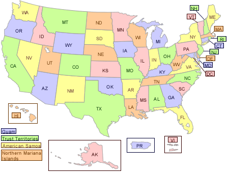
Custom Files have been developed for a subset of states and territories. Unlike the Standard File, these contain pre-loaded indicator data and do not import data from EPA’s online indicator database. The pre-loaded data typically includes indicators which have been calculated from state-specific or territory-specific datasets in addition to national datasets. In some cases, these files allow users to screen additional or alternative watershed units beyond HUC12 subwatersheds (e.g., HUC14 subwatersheds). The Custom Files will continue to be updated and maintained. The Custom Files are available for download below.
| State/Territory Name | Watershed Scale(s) | Indicator Data Sources | Download Link | Last Updated |
|---|---|---|---|---|
| Alaska | HUC8 | National Datasets | Alaska Excel RPS Tool (xlsm) | 2022 |
| American Samoa | NHDPlus Version 2 Catchments | Territory-Specific Datasets | American Samoa Excel RPS Tool (xlsm) | 2022 |
| Guam | NHDPlus Version 2 Catchments; Territory-Specific Subwatersheds | Territory-Specific Datasets | Guam Excel RPS Tool (xlsm) | 2022 |
| Hawaii | HUC12; State-Specific Subwatersheds | State-Specific Datasets | Hawaii Excel RPS Tool (xlsm) | 2022 |
| Massachusetts | HUC12; State-Specific Subwatersheds | National Datasets; State-Specific Datasets | Massachusetts Excel RPS Tool (xlsm) | 2023 |
| New Jersey | HUC12; State-Specific Subwatersheds | National Datasets; State-Specific Datasets | New Jersey Excel RPS Tool (xlsm) | 2022 |
| Northern Mariana Islands | NHDPlus Version 2 Catchments; Territory-Specific Subwatersheds | Territory-Specific Datasets | Northern Mariana Islands Excel RPS Tool (xlsm) | 2022 |
| Puerto Rico | HUC12 | Territory-Specific Datasets | Puerto Rico Excel RPS Tool (xlsm) | 2022 |
| US Virgin Islands | NHDPlus Version 2 Catchments | Territory-Specific Datasets | US Virgin Islands Excel RPS Tool (xlsm) | 2022 |
Excel RPS Tool - Generic Template File
Excel RPS Tool - Generic Template (xlsm)
The Generic Template File enables a user to define their own geographic area of interest (e.g., river basin or multi-state region) and add indicator data for up to three different watershed scales within that area of interest. Once a user has added watershed units and indicator data, a screening can be run to calculate the RPS indices, and results can be viewed in table or graph form. Mapping is not supported in this version of the Excel RPS Tool. Alternatives for mapping include using GIS software or the Watershed Index Online (WSIO) Tool.
Excel RPS Tool - Legacy Files
The Legacy Files were created in August 2022 and contain 300+ pre-loaded HUC12 indicators. Each file stores indicator data for a single state (e.g., the Maine file contains indicator data for all HUC12s in Maine). These files are no longer maintained with updated indicator data and have been replaced with the new Standard File that imports indicator data from EPA’s online database for any user-selected state.
The Legacy Files can be downloaded by clicking on a state from the map below but will be removed from this site in the future. Note that states and territories with Custom Files are not clickable in the map (see Custom Files section above).