
Downloadable RPS Tools for Comparing Watersheds
On this page:
- About RPS Tools in General
- Statewide RPS Tools
- Generic RPS Tool Template
- About RPS Tool User Support
About RPS Tools in General
RPS Tools are custom-coded Excel spreadsheets that store watershed indicator datasets, use them to auto-calculate index scores and generate project results in several formats useful for watershed comparison and priority setting. They require only moderate skills in the use of Excel. RPS Tools perform all RPS index calculations automatically and generate maps, graphs and tables of index values and rank orders from these calculations. Users control the choice and weighting of watershed indicators, the watershed units compared and the customized appearance of tables, graphs and maps in their screening results. Watch the Introducing the RPS Tool training video for a general overview and information about more specific technical training on RPS Tools.
Most RPS Tools cover whole states, although some have been developed for large, multi-state river basins. A state-specific RPS Tool contains a national standard set of roughly 300 indicators, a state-specific set of indicators, or both. The national indicator data are available across the lower 48 states for HUC12 scale watershed units which average about 35 square miles in area. Many of the indicators are landscape characteristics derived from common GIS datasets, but other attributes such as selected impairment-specific data derived from field monitoring, are also included. All RPS indicator data are measurements of the individual HUC or other watershed unit, not cumulative full-watershed measurements, unless specified in the indicator description. Additional watershed scales and data at those scales have sometimes been added; for example, HUC8s (averaging approximately 1400 square miles each) or NHDPlus catchments (about 1 square mile apiece). All RPS Tools accept new indicator data added by the user at a watershed scale already present in the Tool.
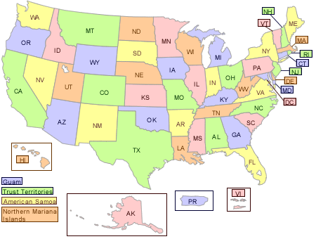
Statewide RPS Tools
RPS Tools exist for all states and territories and are updated as resources permit. Recovery Potential Screening originated as EPA assistance to state water programs to help in performing their Clean Water Act planning and restoration duties. The lower 48 state-specific tools, updated in November 2021, contain 300+ embedded indicators for all HUC12s that are wholly or partially within the state’s boundary, and many state tools have additional state-specific indicators and/or scales. RPS Tools for AK, HI and US Territories were custom-developed and vary in numbers of indicators and scales included. You can download state-specific RPS tools by clicking on the map or drop-down menu below.
Generic RPS Tool Template
This version of the RPS Tool is set up to enable the user to select their own geographic area of coverage, include up to three different watershed scales within their area, and add indicator data at each watershed scale. Once a user has added watershed units and indicator data, their Tool can be used to calculate all the RPS indices, create scoring and rank-ordered lists, and develop user-customized graphs. The map functions are not supported in this Tool. Alternatives include using GIS software to handle the mapping, or users may visit Watershed Index Online (WSIO) to create a Tool with a custom map.
Downloadable 2022 RPS Generic Tool (xlsm)
About RPS Tool User Support
All RPS Tools contain basic instructions embedded within the Excel file; look for the light green text boxes at the top of every page. The RPS Tool User Manual (PDF) (53 pp, 31 MB) also provides more detailed treatment of all the components and functions of the Tool file, including more advanced techniques for customizing the bubble plot graphics and color-coded watershed maps. Users should note that guidance on how to use the Tool should be accompanied by reading the Step by Step RPS Methodology and other User Support Resources found throughout this website.