U.S. flag

An official website of the United States government

Here’s how you know

Dot gov

Official websites use .gov
A .gov website belongs to an official government organization in the United States.

HTTPS

Secure .gov websites use HTTPS
A lock (LockA locked padlock) or https:// means you’ve safely connected to the .gov website. Share sensitive information only on official, secure websites.

    • Environmental Topics
    • Air
    • Bed Bugs
    • Cancer
    • Chemicals, Toxics, and Pesticide
    • Emergency Response
    • Environmental Information by Location
    • Health
    • Land, Waste, and Cleanup
    • Lead
    • Mold
    • Radon
    • Research
    • Science Topics
    • Water Topics
    • A-Z Topic Index
    • Laws & Regulations
    • By Business Sector
    • By Topic
    • Compliance
    • Enforcement
    • Laws and Executive Orders
    • Regulations
    • Report a Violation
    • Environmental Violations
    • Fraud, Waste or Abuse
    • About EPA
    • Our Mission and What We Do
    • Headquarters Offices
    • Regional Offices
    • Labs and Research Centers
    • Planning, Budget, and Results
    • Organization Chart
    • EPA History

Breadcrumb

  1. Home
  2. Urban Waters Partnership
  3. 21 Designated Urban Waters Locations

Urban Waters and the Western Lake Erie Basin near Toledo (Ohio)

The Western Lake Erie Basin spans the Midwest states of Ohio, Michigan and Indiana. The basin is home to over 2 million residents. These residents share ten sub-watersheds, including the Upper and Lower Maumee. These extend from the headwaters in Allen County, Indiana and flow northeast through Toledo, Ohio and into Lake Erie.

Children and adults enjoy paddling a canoe on the Maumee River in Toledo

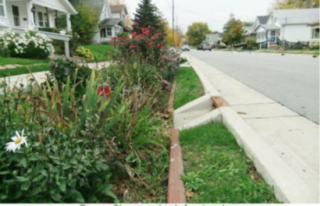
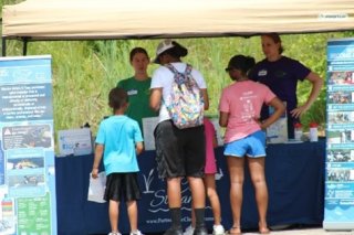
Western Lake Erie Basin (WLEB) is almost 6 million acres in size. The basin drains portions of 29 counties into the shallow western third of Lake Erie. The largest metropolitan area in the basin is the port and industrial city of Toledo, Ohio. Lake Erie serves as the municipal water source for the WLEB. While land is used predominantly for agriculture (60-80%), the urban areas are nothing short of vibrant as citizens lead and volunteer in community projects that improve their home. The people of the WLEB are engaged in and championing programs that center around communities – activities such as operating many community gardens, advocating for water quality, and volunteering to help monitor water quality.

Rain garden installation with drainage from street
Residents learn about water quality in Western Lake Erie Basin

Western Lake Erie has an average depth of less than 25 feet, yet it supports a commercial fishing industry and recreational opportunities for millions of people. The area is also home to diverse plant and wildlife communities, high quality coastal wetlands and tributaries, and several federal and state threatened and endangered species like Piping Plover, the Karner Blue Butterfly, and the Eastern Prairie Fringed Orchid.   


Resources
  • Background Information:
    • Urban Focus for the Western Lake Erie Basin
  • News
  • Map
  • Program Contacts
  • Meetings & Events
  • Related Links

Urban Waters Partnership

  • About the Urban Waters Partnership
  • 21 Designated Urban Waters Locations
    • Anacostia Watershed (DC/MD)
    • Blue River (Kansas City, MO)
    • Bronx and Harlem River Watersheds (NY)
    • Caño Martín Peña (PR)
    • Grand River / Grand Rapids (MI)
    • Greater Philadelphia Area / Delaware River Watershed (PA, NJ, DE)
    • Green-Duwamish Watershed (Washington)
    • Lake Pontchartrain Area / New Orleans (LA)
    • Los Angeles River Watershed (CA)
    • The Meramec River and Big River (Missouri)
    • Middle Rio Grande / Albuquerque (NM)
    • Mystic River Watershed (MA)
    • Northwest Indiana (IN)
    • Passaic River / Newark (NJ)
    • Patapsco Watershed / Baltimore Region (MD)
    • Proctor Creek Watershed / Atlanta (GA)
    • Rio Reimagined-Rio Salado Project
    • San Antonio River Basin within Bexar County (Texas)
    • South Platte Watershed, Headwaters to Denver Metropolitan Area (CO)
    • Walnut Creek Watershed / Raleigh (NC)
    • Western Lake Erie Basin, near Toledo (OH)
  • Federal Partners
Contact Us About the Urban Waters Partnership
Contact Us to ask a question, provide feedback, or report a problem.
Last updated on January 16, 2025
  • Assistance
  • Spanish
  • Arabic
  • Chinese (simplified)
  • Chinese (traditional)
  • French
  • Haitian Creole
  • Korean
  • Portuguese
  • Russian
  • Tagalog
  • Vietnamese
United States Environmental Protection Agency

Discover.

  • Accessibility Statement
  • Budget & Performance
  • Contracting
  • EPA www Web Snapshot
  • Grants
  • No FEAR Act Data
  • Plain Writing
  • Privacy
  • Privacy and Security Notice

Connect.

  • Data
  • Inspector General
  • Jobs
  • Newsroom
  • Regulations.gov
  • Subscribe
  • USA.gov
  • White House

Ask.

  • Contact EPA
  • EPA Disclaimers
  • Hotlines
  • FOIA Requests
  • Frequent Questions
  • Site Feedback

Follow.