
Get NHDPlus (National Hydrography Dataset Plus) Data
- Download NHDPlus Version 2 (NHDPlusV2) Data
- NHDPlusV2 Data Map
- List of Areas by Number
- Download NHDPlus High Resolution EPA Snapshot 2022 Data
Download NHDPlus Version 2 (NHDPlusV2) Data
NHDPlusV2 benefits from significant improvements to its primary ingredient datasets as well as a more robust stream flow estimation process, which incorporates runoff estimates from a USGS national water balance model. There are also new components, such as, excess potential evapotranspiration, major water withdrawals and additions and network-interpolated adjustments to align with gaged flows.
- Greatly improved 1:100K National Hydrography Dataset (NHD).
- Greatly improved 30 meter National Elevation Dataset (NED).
- Nationally complete Watershed Boundary Dataset (WBD).
- A set of value added attributes to enhance stream network navigation, analysis and display.
- An elevation-based catchment for each flowline in the stream network.
- Catchment characteristics.
- Headwater node areas.
- Cumulative drainage area characteristics.
- Flow direction, flow accumulation and elevation grids.
- Flowline min/max elevations and slopes.
- Flow volume & velocity estimates for each flowline in the stream network.
- Catchment attributes and network accumulated attributes.
- Various grids from the hydro-enforcement process including the hydro-enforced DEM.
NHDPlusV2 attribute and vector data are distributed by hydrologic regions (HUC2) or, in the case of regions 10 and 03, parts of hydrologic regions. These regions or parts of regions are called Vector Processing Units (VPUs). The NHDPlusV2 raster components are distributed by sub-parts of VPUs called Raster Processing Units (RPUs). A national shapefile of the VPU and RPU boundaries is available.
In addition to the user guide and metadata, the release notes that are posted with each VPU contain supplemental information describing data lineage.
NHDPlusV2 Data Map
Select the data region of your choice by clicking on the map below or selecting the name from the list.
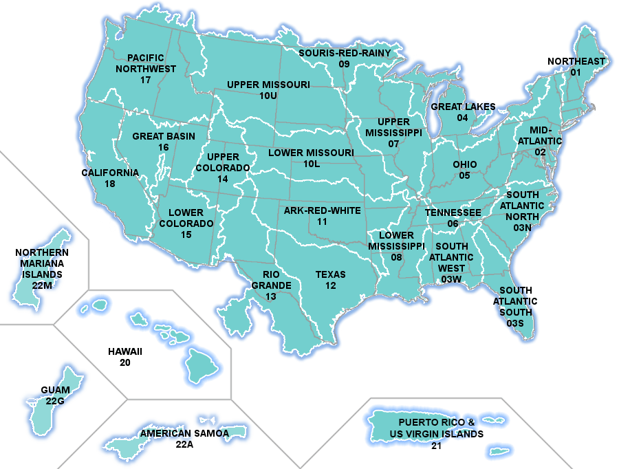
List of Areas by Number
Download NHDPlus High Resolution EPA Snapshot 2022 Data
National:
- Esri File Geodatabase (39.4 GB)
- OGC GeoPackage (72.7 GB)
State and State-Equivalent:
Release notes and metadata forthcoming.