
Rouge River AOC

Julie Carter
(carter.julie@epa.gov)
312-886-7899
Latest News
EPA Resumes Contaminated Sediment Cleanup in Detroit’s Lower Rouge River Old Channel

Overview
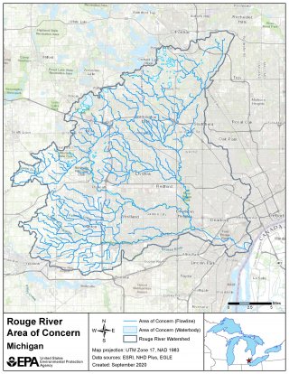
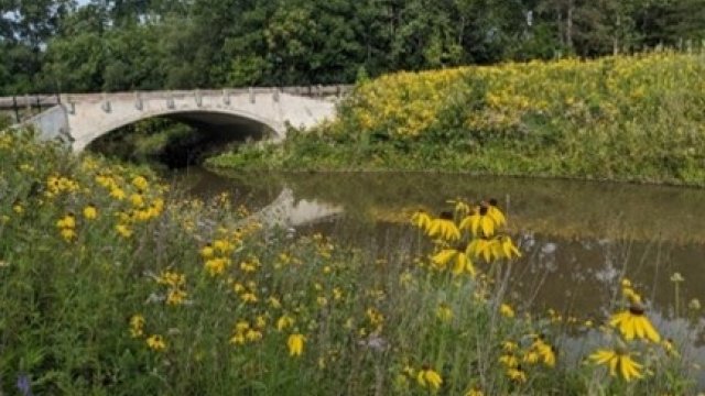
Located in southeastern Michigan, the Rouge River was designated as an Area of Concern under the Great Lakes Water Quality Agreement of 1987. The boundaries include the main branch of the Rouge River, Upper Rouge River, Middle Rouge River, and Lower Rouge River. Upland areas in the watershed are the pollution source area and the AOC is delineated as the waterbodies within the watershed.
The Rouge River watershed drains 466 square miles into the Detroit River and encompasses 48 communities. The Rouge River watershed contains the oldest and most heavily populated and industrialized area in southeast Michigan. This has led to sediment and water contamination from industrial development and discharge, combined and sanitary sewer overflows, and nonpoint source pollution.
Degradation of the Rouge River is representative of that found in many urbanized and industrialized areas within the Great Lakes Basin:
- Over 50% of the land use is residential, commercial, or industrial, with increasing development pressures in the headwaters.
- Over 50 miles of publicly owned parklands in the northern and western portions of the watershed are adjacent to watercourses.
- Land uses include rural, suburban, urbanized and industrial.
Nine of the fourteen Beneficial Use Impairments (BUIs) are impaired for the Rouge River AOC. Sediment and water contamination affect fish and wildlife habitat and populations as well as recreational opportunities. Contaminants within the watershed include heavy metals, polychlorinated biphenyls (PCBs), polycyclic aromatic hydrocarbons (PAHs), mercury, oil and grease. Remedial Action Plan priorities developed for the Rouge River AOC include eliminating of combined sewer overflows, nonpoint source pollution control, industrial discharge pretreatment and contaminated sediment cleanup.
Beneficial Use Impairments
An interim success of remediation and restoration work is removing BUIs. BUIs are designations given by the International Joint Commission representing different types of significant environmental degradation. As cleanup work is completed, and monitoring demonstrates sufficient environmental health improvements, BUIs can be removed. Once all BUIs are removed, the process of delisting the AOC can begin.
- Restrictions on Fish and Wildlife Consumption
- Eutrophication or Undesirable Algae
- Degradation of Fish and Wildlife Populations
- Beach Closings
- Fish Tumors or Other Deformities
- Degradation of Aesthetics
- Degradation of Benthos
- Restriction on Dredging Activities
- Loss of Fish and Wildlife Habitat
More information:
General information about BUIs: Beneficial Use Impairments for the Great Lakes AOCs
Remediation and Restoration Work
Through multiple partnerships, remediation and restoration efforts have continued to within the Rouge River AOC. Following a Degradation of Fish and Wildlife Populations and Degradation of Benthos BUI pre-assessment that was completed in 2014, a list of the most impaired reaches or segments within the AOC were identified.
From this list, 31 habitat projects were identified. These habitat projects were chosen to advance progress toward to BUI removals. The habitat projects include river connectivity, wetland restoration, streambank restoration, fish passage, and invasive species management. Implementation of the projects will be a key step forward in the restoration of the Rouge River.
2 sediment remediation projects were also identified. One is currently underway and the other is estimated to move into design by the end of 2026. Over 550,000 cubic yards of contaminated sediment will be addressed through these projects.
For more information visit Documents on Restoring Rouge River AOC
-
Dredging the Lower Rouge River Old Channel
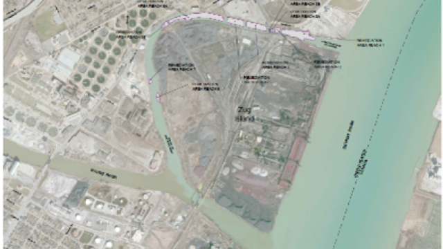
Additional information regarding dredging the Lower Rouge River.
-
Tamarack Creek Stream and Wetland Restoration
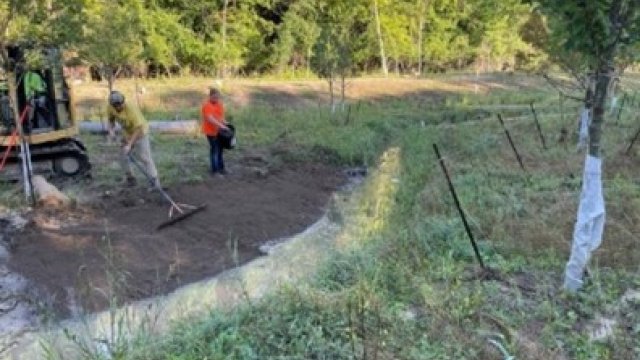
Additional Information for Tamarack Creek restoration project.
-
The Henry Ford Estate Dam Fishway
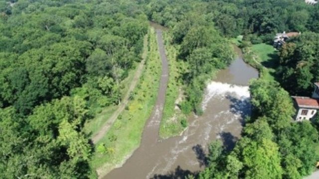
Additional information regarding The Henry Ford Estate Dam Fishway Restoration.
-
The Rouge Oxbow
Additional Information describing The Rouge Oxbow Restoration Project.
-
Table of Projects
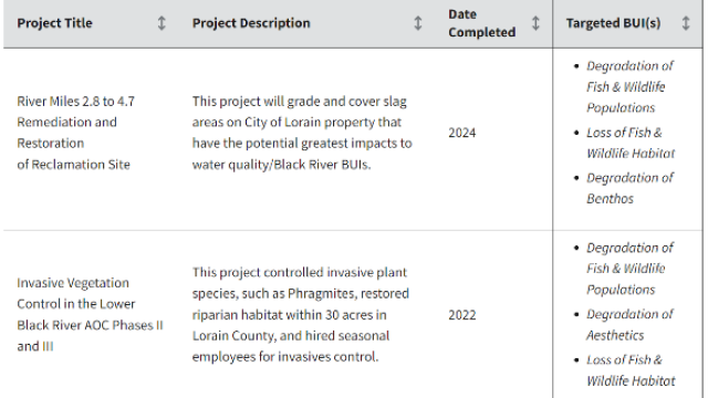
Remediation and restoration project table.
Partners
- National Oceanic and Atmospheric Administration
- The National Park Service
- U.S. Army Corps of Engineers – Detroit District
- Alliance of Rouge Communities
- Friends of the Rouge
- Honeywell, Inc.
- IL-IN Sea Grant
- Michigan Department of Natural Resources
- Michigan Department of Environment, Great Lakes and Energy
- Rouge River Advisory Council
- The Henry Ford Historic Site
- Wayne County