U.S. flag

An official website of the United States government

Here’s how you know

Dot gov

Official websites use .gov
A .gov website belongs to an official government organization in the United States.

HTTPS

Secure .gov websites use HTTPS
A lock (LockA locked padlock) or https:// means you’ve safely connected to the .gov website. Share sensitive information only on official, secure websites.

    • Environmental Topics
    • Air
    • Bed Bugs
    • Cancer
    • Chemicals, Toxics, and Pesticide
    • Emergency Response
    • Environmental Information by Location
    • Health
    • Land, Waste, and Cleanup
    • Lead
    • Mold
    • Radon
    • Research
    • Science Topics
    • Water Topics
    • A-Z Topic Index
    • Laws & Regulations
    • By Business Sector
    • By Topic
    • Compliance
    • Enforcement
    • Laws and Executive Orders
    • Regulations
    • Report a Violation
    • Environmental Violations
    • Fraud, Waste or Abuse
    • About EPA
    • Our Mission and What We Do
    • Headquarters Offices
    • Regional Offices
    • Labs and Research Centers
    • Planning, Budget, and Results
    • Organization Chart
    • EPA History

Breadcrumb

  1. Home
  2. Restoration and Protection Screening
  3. RPS Data and Map Service

Supplemental GIS Files

This page provides access to additional geospatial data used by the EPA RPS Team as part of HUC12 indicator calculations. The datasets are provided as a reference for users who are interested in learning more about the HUC12 indicators and for users who would like to complete additional analysis. 
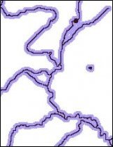
Water Mask

A Water Mask raster.

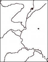
The Water Mask is a raster dataset that depicts the presence of surface water features (rivers, lakes, reservoirs, estuaries, wetlands, oceans) on the landscape for the contiguous U.S. 

The Water Mask dataset was created by combining surface water features from the National Land Cover Dataset (NLCD) and the National Hydrography Dataset Plus (NHDPlus) Version 2. 

  • Water Mask Data File 
  • Water Mask Map Service

Wetness Index

A Wetness Index raster.

The Wetness Index is a raster dataset for the contiguous U.S. that provides a relative measure of average soil moisture and runoff potential based on topography and landscape position. The Wetness Index is also referred to as the Topographic Index in scientific literature.

The Wetness Index dataset was generated from the National Elevation Dataset (NED) and Flow Accumulation rasters in the NHDPlus Version 2. For each grid pixel in the dataset, the Wetness Index is calculated as: 100*(ln(Flow Accumulation/tan(Slope)) + 3x3 mean of ln(Flow Accumulation/tan(Slope))/2.

Due to the large size of the Wetness Index raster, it cannot be offered for download on this site but is offered as a map service. 
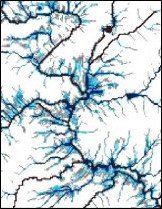
  • Wetness Index Map Service

Riparian Zone

A Riparian Zone raster.

The Riparian Zone is a raster dataset that depicts the corridor of land adjacent to surface waters. The Riparian Zone was delineated by applying a 108-meter buffer around each side of surface water features in the Water Mask.

  • Riparian Zone Data File
  • Riparian Zone Map Service

Hydrologically Connected Zone

A Hydrologically Connected Zone raster.

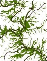
The Hydrologically Connected Zone (HCZ) is a raster dataset that depicts the location of wet areas with high runoff potential that are contiguous to surface water. The HCZ raster was generated for the contiguous U.S. using the Wetness Index and Water Mask datasets described above. The Wetness Index was first used to identify wet areas, defined as grid pixels with a Wetness Index of 550 or greater. The HCZ was then defined as wet pixels, which were also contiguous to surface water in the Water Mask.

  • HCZ Data File
  • HCZ Map Service

Restoration and Protection Screening

  • RPS Overview
  • RPS Goals and Benefits
  • RPS FAQs
  • RPS Methods
    • Step 1
    • Step 2
    • Step 3
    • Step 4
    • Step 5
    • Step 6
    • Step 7
  • RPS Indicators
    • Base Indicators
    • Ecological Indicators
    • Stressor Indicators
    • Social Indicators
  • RPS Tool
    • Web RPS Tool
    • Excel RPS Tool
    • WSIO Tool
  • RPS Data and Map Service
    • RPS Indicator Database
    • RPS Map Service
    • Supplemental GIS Files
  • RPS User Resources
  • RPS Publications & Citing RPS
Contact Us About Restoration and Protection Screening
Contact Us to ask a question, provide feedback, or report a problem.
Last updated on January 17, 2025
  • Assistance
  • Spanish
  • Arabic
  • Chinese (simplified)
  • Chinese (traditional)
  • French
  • Haitian Creole
  • Korean
  • Portuguese
  • Russian
  • Tagalog
  • Vietnamese
United States Environmental Protection Agency

Discover.

  • Accessibility Statement
  • Budget & Performance
  • Contracting
  • EPA www Web Snapshot
  • Grants
  • No FEAR Act Data
  • Plain Writing
  • Privacy
  • Privacy and Security Notice

Connect.

  • Data
  • Inspector General
  • Jobs
  • Newsroom
  • Regulations.gov
  • Subscribe
  • USA.gov
  • White House

Ask.

  • Contact EPA
  • EPA Disclaimers
  • Hotlines
  • FOIA Requests
  • Frequent Questions
  • Site Feedback

Follow.