
Tracking Wildfire Smoke: EPA Researchers Make Better Maps with Drones
Published November 8, 2022
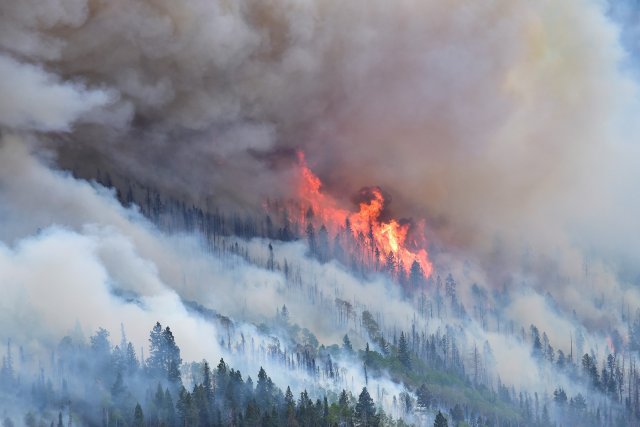
Wildfires cause dangerous flames, inescapable gray soot, and clouds of smoke that can travel hundreds of miles. Wildfire smoke is a mix of gases and fine particles from everything burned by fire, including vegetation, buildings, and other materials. Breathing it in can cause coughing, trouble breathing normally, stinging eyes, and a scratchy throat - or worse. To help protect communities affected by wildfire smoke, EPA researchers take air quality measurements to better understand the chemistry of smoke and improve models used to predict where smoke from wildland fires will travel. Being in the path of the smoke plume is dangerous for everyone – including firefighters and the scientists who study the effects and spread of wildfire smoke.

Airplanes and helicopters are often used to track fires, but they’re costly and can’t fly in poor conditions. Flying over huge forest fires is also risky for the pilots and crew.
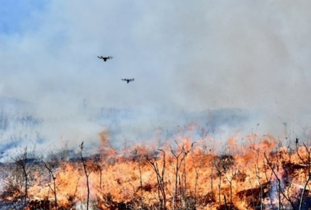
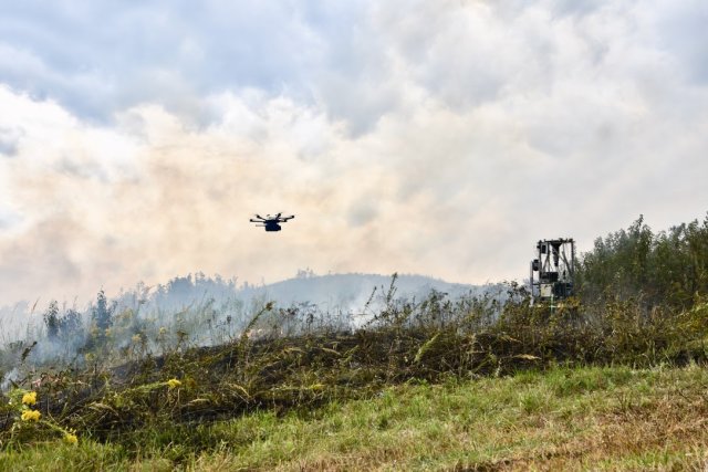
That’s where using an unmanned aircraft system (UAS) can help. A UAS can fly without having a person present in or on the device. Also known as drones, they are an emerging research tool that may provide a safer, more cost-effective, and more comprehensive approach than traditional, ground-based research methods. Drones can be equipped with cameras and sensors and zip through spots that helicopters can’t safely access.
EPA researchers have developed an air emission sensor and sampling instrument to use on a UAS and in other applications. The shoebox-sized equipment is called the Kolibri, which means “hummingbird” in several languages. It’s a lightweight system that weighs up to eight pounds and can record and send data in real time.
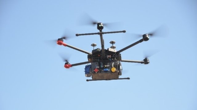
The instrument is attached to a UAS, where it can remotely and safely sample emissions from wildland fires.
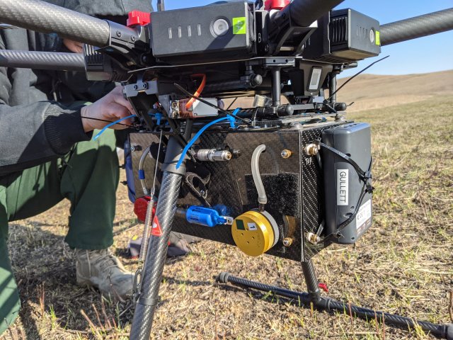
The Kolibri air sampling instrument gathers a whole set of emissions information that couldn’t be safely collected before. As EPA senior scientist Brian Gullett notes, “The ability to sample emissions with a Kolibri-equipped UAS provides scientists and first responders with access to immediate, comprehensive data while eliminating the risk to ground-based personnel and equipment.”
Drones are often used at wildfires to locate smaller fires and see what’s happening on the ground. Using the UAS in a novel way – to gather information in the air about what’s in the smoke and where it’s heading – allows scientists to improve their dispersion models, which predict how and where smoke can spread. On-scene coordinators can then better protect firefighters and the downwind population by knowing where to go for cleaner air and what actions to take.
Note: While people may want to see what a wildfire looks like up close, flying a personal drone during a wildland fire is a federal felony. To avoid a potential midair collision, fire response officials may have to ground their aircraft, hindering the protection of firefighters, residents and property in nearby communities. During a wildfire, scientists coordinate closely with fire officials and their aerial operations, which include planes, helicopters and drones.
Learn more:
Studies Advance Air Monitoring During Wildfires and Improve Forecasting of Smoke