U.S. flag

An official website of the United States government

Here’s how you know

Dot gov

Official websites use .gov
A .gov website belongs to an official government organization in the United States.

HTTPS

Secure .gov websites use HTTPS
A lock (LockA locked padlock) or https:// means you’ve safely connected to the .gov website. Share sensitive information only on official, secure websites.

    • Environmental Topics
    • Air
    • Bed Bugs
    • Cancer
    • Chemicals, Toxics, and Pesticide
    • Emergency Response
    • Environmental Information by Location
    • Health
    • Land, Waste, and Cleanup
    • Lead
    • Mold
    • Radon
    • Research
    • Science Topics
    • Water Topics
    • A-Z Topic Index
    • Laws & Regulations
    • By Business Sector
    • By Topic
    • Compliance
    • Enforcement
    • Laws and Executive Orders
    • Regulations
    • Report a Violation
    • Environmental Violations
    • Fraud, Waste or Abuse
    • About EPA
    • Our Mission and What We Do
    • Headquarters Offices
    • Regional Offices
    • Labs and Research Centers
    • Planning, Budget, and Results
    • Organization Chart
    • EPA History

Breadcrumb

  1. Home
  2. Urban Waters Partnership

Improving Public Participation: Stewardship Map and Community Involvement Guide

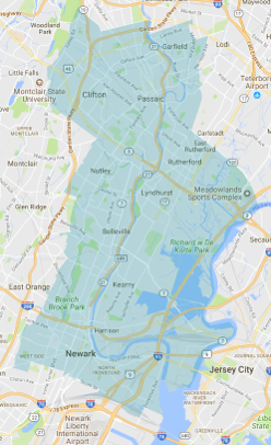
In 2017, the Lower Passaic River Urban Waters federal partnership created two resources to proactively improve public participation in environmental projects on the Lower Passaic River. The Stewardship Map is designed to help civic organizations network with one another, and the Community Involvement Guide is geared towards agencies seeking to develop robust Community Involvement Plans for their projects.

Stewardship Map

The Lower Passaic River Stewardship Map helps community and stewardship organizations connect with new organizational partners and collaborate on issues related to the Partnership’s mission. The survey used to create the map asked organizational representatives about their missions, how they reach their membership, as well as where they have ongoing projects. For government agencies, the map can be used to identify community “hub” organizations active within a specific geography. These “hub” organizations who provided data can act as portals to reaching other local stakeholders, as well as their memberships.

Lower Passaic Watershed

Click here for full Map

Large orange points represent the office locations of organizations who provided data for the map. These points also reveal information about an organization’s mission, communication tools, and partners. The filter on the right can sort these groups by their area of focus.
 
Smaller green points connected by lines represent collaborators and partners named by the organizations who provided data. To get connected to one of these listed partners, use the contact information for one of their networked partners, and mention the Lower Passaic River Stewardship Map.
 
The polygons reveal a list of groups that have active projects in that area. The polygons themselves represent ZIP codes in riverfront municipalities that fall within the Lower Passaic River Watershed, and together make up the Urban Waters Federal Partnership core area.
 
Didn’t see your group on the map? Fill out NY/NJ Baykeeper’s Stewardship Survey here . 
 

Community Involvement Guide

The Lower Passaic River Community Involvement Guide is focused on the formal modes of public input outlined by the National Environmental Protection Act. It is geared towards helping agencies advancing flood-risk management and ecological restoration projects develop robust Community Involvement Plans for their projects. The Guide is not a comprehensive guide to civic organizations and local communication tools in the Lower Passaic River Watershed. Rather, it consists of time-specific reflections from conversations at existing community meetings facilitated by the partnership’s Ambassador, called “Community Snapshots”. The introductory document provides guidance to agencies for how this information can be used within existing planning frameworks for federal projects. Interested in having a “Community Snapshot” created for your organization? Reach out to the Partnership’s ambassador here.

Lower Passaic River Community Involvement Guide

Community Snapshots

Urban Waters Partnership

  • About the Urban Waters Partnership
  • 21 Designated Urban Waters Locations
    • Anacostia Watershed (DC/MD)
    • Blue River (Kansas City, MO)
    • Bronx and Harlem River Watersheds (NY)
    • Caño Martín Peña (PR)
    • Grand River / Grand Rapids (MI)
    • Greater Philadelphia Area / Delaware River Watershed (PA, NJ, DE)
    • Green-Duwamish Watershed (Washington)
    • Lake Pontchartrain Area / New Orleans (LA)
    • Los Angeles River Watershed (CA)
    • The Meramec River and Big River (Missouri)
    • Middle Rio Grande / Albuquerque (NM)
    • Mystic River Watershed (MA)
    • Northwest Indiana (IN)
    • Passaic River / Newark (NJ)
    • Patapsco Watershed / Baltimore Region (MD)
    • Proctor Creek Watershed / Atlanta (GA)
    • Rio Reimagined-Rio Salado Project
    • San Antonio River Basin within Bexar County (Texas)
    • South Platte Watershed, Headwaters to Denver Metropolitan Area (CO)
    • Walnut Creek Watershed / Raleigh (NC)
    • Western Lake Erie Basin, near Toledo (OH)
  • Federal Partners
Contact Us About the Urban Waters Partnership
Contact Us to ask a question, provide feedback, or report a problem.
Last updated on June 30, 2024
  • Assistance
  • Spanish
  • Arabic
  • Chinese (simplified)
  • Chinese (traditional)
  • French
  • Haitian Creole
  • Korean
  • Portuguese
  • Russian
  • Tagalog
  • Vietnamese
United States Environmental Protection Agency

Discover.

  • Accessibility Statement
  • Budget & Performance
  • Contracting
  • EPA www Web Snapshot
  • Grants
  • No FEAR Act Data
  • Plain Writing
  • Privacy
  • Privacy and Security Notice

Connect.

  • Data
  • Inspector General
  • Jobs
  • Newsroom
  • Regulations.gov
  • Subscribe
  • USA.gov
  • White House

Ask.

  • Contact EPA
  • EPA Disclaimers
  • Hotlines
  • FOIA Requests
  • Frequent Questions
  • Site Feedback

Follow.