


MARPLOT Software
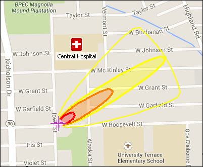
MARPLOT® (Mapping Application for Response, Planning, and Local Operational Tasks) is the mapping program for the CAMEO® (Computer-Aided Management of Emergency Operations) software suite, which is used widely to plan for and respond to chemical emergencies.
MARPLOT’s easy-to-use interface allows you to add objects to a map, as well as view and edit data associated with the objects. You can choose between several background basemap images, and you can customize your map further with annotations and online map services. You can also interact with the map in other ways, such as getting population estimates within an area. MARPLOT can be run by itself as a general mapping program. It can also be used interactively with programs in the CAMEO suite, such as to display ALOHA® (Areal Locations of Hazardous Atmospheres) threat zone estimates on the map or to link map objects to database records in CAMEO Data Manager.
On this page:
Download MARPLOT
Visit the National Oceanic and Atmospheric Administration's MARPLOT webpage to download MARPLOT for Windows and Mac operating systems.
Learn About MARPLOT
To learn how to use MARPLOT refer to the "Help" function within the software and visit the CAMEO Training and Events webpage.
For a brief summary of the MARPLOT program and its capabilities, download the MARPLOT fact sheet (pdf).
Get Help
You can report software bugs or obtain additional assistance by emailing the Risk Management Program Reporting Center (RMPRC@epacdx.net), or by calling the CAMEO help desk at (703) 227-7650 on weekdays from 8:00 a.m. to 4:30 p.m., Eastern Time.