
Superfund Sites in Reuse in Rhode Island
If you are having trouble viewing the map in your browser, click the 'View larger map' link below
CENTRAL LANDFILL
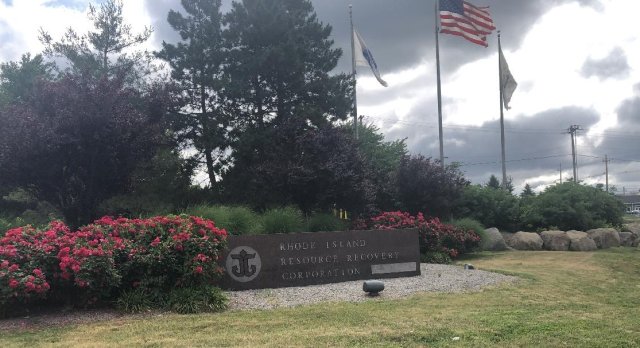
The Central Landfill Superfund site is a 154-acre former landfill in Johnston, Rhode Island. During the 1970s, operators disposed of industrial liquid waste in the landfill’s hazardous material disposal area. In 1982, the state ordered the site owner to close this area. The EPA placed the site on the National Priorities List (NPL) in 1986. Cleanup activities included construction of a multi-layer cap, containment and treatment of groundwater, deed restrictions on groundwater use and land use, and evaluation of the site’s landfill gas collection system. Today, the site remains in continued use. Central Landfill, which is owned and operated by the Rhode Island Resource Recovery Corporation (RIRRC), is on-site. It receives over 90% of Rhode Island’s municipal solid waste. RIRRC leads tours of the landfill and recycling center for community groups and local schools. The capped part of the landfill also includes a pollinator garden. Broadrock Renewables, LLC also owns and operates a facility on-site. It turns gas collected from the landfill into electricity. The company expanded the energy-generating facility in stages. The facility includes 15 engine generator sets that produce up to 20 megawatts of electricity.
Last updated September 2024
As of December 2025, EPA had data on one on-site business. EPA did not have further economic details related to this business. For additional information click here.
For more information:
CENTREDALE MANOR RESTORATION PROJECT
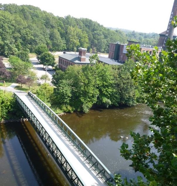
The Centredale Manor Restoration Project Superfund site includes a 9-acre property in North Providence, Rhode Island, and downstream areas. A chemical company and a drum reconditioning facility were on-site at different times beginning in the early 1940s. Operations ended in 1972 when a fire destroyed most of the facility. Disposal practices included burying waste or releasing chemicals directly onto the ground or into the river. These practices resulted in widespread contamination on-site and downstream. Residential development followed – Brook Village Apartments in 1977 and Centredale Manor Apartments in 1983. The EPA's investigations found contamination in soil, sediment, groundwater, surface water and animals on site. The EPA added the site to the National Priorities List (NPL) in 2000. The EPA’s early actions included capping and fencing the site, as well as removing some contaminated soil from low-lying residential properties and restoring the Allendale Dam. In 2018, the site’s potentially responsible parties began the site’s long-term cleanup with oversight from the EPA and the Rhode Island Department of Environmental Management. Since then, the site’s potentially responsible parties completed a hazardous waste cap in the source area on the peninsula, repaired a sluice gate on the Lyman Mill Dam to make it operational, and developed cleanup design plans for other areas of the site. In 2019, 2020 and 2024, the EPA’s Superfund Redevelopment Program supported regional seed projects at the site to help facilitate reuse discussions among the EPA and local stakeholders and plan for future uses at the site. Today, the Brook Village and Centredale Manor apartment complexes remain on-site. The EPA’s cleanup approach has been compatible with the continued residential use at the site.
Last updated September 2024
As of December 2025, EPA had data on 4 on-site businesses. These businesses employed 11 people and generated an estimated $1,119,960 in annual sales revenue. For additional information click here.
For more information:
Centredale Manor Restoration Project – National Land Conservation Conference
DAVIS (GSR) LANDFILL
The 58-acre Davis (GSR) Landfill Superfund site includes a 21-acre inactive landfill in the towns of Glocester and Smithfield, Rhode Island. The landfill first received municipal wastes in 1974. In 1978, the public expressed concern about the landfill’s effect on the local groundwater drinking supply. The state cited several violations and later took legal action. The landfill closed in 1982. It was never properly capped or stabilized. The state found contamination in several on-site and nearby wells in the early 1980s. The EPA added the site to the National Priorities List (NPL) in 1986. An EPA investigation found that while the landfill was a source of contamination, the spread of the contamination was not extensive and posed little risk to human health. Residential well tests starting in the 1980s confirmed no site-related contamination. The EPA and the state agreed to continue to monitor the site for potential future risks and that no further cleanup action was needed. The EPA took the site off the NPL in 1999. Five rounds of residential well tests since then have found no contamination. The site’s ecological resources include a forested area and wetlands.
Last updated September 2024
As of December 2025, EPA did not have economic data related to on-site businesses, or economic data were not applicable due to site use. For additional information click here.
For more information:
DAVISVILLE NAVAL CONSTRUCTION BATTALION CENTER
The former Davisville Naval Construction Battalion Center (Davisville NCBC), North Kingston, Rhode Island site is 18 miles south of Providence, Rhode Island. It includes 1,290 acres along Narragansett Bay. From 1951 to 1994, Davisville NCBC supported mobilization of naval construction forces. Operations and waste disposal practices at the site resulted in widespread soil and groundwater contamination. Operations also contaminated surface water in nearby Allen Harbor. In 1989, the EPA added the site to the National Priorities List (NPL). Davisville NCBC was selected for closure during the 1991 Base Realignment and Closure (BRAC) program. Operational closure took place on April 1, 1994. After its closure, various state entities managed and developed the former Davisville NCBC property. The property had three parts: the Main Site (about 846 acres), West Davisville (about 70 acres, located 1 mile from the Main Site) and Camp Fogarty (about 374 acres, located 4 miles west of the Main Site). To date, 1,202 of the 1,290 acres have been transferred or conveyed. The remaining 88 acres will be conveyed at a later date. In January 1993, the U.S. Navy transferred 374 acres to the U.S. Army for use in training the Rhode Island National Guard. About 445 acres, including the West Davisville parcel, were conveyed to the Rhode Island Economic Development Corporation (RIEDC) via negotiated sale through conveyances in 1998, 2000 and 2004. Additional conveyances included 211 acres to the town of North Kingston in 2000 under a Public Benefit Conveyance (PBC) for parks and recreation purposes through the U.S. Department of the Interior’s National Park Service, and a 1-acre area to Bayside Family Healthcare in 1998 under a PBC for public health. RIEDC also received 96 acres under a PBC for port facility purposes through the U.S. Department of Transportation’s Maritime Administration in 1998. In July 2004, the Rhode Island General Assembly created the Quonset Development Corporation (QDC). The QDC is a special-purpose subsidiary of RIEDC, now known as Rhode Island Commerce Center (RICC). It is responsible for the development and management of the Quonset Business Park.
Last updated September 2024
As of December 2025, EPA did not have economic data related to on-site businesses, or economic data were not applicable due to site use. For additional information click here.
For more information:
- Reuse and the Benefit to Community: A Beneficial Effects Economic Case Study for the Davisville Naval Construction Battalion Center Superfund Site (PDF)
- Superfund Site Profile Page
NEWPORT NAVAL EDUCATION & TRAINING CENTER
The 1,063-acre Newport Naval Education & Training Center (NETC) Superfund site (currently named Naval Station (NAVSTA) Newport) is on the west coast of Aquidneck Island in Portsmouth, Middletown, Newport and on the northern third of Gould Island in Jamestown, Rhode Island. NETC has been used by the U.S. Navy since the Civil War era. Activities increased during wartime but decreased later as naval forces were reorganized. Between 1900 and the mid-1970s, the facility was used as a refueling depot. NETC was established at NAVSTA Newport in the 1970s. In the mid-1990s, several new laboratories were constructed at the Naval Undersea Warfare Center (NUWC, formerly the Naval Undersea Systems Center, or NUSC) to provide research, development, testing, evaluation, engineering and fleet support for submarines and underwater systems. In 1998, NAVSTA Newport was established as the primary host command, taking over base operating support responsibilities from NETC. The NAVSTA Newport facility encompasses about 1,000 acres on the west shore of Aquidneck Island, facing the east passage of Narragansett Bay in the towns of Portsmouth, Middletown and Newport. The facility also encompasses the northern third of Gould Island, which is part of the town of Jamestown. The EPA added the site to the National Priorities List (NPL) in 1989. The U.S. Navy continues to lead ongoing investigations and cleanup at 17 recognized site areas and continues to host different commands on the naval base. Several non-Superfund parcels and buildings have already been transferred and redeveloped as a marina, a community college campus and other recreational, commercial and industrial uses. Parcels continue to be considered for transfer. Solar arrays have been constructed on two site areas (a landfill (Solar Breakers McAlister) and a former tank farm (Solar Breakers 4)) through a U.S. Navy lease with a private party. The power, approximately 11 megawatts (MW) from these two facilities, is reportedly sold to Rhode Island universities. System upgrades are in progress.
Last updated September 2024
As of December 2025, EPA did not have economic data related to on-site businesses, or economic data were not applicable due to site use. For additional information click here.
For more information:
PETERSON/PURITAN, INC.
The Peterson/Puritan, Inc. Superfund site spans over 500 acres in Providence County, Rhode Island. In 1959, a plant at the north end of the site began packaging aerosol consumer products. A rail car accident and tank spill on the property in 1974 released 6,000 gallons of solvent. In 1979, the Rhode Island Department of Health found contamination in groundwater affecting nearby public well fields. Immediate measures were taken to provide an alternative water supply to local communities. The EPA found that the Peterson/Puritan, Inc. facility was the source of the groundwater contamination. The EPA added the site to the National Priorities List (NPL) in 1983. In 1990, the EPA divided the site into two cleanup areas, known as operable unit 1 (OU1) and OU2. The cleanup design for OU2, which includes wetlands and wildlife habitat, began in 2016. For OU1, systems are in place to clean up contaminated groundwater and soil. Cooperation among EPA, the Rhode Island Department of Environmental Management and the community enabled on-site businesses to remain open during cleanup. Megawatt Energy Solutions installed over 2,000 solar panels on the roof of a warehouse building on-site in 2014. The solar array produces about 650,000 kilowatts of electricity per year. The warehouse owner also installed a similar system on a second building at the site. The state of Rhode Island and the municipality also completed redevelopment projects on-site, including a town dog pound. Other projects in the area include a riverside park and a bike path along the Blackstone River and Canal. The Blackstone River remains an important natural, recreational and cultural resource for the region. In 2014, the area became part of the national park system as the Blackstone River Valley National Historic Park. The EPA’s Superfund Redevelopment Program provided assistance for a regional support project at the site between 2018 and 2020 to help the EPA's Region 1 make sure the site’s remedy aligns well with the recreation and cultural heritage goals of area communities.
Last updated September 2024
As of December 2025, EPA had data on 33 on-site businesses. These businesses employed 958 people and generated an estimated $73,047,213 in annual sales revenue. For additional information click here.
For more information:
- Reuse and the Benefit to Community: Peterson/Puritan, Inc. Case Study (2014) (PDF)
- Reuse Assessment: Peterson/Puritan, Inc.
- Superfund Site Profile Page
PICILLO FARM
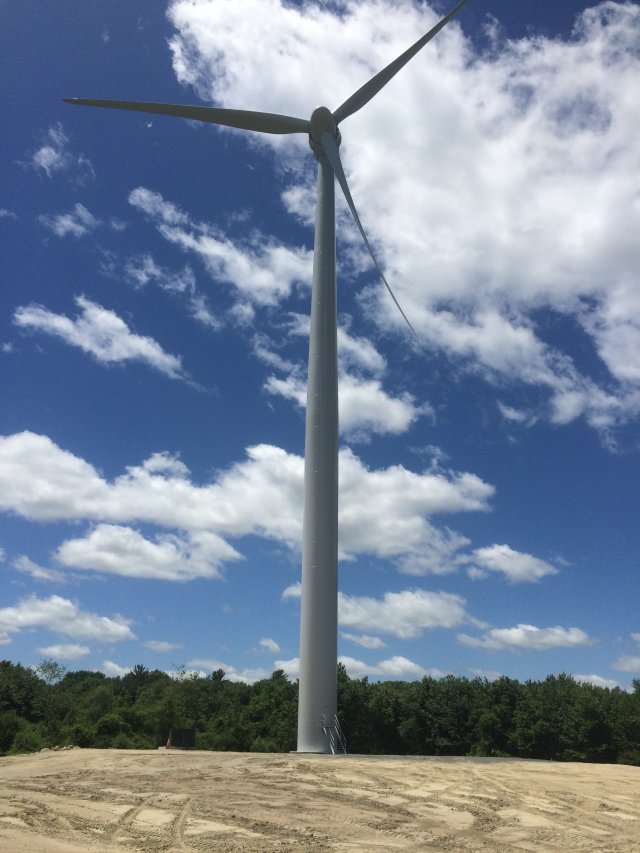
The 10-acre Picillo Farm Superfund site is in Coventry, Rhode Island. During the 1970s, a pig farm was on-site. In 1977, farm owners allowed for the disposal of liquid chemical wastes, solid wastes and at least 10,000 drums of hazardous substances in several unlined trenches. These actions contaminated soil, surface water and groundwater with chemicals, including industrial solvents, pesticides, oils and paint sludges. In 1977, regulatory agencies found the site after an explosion and fire. The EPA added the site to the National Priorities List (NPL) in 1983. Cleanup included removal of bulk wastes and buried drums, removal and off-site disposal of contaminated soils, treatment of on-site soils, groundwater extraction and treatment, surface drainage controls, fencing and institutional controls. Groundwater monitoring is ongoing. In 2016, a wind energy developer installed three wind turbines next to the site. One of the turbines is in the groundwater institutional control area. Power generated by the turbines is sold back to the grid.
Last updated September 2024
As of December 2025, EPA did not have economic data related to on-site businesses, or economic data were not applicable due to site use. For additional information click here.
For more information:
ROSE HILL REGIONAL LANDFILL
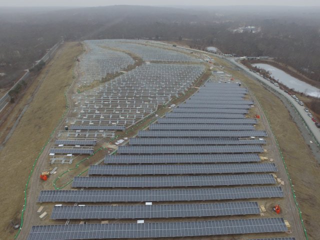
The Rose Hill Regional Landfill Superfund site is a former municipal landfill in South Kingstown, Rhode Island. From 1967 to 1983, South Kingstown leased the area for use as a domestic and industrial waste disposal facility. Improper disposal activities contaminated site groundwater, soils and three nearby private wells. Runoff contaminated nearby surface water bodies. The EPA found the contamination in 1981. In 1983, the facility stopped operations and the operator graded and seeded the disposal areas. In 1989, the EPA added the site to the National Priorities List (NPL). Early investigations found landfill gases moving off-site, toward nearby homes. Cleanup activities included extending the public water supply to homes with contaminated wells, putting in gas alarms for nearby homes and relocating one residence. Landfill cleanup activities include consolidating landfill areas, capping the landfill, installing a landfill gas destruction system, monitoring and restricting groundwater use. The EPA will determine the need for more cleanup activities based on monitoring. A South Kingston transfer station for municipal wastes is on part of the site. Surrounding land uses include a hunting preserve, a bird dog kennel and field training facilities, and a pet cemetery. South Kingstown Town Council also authorized development of a solar photovoltaic energy farm on-site. The 4.7-megawatt solar farm is located on the landfill caps. It opened in 2018.
Last updated September 2024
As of December 2025, EPA had data on 2 on-site businesses. EPA did not have further economic details related to these businesses. For additional information click here.
For more information:
- Site Redevelopment Profile: Rose Hill Regional Landfill Superfund Site (PDF)
- Superfund Site Profile Page
WEST KINGSTON TOWN DUMP/URI DISPOSAL AREA
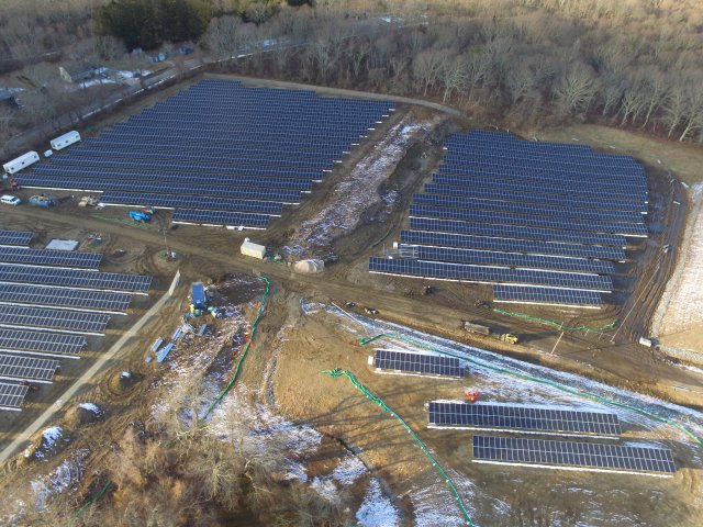
The 18-acre West Kingston Town Dump/URI Disposal Area Superfund site is in South Kingston, Rhode Island. A gravel mine opened on part of the site, the West Kingston Town Dump, in the 1930s. From the late 1940s to 1975, a gravel mine also operated on-site, at the URI Disposal Area. Starting in 1951, area towns and URI began disposing of unregulated waste on-site. The dump closed in 1978. However, disposal continued until at least 1987. Starting in 1988, the state connected affected residential wells nearby to the city water supply. A 1989 inspection found leaking drums next to the site. Drum contents contaminated subsurface soil and groundwater. The EPA added the site to the National Priorities List (NPL) in October 1992. For cleanup, the potentially responsible parties combined waste from both areas and capped it on-site. In 2009 and 2011, the EPA injected chemicals to help break down contaminants in the groundwater. Operation and maintenance activities and groundwater monitoring are ongoing. Residents and URI students use walking trails on-site. Solar facilities at the West Kingston Town Dump, the URI Disposal Area and an adjacent field opened in 2018. These facilities have a combined capacity of 4.6 megawatts.
Last updated September 2024
As of December 2025, EPA had data on one on-site business. EPA did not have further economic details related to this business. For additional information click here.
For more information:
- Site Redevelopment Profile: West Kingston Town Dump/URI Disposal Area Superfund Site (PDF)
- Superfund Site Profile Page
WESTERN SAND & GRAVEL
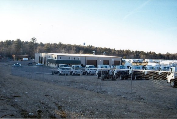
The Western Sand & Gravel Superfund site includes about 25 acres in a rural area on the boundary of Burrillville and North Smithfield, Rhode Island. From 1953 to 1975, a sand and gravel quarry was active on-site. From 1975 to 1979, a waste disposal area was on-site. Operators disposed of wastes in unlined lagoons and pits. These waste handling practices resulted in contamination of soil and groundwater. The EPA added the site to the National Priorities List (NPL) in 1983. Cleanup included a groundwater recirculation system, an alternate water supply, restrictions on groundwater and land use, and monitoring of natural processes to clean up groundwater. It also included waste removal, capping of a 2-acre area and fencing of the 6-acre area of contaminated soil. In 2001, Supreme Mid-Atlantic purchased the site property through a Prospective Purchaser Agreement (PPA). A PPA encourages the reuse of Superfund site properties by addressing purchaser and lessee liability concerns. In 2004, the company completed construction of a 20,000-square-foot truck-body assembly building and open space for truck parking. Supreme Mid-Atlantic conducted assembly, sales and service activities at the site until 2016, when it closed its Rhode Island operation. Doering Equipment Company bought the property in 2018. It operates a body shop for service and utility trucks on-site.
Last updated September 2024
As of December 2025, EPA had data on one on-site business. This business employed 14 people and generated an estimated $1,808,000 in annual sales revenue. For additional information click here.
For more information: