U.S. flag

An official website of the United States government

Here’s how you know

Dot gov

Official websites use .gov
A .gov website belongs to an official government organization in the United States.

HTTPS

Secure .gov websites use HTTPS
A lock (LockA locked padlock) or https:// means you’ve safely connected to the .gov website. Share sensitive information only on official, secure websites.

    • Environmental Topics
    • Air
    • Bed Bugs
    • Cancer
    • Chemicals, Toxics, and Pesticide
    • Emergency Response
    • Environmental Information by Location
    • Health
    • Land, Waste, and Cleanup
    • Lead
    • Mold
    • Radon
    • Research
    • Science Topics
    • Water Topics
    • A-Z Topic Index
    • Laws & Regulations
    • By Business Sector
    • By Topic
    • Compliance
    • Enforcement
    • Laws and Executive Orders
    • Regulations
    • Report a Violation
    • Environmental Violations
    • Fraud, Waste or Abuse
    • About EPA
    • Our Mission and What We Do
    • Headquarters Offices
    • Regional Offices
    • Labs and Research Centers
    • Planning, Budget, and Results
    • Organization Chart
    • EPA History

Breadcrumb

  1. Home
  2. Water Data and Tools

How's My Waterway

Description

Click on the map to launch the application

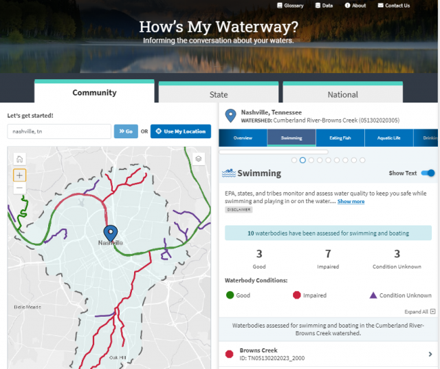
How's My Waterway was designed to provide the general public with information about the condition of their local waters based on data that states, federal, tribal, local agencies and others have provided to EPA. Water quality information is displayed on 3 scales in How’s My Waterway; community, state and national. More recent or more detailed water information may exist that is not yet available through EPA databases or other sources.  Check out the How's My Waterway Fact Sheet.  For the latest changes in How's My Waterway, view our update page.

What will I find in How’s My Waterway?  

Community: 

  • Water quality in your local watershed.
  • Information on swimming, eating fish and aquatic life.
  • Restoration and protection efforts.
  • Permitted discharger information.
  • Identified Issues (impairments and discharge violations).
  • Local drinking water information.
  • Water monitoring information.

State:

  • Information about a state's water program.
  • Summaries of specific water assessments.
  • A state-wide survey of water quality where available.
  • State drinking water metrics.

National: 

  • The quality of water resources nationwide and their main challenges.
  • National drinking water information and metrics.

New Widget

The How's My Waterway widget is live! Grab the code here to host it on your website.

Announcements:

  • How's My Waterway January 25, 2023 Webcast recording now available
  • Check out our new educators section
  • How's My Waterway Widget Instructions
  • How's My Waterway January 20, 2022 Webcast recording now available
  • How's My Waterway December 15, 2020 Webcast recording now available
  • View the How's My Waterway Intro Video on YouTube

Water Data and Tools

  • Integrated Water Analysis
  • Ambient Water Quality
  • Community Financing
  • Drinking Water
  • Water Restoration
  • Water Quality Models
Contact Us About Water Data and Tools
Contact Us to ask a question, provide feedback, or report a problem.
Last updated on December 12, 2024
  • Assistance
  • Spanish
  • Arabic
  • Chinese (simplified)
  • Chinese (traditional)
  • French
  • Haitian Creole
  • Korean
  • Portuguese
  • Russian
  • Tagalog
  • Vietnamese
United States Environmental Protection Agency

Discover.

  • Accessibility Statement
  • Budget & Performance
  • Contracting
  • EPA www Web Snapshot
  • Grants
  • No FEAR Act Data
  • Plain Writing
  • Privacy
  • Privacy and Security Notice

Connect.

  • Data
  • Inspector General
  • Jobs
  • Newsroom
  • Regulations.gov
  • Subscribe
  • USA.gov
  • White House

Ask.

  • Contact EPA
  • EPA Disclaimers
  • Hotlines
  • FOIA Requests
  • Frequent Questions
  • Site Feedback

Follow.