U.S. flag

An official website of the United States government

Here’s how you know

Dot gov

Official websites use .gov
A .gov website belongs to an official government organization in the United States.

HTTPS

Secure .gov websites use HTTPS
A lock (LockA locked padlock) or https:// means you’ve safely connected to the .gov website. Share sensitive information only on official, secure websites.

    • Environmental Topics
    • Air
    • Bed Bugs
    • Cancer
    • Chemicals, Toxics, and Pesticide
    • Emergency Response
    • Environmental Information by Location
    • Health
    • Land, Waste, and Cleanup
    • Lead
    • Mold
    • Radon
    • Research
    • Science Topics
    • Water Topics
    • A-Z Topic Index
    • Laws & Regulations
    • By Business Sector
    • By Topic
    • Compliance
    • Enforcement
    • Laws and Executive Orders
    • Regulations
    • Report a Violation
    • Environmental Violations
    • Fraud, Waste or Abuse
    • About EPA
    • Our Mission and What We Do
    • Headquarters Offices
    • Regional Offices
    • Labs and Research Centers
    • Planning, Budget, and Results
    • Organization Chart
    • EPA History

Breadcrumb

  1. Home
  2. Permitting Under the Clean Air Act

Veolia Sauget Air Monitoring

Overview 

Veolia ES Technical Solutions stores and burns hazardous waste at its facility at 7 Mobile Ave., Sauget, Illinois. In 2021, EPA conducted an air monitoring study using state-of-the-art technology at Veolia and monitors did not detect anything that would have short- or long-term health effects for people living nearby. The EPA study focused on metals, like lead and mercury. EPA monitored for nine months to ensure that the data was representative of typical operations at the facility. EPA has not seen any recent air quality data to suggest that residents are exposed to unhealthy air pollution levels coming from the Veolia facility.  

EPA placed two temporary monitoring sites in Sauget, Illinois, near the Veolia facility.  The mercury monitoring site is located about 750 feet directly east of Veolia’s southern emissions stack.  The metals monitoring site is located just east of Veolia’s two northern emission stacks.  The Illinois EPA operates a permanent air monitoring site approximately 1.5 miles to the northeast of Veolia’s northern emission stack.

Study Design 

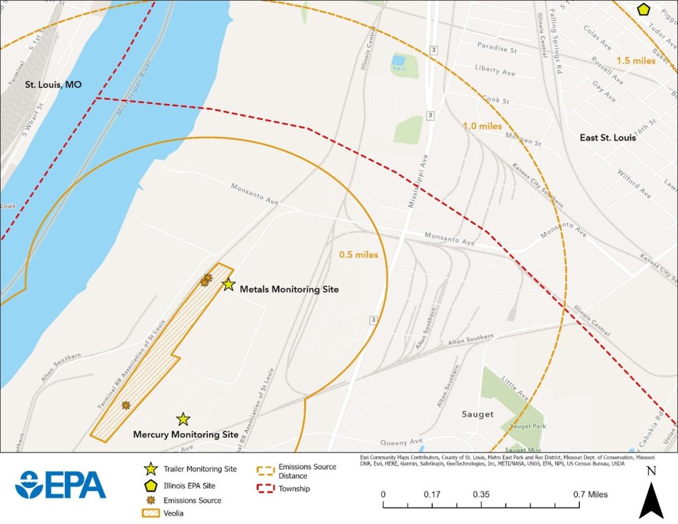
As shown on the map above, EPA operated two air-monitoring trailers over the 9-month study. Based on meteorology and air-dispersion modeling, EPA located the monitors to measure the highest levels of pollution from Veolia.  

One monitoring trailer measured concentrations of 23 different metals on an hourly basis. For metals, it measured particles equal to or smaller than 10 µm in size (i.e., PM10). For reference, a human hair is typically 50-70 µm in diameter. This trailer also monitored wind speed, wind direction, temperature, and barometric pressure.  

The other air-monitoring trailer measured different types of mercury: gaseous elemental mercury (5-minute), gaseous oxidized mercury (2-hour), and particulate-bound mercury (2-hour, 2.5 µm in size – i.e., PM2.5).  

Results 

Based on metal concentrations collected and analyzed during EPA’s study, monitors did not record any values above levels expected to cause health impacts for people living near Veolia. To understand what the data means for the health of nearby residents, EPA compared the results to current health benchmarks, including the Agency for Toxic Substances and Disease Registry’s minimal risk levels (MRLs). Concentrations of metals were below both acute (short-term) and chronic (long-term) health benchmarks. EPA also calculated the potential cumulative cancer risk from breathing levels of these metals continuously for 70 years. The estimated cancer risk is well below EPA’s level for additional review. 

Daily-averaged data summaries are available on this website
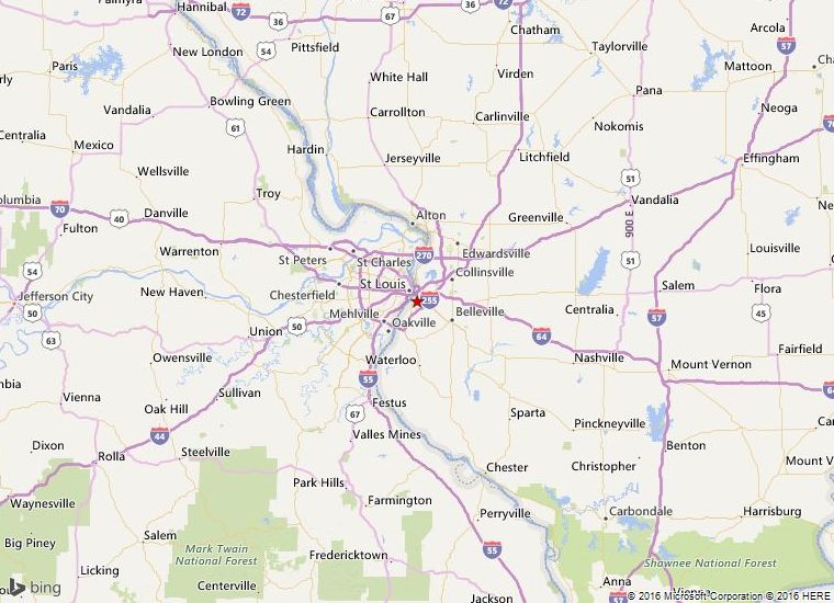
Veolia Air Monitoring (xlsx) (80.67 KB)

Location

Veolia Sauget map area

Contact Information

Katherine Haile 
(haile.katherine@epa.gov)
312-886-6439

Permitting Under the Clean Air Act

  • Clean Air Act Permitting Around the Nation
    • New England Region (R1)
    • New York, New Jersey, Puerto Rico and U.S. Virgin Islands (R2)
    • Mid-Atlantic Region (R3)
    • Southeastern Region (R4)
    • Great Lakes Region (R5)
    • South Central Region (R6)
    • Midwest Region (R7)
    • Mountains and Plains Region (R8)
    • Pacific Southwest Region (R9)
      • About PSD Permitting in Region 9
      • Air Permit Delegation and PSD SIP Approval Status in Region 9
      • About NSR Permitting in Region 9
      • About Title V Permitting in Region 9
      • Electronic Permit System and Dashboards
      • Pending and Completed Permit Actions
      • Clean Air Act Permitting in Arizona
      • Clean Air Act Permitting in California
      • Clean Air Act Permitting in Hawai'i and Pacific Islands
      • Clean Air Act Permitting in Nevada
    • Pacific Northwest Region (R10)
  • CAA Permitting Tools & ​Related Resources
  • Outer Continental Shelf Air Permits
Contact Us About Permitting Under the Clean Air Act
Contact Us to ask a question, provide feedback, or report a problem.
Last updated on May 2, 2025
  • Assistance
  • Spanish
  • Arabic
  • Chinese (simplified)
  • Chinese (traditional)
  • French
  • Haitian Creole
  • Korean
  • Portuguese
  • Russian
  • Tagalog
  • Vietnamese
United States Environmental Protection Agency

Discover.

  • Accessibility Statement
  • Budget & Performance
  • Contracting
  • EPA www Web Snapshot
  • Grants
  • No FEAR Act Data
  • Plain Writing
  • Privacy
  • Privacy and Security Notice

Connect.

  • Data
  • Inspector General
  • Jobs
  • Newsroom
  • Regulations.gov
  • Subscribe
  • USA.gov
  • White House

Ask.

  • Contact EPA
  • EPA Disclaimers
  • Hotlines
  • FOIA Requests
  • Frequent Questions
  • Site Feedback

Follow.