
Dasymetric Toolbox
Dasymetric Mapping
Dasymetric mapping is a geospatial technique that uses information such as land use and land cover to distribute population counts within selected boundaries like census blocks. EnviroAtlas researchers use dasymetric population data to calculate the distribution of ecosystem services, model viewsheds, estimate resource use, and measure exposure potential.
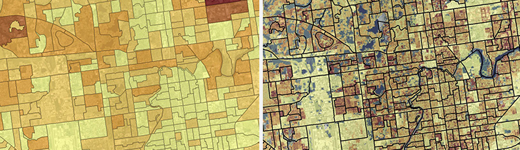
- EnviroAtlas uses dasymetric mapping to spatially distribute census population counts based on land cover classifications in the National Land Cover Database (NLCD) and other ancillary data.
- By removing areas that are uninhabited (e.g., open water, steep slopes, rail yards, cemeteries), researchers can better estimate where people live.
- EnviroAtlas researchers use the dasymetric data to calculate the distribution of ecosystem services and other metrics including walkability, viewsheds, resource use, and exposure potential.
- 2020 dasymetric data at 30 m resolution has been developed for all 50 States, Puerto Rico, and the US Virgin Islands.
- 2010 dasymetric data at 30 m resolution is available for the conterminous US
- For more information on the dasymetric data created for EnviroAtlas, read the Dasymetric Allocation of Population Fact Sheet.
Intelligent Dasymetric Mapping (IDM) Toolbox
Following the methods described in Baynes, J., Neale, A., & Hultgren, T. (2022), EPA developed the Intelligent Dasymetric Mapping (IDM) toolbox for ArcGIS Pro and a corresponding toolbox that uses open source GIS packages.
- Download the IDM Toolbox for ArcGIS Pro (originally developed for version 2.2.4; tested on versions up to 3.2)
- Download the IDM Toolbox for Open-Source GIS
Click the '<> Code' button at the top of the linked GitHub pages to either clone the repository or download as a .ZIP file.
*Previous versions of the IDM toolbox are available for reference, but are no longer maintained.
The IDM Toolbox uses ArcPy and arcpy.da functionality. This version requires ArcGIS 10.3 or higher. The ArcPy toolbox contains a number of scripts that assist preparing vector population and raster ancillary datasets for intelligent dasymetric mapping, performs the dasymetric calculations, and then generates a floating point output raster of revised population density. Please see the documentation in the zip file for more information on the individual tools.
- Download the IDM Toolbox for ArcGIS 10.3 (ZIP) (75 K, August 2015)
The ArcGIS 10.2 version below contains bug fixes related to broken links within the included models and minor code changes that should speed processing from previous versions. Please note this toolbox is available for ArcGIS 10.2 (may work for 10.0 and 10.1, but not tested) and ArcPy, 4/16/15.
- Download the IDM Toolbox for ArcGIS 10.2 (ZIP)(65 K, April 2015)