Photo Gallery for the Southeast New England Program
- NEP and Restore America's Estuaries Announce FY2018 Grantees
- Oyster Pond Furlong Site (Oyster Pond, Chatham, MA)
- Gateway Marina Site (Hyannis Inner Harbor, Hyannis, MA)
- SNECWRP Public Launch - October 2014
- Photographs of the Southeast New England Region
NEP and Restore America's Estuaries Announce FY2018 Grantees
Oyster Pond Furlong Site (Oyster Pond, Chatham, MA)
Gateway Marina Site (Hyannis Inner Harbor, Hyannis, MA)
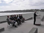
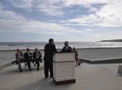
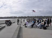
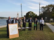
SNECWRP Public Launch - October 2014
Photographs of the Southeast New England Region

View a larger version of this image.
(Photo Credit - Save the Bay)

View a larger version of this image.
(Photo Credit - Cape Cod Commission)

View a larger version of this image.
(Photo Credit - Cape Cod Commission)

View a larger version of this image.
(Photo Credit - Cape Cod Commission)

View a larger version of this image.
(Photo Credit - Cape Cod Commission)
View a larger version of this image.
(Photo Credit - Save the Bay)

View a larger version of this image.
(Photo Credit - Save the Bay)

View a larger version of this image.
(Photo Credit - Save the Bay)

View a larger version of this image.
(Photo Credit - Save the Bay)

View a larger version of this image.
(Photo Credit - Cape Cod Commission)

View a larger version of this image.
(Photo Credit - Buzzards Bay National Estuary Program)

View a larger version of this image.
(Photo Credit - Buzzards Bay National Estuary Program)

View a larger version of this image.
(Photo Credit - Buzzards Bay National Estuary Program)

View a larger version of this image.
(Photo Credit - Buzzards Bay National Estuary Program)

View a larger version of this image.
(Photo Credit - Buzzards Bay National Estuary Program)

View a larger version of this image.
(Photo Credit - Buzzards Bay National Estuary Program)
View a larger version of this image.
(Photo Credit - Buzzards Bay National Estuary Program)

View a larger version of this image.
(Photo Credit - Buzzards Bay National Estuary Program)

View a larger version of this image.
(Photo Credit - Buzzards Bay National Estuary Program)

View a larger version of this image.
(Photo Credit - Buzzards Bay National Estuary Program)

View a larger version of this image.
(Photo Credit - Buzzards Bay National Estuary Program)
View a larger version of this image.
(Photo Credit - Buzzards Bay National Estuary Program)

View a larger version of this image.
(Photo Credit - Buzzards Bay National Estuary Program)

View a larger version of this image.
(Photo Credit - Buzzards Bay National Estuary Program)

View a larger version of this image.
(Photo Credit - Buzzards Bay National Estuary Program)
View a larger version of this image.
(Photo Credit - Buzzards Bay National Estuary Program)


![Before Site Clearing [06/03/2015] Before Site Clearing [06/03/2015]](/system/files/images/2025-08/chatham-201506-1-sm.jpg)

![Site Clearing [06/03/2015] Site Clearing [06/03/2015]](/system/files/images/2025-08/chatham-201506-2-sm.jpg)

![Site Cleared [06/17/2015] Site Cleared [06/17/2015]](/system/files/images/2025-08/chatham-201506-3-sm.jpg)

![ISR Stone [08/2015] ISR Stone [08/2015]](/system/files/images/2025-08/chatham-201508-1-sm.jpg)
![Trees Needing Removal [08/2015] Trees Needing Removal [08/2015]](/system/files/images/2025-08/chatham-201508-2-sm.jpg)
![Delivering ISR Stone [08/12/2015] Delivering ISR Stone [08/12/2015]](/system/files/images/2025-08/chatham-201508-3-sm.jpg)
![Inlet Structure Array [08/12/2015] Inlet Structure Array [08/12/2015]](/system/files/images/2025-08/chatham-201508-4-sm.jpg)
![Forebay and Infiltration Zone [08/13/2015] Forebay and Infiltration Zone [08/13/2015]](/system/files/images/2025-08/chatham-201508-5-sm.jpg)
![Forebay and Infiltration Zone [08/13/2015] Forebay and Infiltration Zone [08/13/2015]](/system/files/images/2025-08/chatham-201508-6-sm.jpg)
![Biosoil Top Layer [08/19/2015] Biosoil Top Layer [08/19/2015]](/system/files/images/2025-08/chatham-201508-7-sm.jpg)
![Forebay and Biosoil [08/20/2015] Forebay and Biosoil [08/20/2015]](/system/files/images/2025-08/chatham-201508-8-sm.jpg)
![Outlet Structure Array [08/20/2015] Outlet Structure Array [08/20/2015]](/system/files/images/2025-08/chatham-201508-9-sm.jpg)
![Placing D Structure [11/2015] Placing D Structure [11/2015]](/system/files/images/2025-08/chatham-201511-1-sm.jpg)

![Gateway Marina Barnstable BMP Parcel [Before] Gateway Marina Barnstable BMP Parcel [Before]](/system/files/images/2025-08/gateway-marina-2-sm.jpg)
![Gateway Marina Barnstable BMP Parcel [Before] Gateway Marina Barnstable BMP Parcel [Before]](/system/files/images/2025-08/gateway-marina-3-sm.jpg)
![Materials Management [04/14/2015] Materials Management [04/14/2015]](/system/files/images/2025-08/barnstable-201504-1-sm.jpg)
![Materials Management [04/14/2015] Materials Management [04/14/2015]](/system/files/images/2025-08/barnstable-201504-2-sm.jpg)
![Public Outreach [04/14/2015] Public Outreach [04/14/2015]](/system/files/images/2025-08/barnstable-201504-3-sm.jpg)
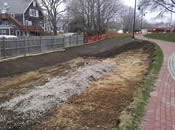
![Excavation and Grading of Barnstable BMP [04/21/2015] Excavation and Grading of Barnstable BMP [04/21/2015]](/system/files/images/2025-08/gateway-marina-4-sm.jpg)
![Materials Management [04/21/2015] Materials Management [04/21/2015]](/system/files/images/2025-08/barnstable-201504-4-sm.jpg)
![Leaching Field [04/21/2015] Leaching Field [04/21/2015]](/system/files/images/2025-08/barnstable-201504-5-sm.jpg)
![Leaching Field [04/21/2015] Leaching Field [04/21/2015]](/system/files/images/2025-08/barnstable-201504-6-sm.jpg)
![Barnstable - MS4 Trunk Line [04/22/2015] Barnstable - MS4 Trunk Line [04/22/2015]](/system/files/images/2025-08/barnstable-201504-7-sm.jpg)

![Barnstable BMP Diversion Structure Installation Barnstable D-Structure Install [04/23/2015]](/system/files/images/2025-08/barnstable-201504-8-sm.jpg)
![Groundwater [04/2015] Groundwater [04/2015]](/system/files/images/2025-08/barnstable-201504-9-sm.jpg)
![Materials Management [04/28/2015] Materials Management [04/28/2015]](/system/files/images/2025-08/barnstable-201504-10-sm.jpg)
![Installation of the Geotextile Bottom Liner at Barnstable BMP Site [04/29/2015] Installation of the Geotextile Bottom Liner at Barnstable BMP Site [04/29/2015]](/system/files/images/2025-08/gateway-marina-8-sm.jpg)
![Gravel Being Poured into Barnstable BMP on top of Geotextile Lining [04/29/2015] Gravel Being Poured into Barnstable BMP on top of Geotextile Lining [04/29/2015]](/system/files/images/2025-08/gateway-marina-7-sm.jpg)
![Gravel Being Poured into Barnstable BMP on top of Geotextile Lining [04/29/2015] Gravel Being Poured into Barnstable BMP on top of Geotextile Lining [04/29/2015]](/system/files/images/2025-08/barnstable-201504-11-sm.jpg)
![Barnstable - Constructing Anaerobic Bioreactor [04/29/2015] Barnstable - Constructing Anaerobic Bioreactor [04/29/2015]](/system/files/images/2025-08/barnstable-201504-12-sm.jpg)
![Materials Management [05/2015] Materials Management [05/2015]](/system/files/images/2025-08/barnstable-201505-1-sm.jpg)
![Barnstable - Construction Logistics [05/06/2015] Barnstable - Construction Logistics [05/06/2015]](/system/files/images/2025-08/barnstable-201505-2-sm.jpg)
![Barnstable - Delivering ISR Stone [05/06/2015] Barnstable - Delivering ISR Stone [05/06/2015]](/system/files/images/2025-08/barnstable-201505-3-sm.jpg)
![Groundwater [05/12/2015] Groundwater [05/12/2015]](/system/files/images/2025-08/barnstable-201505-4-sm.jpg)
![Barnstable - Infiltration Basin and Begin Biosoil [05/14/2015] Barnstable - Infiltration Basin and Begin Biosoil [05/14/2015]](/system/files/images/2025-08/barnstable-201505-5-sm.jpg)
![Barnstable - Finish Grading [05/27/2015] Barnstable - Finish Grading [05/27/2015]](/system/files/images/2025-08/barnstable-201505-6-sm.jpg)
![Barnstable - Input and Output Structure Arrays [05/27/2015] Barnstable - Input and Output Structure Arrays [05/27/2015]](/system/files/images/2025-08/barnstable-201505-7-sm.jpg)
![Barnstable Site at Gateway Marina Landscaped, Finished BMP [06/2015] Barnstable Site at Gateway Marina Landscaped, Finished BMP [06/2015]](/system/files/images/2025-08/gateway-marina-9-sm.jpg)
![Hyannis BMP after Large Flash Storm Event [07/01/2015] Hyannis BMP after Large Flash Storm Event [07/01/2015]](/system/files/images/2025-08/gateway-marina-10-sm.jpg)
![Hyannis - 1.71 in Storm [02/11/2016] Hyannis - 1.71 in Storm [02/11/2016]](/system/files/images/2025-08/barnstable-201602-1-sm.jpg)
