U.S. flag

An official website of the United States government

Here’s how you know

Dot gov

Official websites use .gov
A .gov website belongs to an official government organization in the United States.

HTTPS

Secure .gov websites use HTTPS
A lock (LockA locked padlock) or https:// means you’ve safely connected to the .gov website. Share sensitive information only on official, secure websites.

    • Environmental Topics
    • Air
    • Bed Bugs
    • Cancer
    • Chemicals, Toxics, and Pesticide
    • Emergency Response
    • Environmental Information by Location
    • Health
    • Land, Waste, and Cleanup
    • Lead
    • Mold
    • Radon
    • Research
    • Science Topics
    • Water Topics
    • A-Z Topic Index
    • Laws & Regulations
    • By Business Sector
    • By Topic
    • Compliance
    • Enforcement
    • Laws and Executive Orders
    • Regulations
    • Report a Violation
    • Environmental Violations
    • Fraud, Waste or Abuse
    • About EPA
    • Our Mission and What We Do
    • Headquarters Offices
    • Regional Offices
    • Labs and Research Centers
    • Planning, Budget, and Results
    • Organization Chart
    • EPA History

Breadcrumb

  1. Home
  2. EnviroAtlas

EnviroAtlas Web Services

​What are web services, and how can I use EnviroAtlas web services?

Mapping professionals widely use web services to share geospatial data and analysis tasks. A web service allows computers to share software and data over the internet. EnviroAtlas publishes representations of spatial data that a server makes available to other computers or applications. For EnviroAtlas users, web services are important for two reasons:

Ecoregion polygons for the contiguous United States
Ecoregion web service displayed over an imagery basemap.
  • Users can display EnviroAtlas maps and data in other online or desktop applications without having to download the data.
  • Using web services, EnviroAtlas can display relevant maps from other data sources in its Interactive Map.

EnviroAtlas implements Esri's ArcGIS Server technology to create, publish, and share web services for data developed for EnviroAtlas. EnviroAtlas web services are used to display data in the EnviroAtlas​ Interactive Map table of contents and are also available for public use in desktop mapping applications or web-based mapping applications. In some cases, EnviroAtlas uses web services created by other organizations.

Some examples of web services that are displayed in EnviroAtlas:
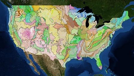
  • EPA Ecoregions data
  • Protected areas (PAD-US) data from the USGS National Gap Program
  • National Hydrography Dataset

Access web services published by EnviroAtlas

EnviroAtlas web services provide access to data layers through ESRI's ArcGIS Server and Open Geospatial Consortium (OGC) service formats. The services are published in the EPA's GeoPlatform Hosting Environment and include metadata that is discoverable through the EPA's Environmental Data Gateway (EDG) and Data.gov. Each EnviroAtlas web service can be imported into applications (such as ArcGIS Desktop, ArcGIS.com, Bing Maps, or OpenLayers) or into the EPA's GeoPlatform Online mapping interface.

Notice: EnviroAtlas Web Services Changed June 26, 2017

Prior EnviroAtlas web services were retired and replaced with the migration to the new interactive mapping application. This spreadsheet provides  detailed crosswalk of the retired and new web services (Excel file, 67 KB).

  • EnviroAtlas Web Services Guide(15 pp, 15 M, About PDF)

Documentation for each web service is located under the blue "info" icon next to the map name in the Interactive Map. OGC web map services (WMS) and web feature services (WFS) are also available for use; the links to these services are located on the ArcGIS Server service page.

  • EnviroAtlas Web Services REST page

EnviroAtlas

  • About Us
    • Ecosystem Services
    • Frequent Questions
    • Project Status
  • Web Apps
    • Interactive Map
    • Eco-Health Browser
  • How to Use
    • Tutorials
    • Example Uses
    • For Brownfields
    • Health Impact Assessment
  • Data
    • About the Data
    • Dynamic Data Matrix
    • Download
  • Resources & Publications
    • Educational Materials
    • Fact Sheets
    • Publications
  • Technical Resources
    • GIS Toolboxes
  • Related Links
Contact Us about EnviroAtlas
Contact Us to ask a question, provide feedback, or report a problem.
Last updated on October 23, 2024
  • Assistance
  • Spanish
  • Arabic
  • Chinese (simplified)
  • Chinese (traditional)
  • French
  • Haitian Creole
  • Korean
  • Portuguese
  • Russian
  • Tagalog
  • Vietnamese
United States Environmental Protection Agency

Discover.

  • Accessibility Statement
  • Budget & Performance
  • Contracting
  • EPA www Web Snapshot
  • Grants
  • No FEAR Act Data
  • Plain Writing
  • Privacy
  • Privacy and Security Notice

Connect.

  • Data
  • Inspector General
  • Jobs
  • Newsroom
  • Regulations.gov
  • Subscribe
  • USA.gov
  • White House

Ask.

  • Contact EPA
  • EPA Disclaimers
  • Hotlines
  • FOIA Requests
  • Frequent Questions
  • Site Feedback

Follow.