
Eastern Abandoned Uranium Mine Region
The Eastern AUM Region includes 101 mines roughly in the area between Gallup and the eastern edge of the Navajo Nation.
Background
- 101 total mines
- Investigations have been completed at 14 of the biggest mines or mines posing the most potential threat to human health
- Investigations are underway at four other of the biggest or highest risk mines
- Removal actions have been completed at eight mines
Mines in the Eastern Abandoned Uranium Mines Region include most of the largest mines on the Navajo Nation. They include deep below-ground mines that had water pumped out, shallower below-ground mines, and surface pit mines. There was also in-situ leaching at several mines near Crownpoint.
Enforcement
EPA has done extensive research to identify companies that can be held responsible for mine site investigations and cleanups. Many of the original mining companies are out of business or sold to other companies. EPA negotiates agreements with the companies still existing so those companies can pay for the work. EPA has legal agreements with United Nuclear Corporation at the NECR Mine, Chevron at the Old Gulf Mine in Mariano Lake Chapter, Western Nuclear at the Ruby Mines in Smith Lake Chapter, Homestake Mining Company for the Mac and Black Jack Mines in both Smith Lake and Mariano Lake Chapters, and has reached a settlement with Tronox Inc., for many old Kerr-McGee mines.
Investigations at the Mine Sites
EPA has scanned radiation levels at all the mines in the region. The results are available in the Site Screen Reports.
The next step is to perform a detailed investigation called a Removal Site Evaluation. This includes thorough scanning of the mine site and surrounding areas for radiation and sampling surface soil, soil from below the ground, and sediments in washes.
Investigations have been completed at:
- Northeast Church Rock (NECR) mine and the Northeast Churchrock Quivira #1 mine in the Coyote Canyon Chapter
- Northeast Church Rock Quivira mine CR-1E in the Standing Rock Chapter
- Old Gulf mine in Mariano Lake Chapter
- Ruby mines in Smith Lake Chapter
- Sections 26, 32, 33 mines in Casamero Lake Chapter
- Haystack #1, Bibo Trespass and Section 24 mines in Haystack Chapter
- Four Mac and Black Jack Mines in Smith Lake and Mariano Lake Chapters
- Old Church Rock Mine in Church Rock Chapter
Interim Actions Completed
EPA has performed actions to address immediate or severe risks at multiple mine sites. Contaminated soils have been excavated and removed from near houses or communities at the NECR Mine, the Quivira Mines, Section 26 mine, and Sections 32 and 33 mines.
- Physical hazards such as open vent holes and adits were closed at the two Ruby Mines.
- Fences and/or signs have been placed at several other mine sites.
Contaminated Structures
EPA and NNEPA have tested hundreds of houses and other structures for radiation that might have been from construction materials or fill soil brought from mine sites. EPA has built new homes for several families whose homesites or buildings were found to be contaminated.
Learn more about Addressing Contaminated Structures.
Community Involvement
Remedial Project Manager: Ali Oppelt
oppelt.alexandra@epa.gov
(415) 314-1902
Remedial Project Manager: Danielle Huang
huang.danielle@epa.gov
(415) 972-3003
Community Involvement Coordinator: Priscilla Tom
tom.priscilla@epa.gov
(505) 240-0093
The mines are spread around many chapters. Residents should know and participate in what EPA is doing in their community, and have a say in it. The main purpose of engaging community members is to give them the opportunity to become involved in EPA’s activities and help shape the decisions that are made affecting their community.
Who Is the Community?
The community includes people in both rural areas and more urban around Gallup. Many people graze livestock near mine sites. The region includes the Baca/Prewitt, Becenti, Bread Springs, Casamero Lake, Church Rock, Coyote Canyon, Crownpoint, Iyanbito, Littlewater, Mariano Lake, Nahodishgish, Pinedale, Red Rock, Rock Springs, Smith Lake, Standing Rock, and Thoreau chapters.
EPA Current Community Involvement Activities
EPA works with community leaders such as the council delegates, chapter, grazing and land board officials Andy Booher, Anthony Begay, Bess Tsosie, Leandra James, Leatricia Cowboy, responsible company liaisons, as well as community members for all outreach activities and information sessions which are conducted with cultural sensitivity. To keep the community informed, EPA has done the following:
- Developed fact sheets
- Conducted interviews for a Community Involvement Plan
- Attend chapter meetings and local events such as fairs and school functions to share information
EPA Past Community Involvement Activities
EPA completed the following activities in the community:
- Interviews for a Community Involvement Plan
- Work with chapter officials and family members to gain access to mine sites
- Attend local events to share information
Partnerships
EPA continues to work and strengthen relationship with a number of organizations focused on uranium and radiation, including:
- Navajo Nation Environmental Protection Agency
- Navajo Nation Abandoned Mine Lands Program
- Indian Health Service Community Uranium Exposure-Journey to Healing
- Indian Health Service Radiation Exposure Screening and Education Program
- Office of Navajo Uranium Workers
- Navajo Birth Cohort Study
- Navajo Nation Department of Health Community Health Representatives
- Bureau of Indian Affairs
- Indian Health Service
- Agency for Toxic Substances and Disease Registry
- Nuclear Regulatory Commission
- Department of Energy
- University of New Mexico
- Northern Arizona University
- Others as suggested by community members and local officials
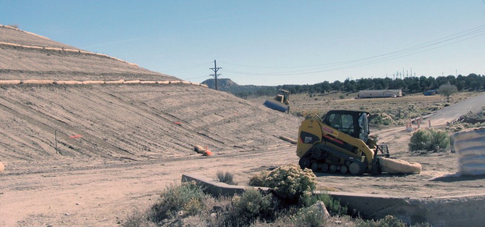
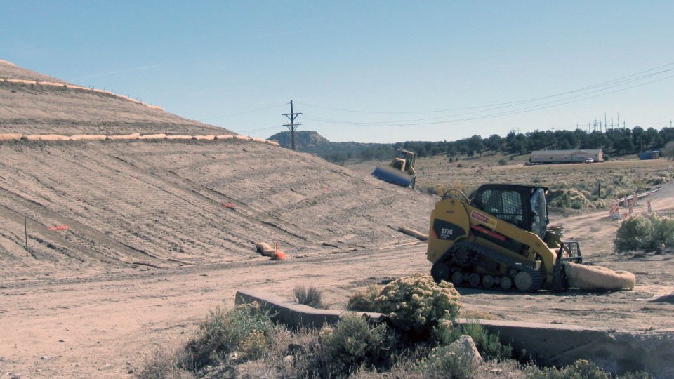
Site Photographs
Photographs of the abandoned uranium mine cleanup work around EPA’s Eastern Abandoned Uranium Mine Region.
-

Uranium Remembrance Day for the Spill at the UNC Mill.
-
Repairing the Cover at the Quivira CR 1 Mine Waste Pile in 2010.
-

New House Built to Replace Contaminated Structure in Haystack.
-

Grading and Covering the Mine Waste Pile at NECR in 2009.
-

Sampling Soils Below the Ground at Ruby #3 Mine.
-

Scanning for Radiation at the Old Gulf Mine.
-

Excavating Contaminated Soils at the NECR Mine.