
Lukachukai Mountains Mining District Tronox Mines
In 2014, the United States entered into a historic legal settlement that will provide almost $1 billion to investigate and clean up approximately 50 uranium mines on or near the Navajo Nation that were operated by Kerr-McGee Corporation and its successor, Tronox. Approximately 32 of these mines are in the Cove/Lukachukai area.
On March 5, 2024, Lukachukai Mountains Mining District (LMMD) was added to the National Priorities List (NPL), commonly called the Superfund List. Sites included on the NPL are eligible to receive federal funding for long-term, permanent cleanup.

Background
- Area is ~47 square miles
- Contains ~52 miles of tributaries
- ~32 of the 50 Tronox AUM are in the Cove/Lukachukai area
- Impacted areas of the LMMD NPL site cover ~37 square miles
Cove was named for its remote location in the foothills of the Chuska mountain range, tucked away in the Carrizo, Lukachukai and the beautiful mountains in northeastern Arizona, in the Northern Agency of the Navajo Nation. Uses of the Lukachukai mountains include farming, traditional gathering activities, grazing livestock, and hunting, but most residents work outside the community. Culturally significant areas, including ceremonial spaces, and geologic features such as mesas, overhangs, and caves, characterize the landscape setting and rich natural resources.
From the late 1940s to the 1980s, Kerr-McGee Corporation mined more than seven million tons of uranium ore on or near the Navajo Nation. About 32 of these mines are located in the Cove and Lukachukai Chapters. The area being assessed by EPA includes the abandoned uranium mines (AUMs) within the Cove and Lukachukai Chapter boundaries and the resulting contaminated areas. This area includes 50 AUMs within Cove Wash watershed.
Prior Investigations
EPA conducted several investigations within the Cove area, including a watershed assessment, a mine category assessment protocol (MCAP), aerial radiological surveys (ASPECT), an irrigation system and farm plot study, an air quality study, and Removal Site Evaluations (RSE) at 32 Tronox mines.
Cove Wash Watershed Assessment
The Cove Wash watershed is approximately 47 square miles, and contains approximately 52 miles of tributaries. The watershed supports diverse wildlife and plant communities, including perennial wetland habitats, and is home to protected species such as Mexican spotted owl and American dipper. Livestock grazing activities move seasonally between the lowlands and steep, mountainous areas.

The Cove Wash watershed is not currently a designated drinking water source but may have been historically used by residents before drinking water was provided by a municipal source 20 years ago. Resident farmers also use these streams for crop irrigation and livestock watering. Wells sampled in the past have shown exceedances in drinking water standards for Total uranium and have been decommissioned for domestic use.
The watershed assessment includes sampling surface water, seeps, springs, wells, and sediment throughout the watershed over the course of several years and several seasonal conditions. Sampling is used to pinpoint contaminated areas and to understand baseline conditions prior to waste removal actions. The assessment also includes biological surveys, and inventories of plants and herbs important for traditional or ceremonial uses.
Mine Category Assessment Protocol
The purpose of the mine category assessment protocol (MCAP) is to develop and implement a systematic method for assessing and surveying AUM sites to determine and evaluate removal factors impacting future site work. MCAP will result in a ranking system for prioritizing Removal Site Evaluations in upcoming years.
Airborne Spectral and Photometric Environmental Collection Technology (ASPECT)

EPA sent a team to perform an aerial radiation and imagery survey of the Navajo Nation abandoned uranium mines in the Cove Chapter area. This area includes the Lukachukai Mountains, containing the Kerr McGee/Tronox associated mine sites as well as the drainages and flat lands north of the mountains, extending past the Cove Chapter house.
The survey was performed by a white low-flying EPA airplane during one week in December 2014. The purpose of this survey was to identify potential additional radiation coming from the dozens of old mines scattered over many miles around the Cove Chapter area.
The survey will also assist EPA and Navajo Nation EPA (NNEPA) prioritize areas for additional environmental assessment activities that will be used to determine if these sites pose a risk to people in the area and, if so, what measures should be taken to minimize that risk.
Irrigation System and Farm Plot Study
Based on community concerns, EPA will investigate whether active and historic irrigation systems (irrigation canals and storage ponds) and farm fields may be impacted by mines, and whether there may be associated human health risks through ingestion of agricultural crops that are grown in sampled areas using irrigation systems and Cove Wash surface water.
Removal Site Assessments (RSE)
In 2018, EPA performed Removal Site Assessment investigations at 38 AUM sites, 37 target sites, 22 miles of drainages, nearly 10 miles of roads, and 32 background study areas. Purposes of the RSE investigations were to: (1) identify contaminants of potential concern, (2) delineate the lateral and vertical extent of mining-related contamination, and (3) determine volume of waste remaining in the areas investigated during the RSE. The field investigation included site mapping, X-ray fluorescence field surveys, gamma radiation surveys, surface soil sampling, subsurface soil sampling, and radon monitoring.
Cove Air Study
Starting in 2020, EPA performed the Cove Air Study by collecting air sampling data in the Cove area. Five sampling locations were selected to evaluate potential exposure to residents in the Cove, which is downwind of the AUMs in the nearby Lukachukai Mountains. Air samples were collected weekly during the effort and analyzed for radionuclides, metals, and particulate matter less than 2.5 micrometers in diameter (PM2.5).
No samples collected had a result above the project action limits for radionuclides, metals, or PM2.5. This indicates that the risk from exposure to the air sampled during this time period for each individual radionuclide and metal studied does not exceed the upper end of the EPA risk management range for excess cancer risk of or a noncancer hazard quotient of 0.1, and PM2.5 concentrations did not exceed the National Ambient Air Quality Standard for PM2.5.
Community Involvement
In the community of Cove, residents should know and participate in what EPA is doing in their community and to have a say in it. The primary purpose of engaging in dialogue and cooperation with Cove community members is to give them the opportunity to become involved in EPA’s activities and help shape the decisions that are made affecting their community.
Who is the Community?
The communities of Cove and Lukachukai are located in a remote areas on either side of the Lukachukai and Carrizo Mountains on the Navajo Nation. According to the 2010 U.S. Census there are 430 people that live in the Cove community and 1,984 people live in the Lukachukai community. Many of the community family members have worked in the mines located on the Lukachukai mountains. Community concerns include AUMs, air and water, future land use, health, workforce development.
EPA Current Community Involvement Activities
EPA works with Cove, Lukachukai, and Round Rock chapter officials as well as community members for all outreach activities and information sessions. All activities are culturally sensitive and are designed to keep the community well informed and engaged. To keep the community informed, EPA has done the following:
- Attends monthly Chapter Meetings
- Held a Superfund Job Training Initiative for Lukachukai Mountains Mining District
- Developed a Lukachukai Mountains Mining District Community Involvement Plan
EPA Past Community Involvement Activities
EPA completed the following activities in the community:
- A Mine Category Assessment Protocol (MCAP) was completed in May 2016.
- We have held community information sessions consistently at the request of local elected officials regarding all EPA activities.
- Provided Hazardous Waste Operations and Emergency Response Standard (HAZWOPER) training.
- Developed factsheets on ASPECT Flyover, Tronox Settlement, HAZWOPER training, Sampling and Internships, Sampling Results, Signage and Water Poster and maps specific to Cove.
- A Community Involvement Plan (CIP) was completed in 2025.
An information repository was created at the Cove Chapterhouse to provide community members access to hard copies of environmental reports, and a computer is provided to help community members view on-line documents. .
Partnerships
EPA conducts its work in close coordination with the Cove, Lukachukai, and Round Rock communities, Navajo agencies and educational institutions, as well as other federal agencies. Partnering activities include developing cooperative agreements and interagency agreements for support to EPA. Examples include:
- Strategic planning and implementation of priority activities in consultation with Navajo Nation EPA
- Engaging local expertise, such as educators and researchers from Dine’ College for technical and cultural sensitivity matters, and Navajo Abandoned Mine Lands Reclamation Department (Shiprock) for technical expertise
- Providing internship opportunities for students at Dine College, Navajo Technical University, University of New Mexico, Northern Arizona University, and others
- Prioritizing and coordinating actions with the Cove Chapter and local residents
- Developing new technical approaches with USGS and Navajo Nation EPA Water Quality
Cleanup Progress Timeline
Mining began in Cove in 1949 but ceased by the late 1960s., and reclamation efforts began in the early 1990s.
There are a total of 50 AUMs in the Cove Wash watershed. There are 26 of the 50 former Kerr-McGee mines listed in the Tronox settlement located in Cove.
The timeline below contains information about past and upcoming activities.
2000s
AML performs reclamation activities on 201 of 232 mine features and waste areas in Cove
2012
EPA performs a removal action at Cove Transfer Stations 1 and 2
2014
ASPECT aircraft flies over Cove and obtains radiological signature data and aerial photographs, December

2015
- Kerr-McGee settlement funding (close to $1 billion) is available to EPA for 32 of the Cove mines and the environmental areas they affect
- Watershed study sampling round 1, June
2016
- Watershed study sampling round 2, March and sampling round 3, August
- Mine Category Assessment Protocol fieldwork to prioritize mines for removal site evaluations, March and April
- Dam and irrigation study field work activities and sampling, June
- Groundwater investigation initiated
- Additional work at Transfer Station 1 to stabilize front yard slope, June
- Biological surveys for Mexican Spotted Owl and plant species, spring and summer
- Signs placed on non-regulated water sources, May
2017
- Removal site evaluations at prioritized mine areas
- Groundwater investigation continues
- Biological surveys for Mexican Spotted Owl and plant species, spring and summer
- Biological survey of the Cove Wash habitat, summer
- Air monitoring commences, spring
- Evaluate technologies that could be used for response actions (e.g. removal strategies and repository locations)
2018
- Removal actions at prioritized mine sites commence in the spring
- Air monitoring continues
- Evaluate permanent solutions and locations for mine waste

2019
- Decisions about permanent solutions and locations for mine waste will be presented to the public and decision documents signed
2020
- Initiate design process for permanent solutions/remedial actions
2023
- Began Time-Critical Removal Action at Cove Transfer Station 1 and 2

2024
- Lukachukai Mountains Mining District added to the National Priorities List
2025
- Completed Time-Critical Removal Action at the Cove Transfer Station 1 and 2
- Initiated a Time-Critical Removal Action at the Mesa V Mine Complex
- Completed investigation of the Cove Day School, with report to be issued in 2026
Site Photographs
Photographs related to the abandoned uranium mine cleanup work around Lukachukai Mountains Mining District Tronox Mines.
-

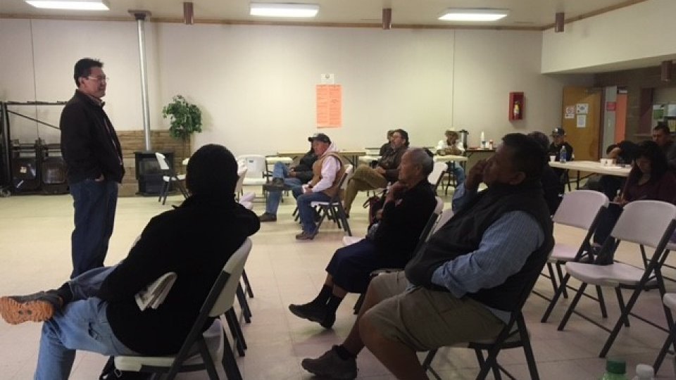
September 2017: A community meeting was held to provide an update on Tronox abandoned uranium mine progress and results of the Crop and Irrigation Study at Cove Chapter on Navajo Nation.
-
Open mine entrance and adjacent mine waste pile at Cove Mesa 5.
-

The Environmental Resource Information Center is available to Cove residents next to the Chapter house.
-
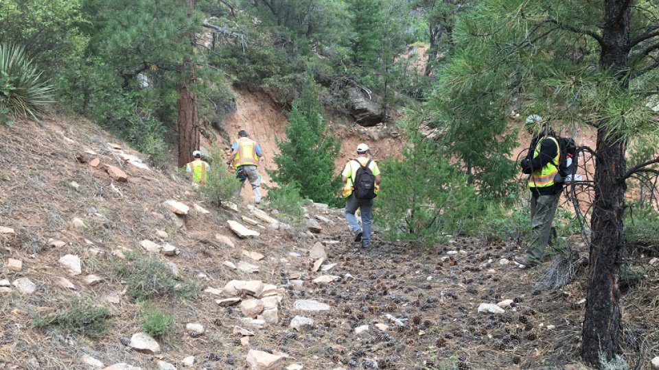
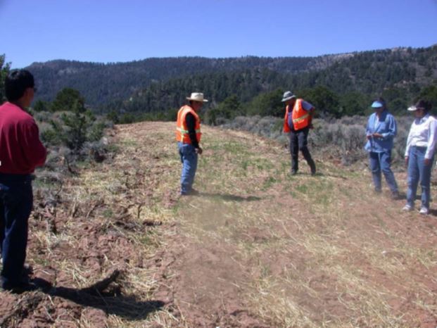
September 2017: EPA Region 9 continuing to assess all Tronox abandoned uranium mines in the Cove and Red Valley area to determine the most accessible roads to conduct Removal Site Evaluations.
-

Open mine entrance and adjacent mine waste pile at Cove Mesa 5.
-
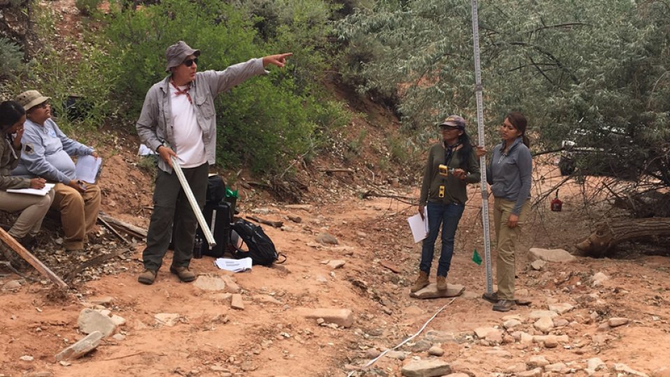
July 2017: EPA ecological risk assessor, Dr. Ned Black, instructing Diné College interns on how to assess the Cove Wash physical characteristics.
-
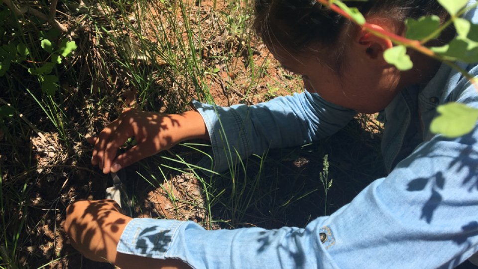
June 2017: Diné College intern helping conduct wetland delineation in the Cove Wash by identifying plant species.
-
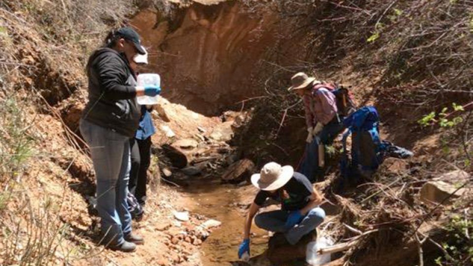
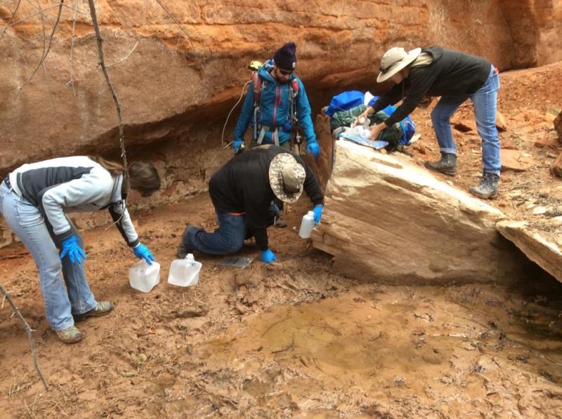
April 2017: EPA contractor and Diné College interns collecting water and sediment samples in the Cove Wash.
-

April 2017: EPA contractor collecting a sediment sample in the Cove Wash.
-
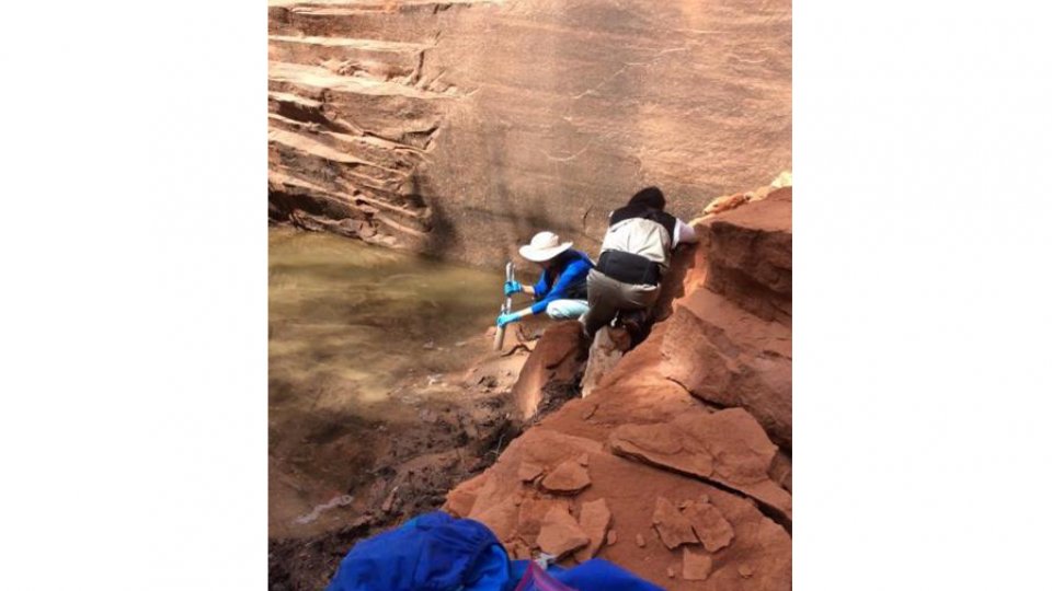
April 2017: EPA contractor collecting sediment in the pooled area at a rock fall in Cove Wash drainage.
-

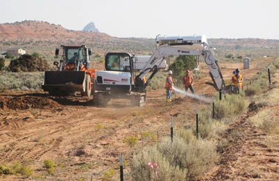
October 2016: Before slope stabilization at the former Transfer Station 1 in the Cove Chapter on the Navajo Nation.
-
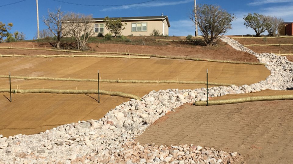
November 2016: EPA Region 9 completed construction activities to mitigate surface erosion at the former Transfer Station 1 located in the Cove Chapter on the Navajo Nation.