
El Paso Natural Gas Abandoned Uranium Mines
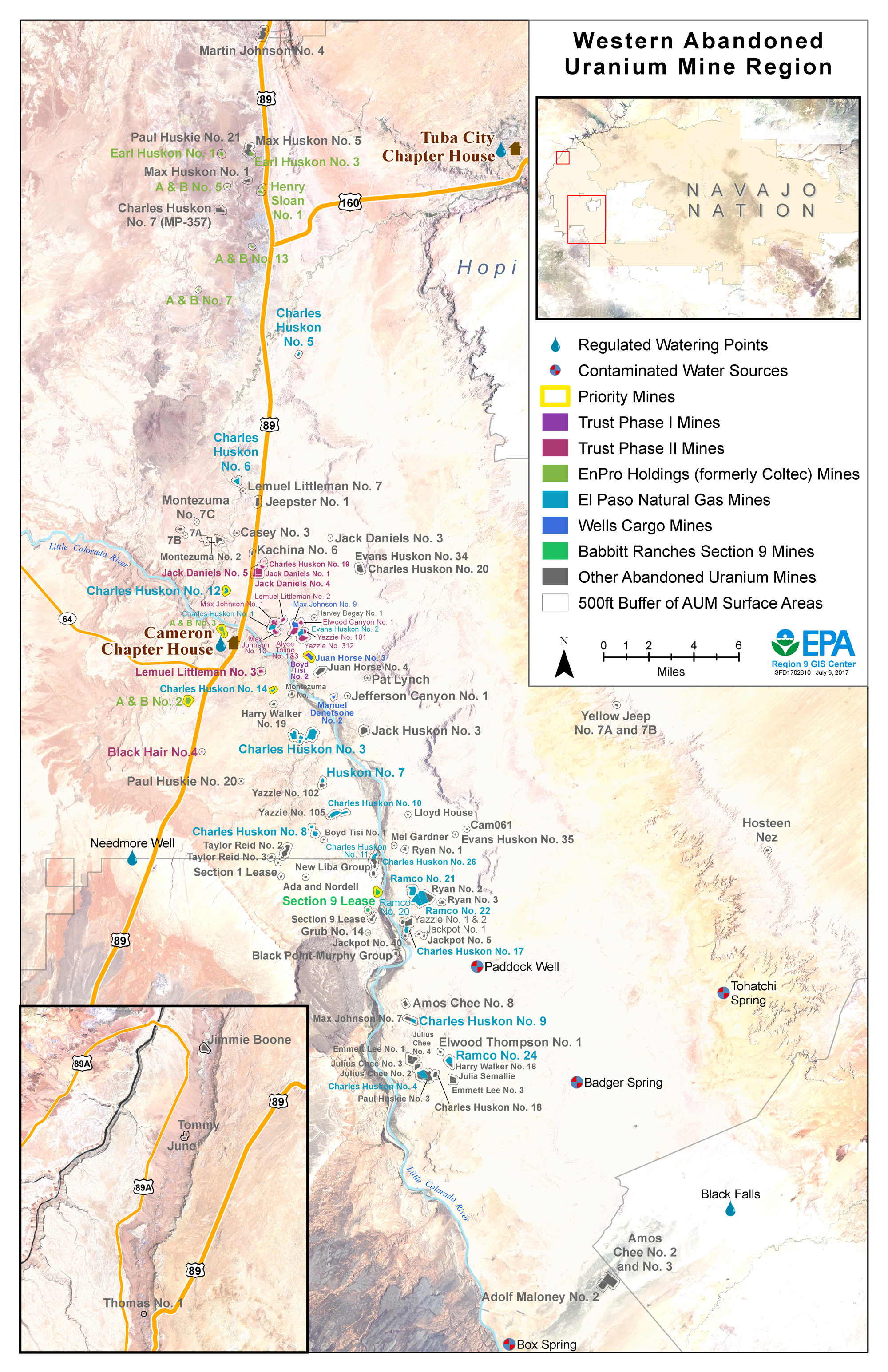
The El Paso Natural Gas Mines are 19 abandoned uranium mine claims generally located along the Little Colorado River or Highway 89 near Cameron, AZ. Under a 2013 Administrative Order on Consent, El Paso Natural Gas agreed to perform assessments for radium-226 at these mines.
El Paso Natural Gas is responsible for assessing 19 of the 111 abandoned uranium mine claims in the region
- Charles Huskon No. 12
- Charles Huskon No. 14
Background
Remedial Project Manager
Colin Larrick
larrick.colin@epa.gov
(415) 972-3086
Community Involvement Coordinator
Elsa Johnson
johnson.elsa@epa.gov
(415) 947-3552
Mines in the Cameron area of Navajo Nation were operated in the 1950s and 1960s by a number of different companies before being abandoned. While the Navajo Nation Abandoned Mine Lands program addressed many of the physical hazards associated with these mines, EPA and Navajo Nation EPA (NNEPA) are working to address remaining chemical and radiological hazards that may pose a risk to community members.
In 2013, EPA signed a legal agreement called an Administrative Order on Consent with El Paso Natural Gas to assess 19 mine claims in western Navajo Nation. View a map showing which mines El Paso Natural Gas is responsible for assessing. For more information about other work taking place in the Western Abandoned Uranium Mine (AUM) Region, visit the regional page.
In June 2017, EPA issued a Modification to the 2013 Administrative Order on Consent. In this Modification, El Paso Natural Gas agreed to do additional work at some of the 19 mine claims. Specifically, El Paso Natural Gas agreed to post additional warning signs at mine sites or groups of mine sites that currently have less than 2 warning signs. El Paso Natural Gas also agreed to complete comprehensive assessments, called Removal Site Evaluations, at two Priority mine sites (Charles Huskon No. 12 and 14).
Current Field Work and Investigations
- Obtaining access agreements from homesite lease and grazing permit holders (completed Fall-Winter 2014)
- Ecological and cultural resource surveys (completed May 2015)
- Placing warning signs and fences at 7 mines; and signs only at 2 mines (completed August 2015)
- Preliminary gamma radiation surveys of the 19 El Paso Natural Gas mine claims (May – November 2016)
- Proposing Background Reference Areas for each of the 19 El Paso Natural Gas mine claims (July – November 2016)
- Lateral Delineation of Mine Contamination at Charles Huskon No. 12 & No. 14
Community Involvement
In the communities of Cameron and Coalmine Canyon, residents should know and participate in what EPA is doing in their community, and have a say in it. The main purpose of engaging community members is to give them the opportunity to become involved in EPA’s activities and help shape the decisions that are made affecting their community.
To further this goal, EPA developed the Western Navajo Abandoned Uranium Mine Region Community Involvement Plan with input from community members. The Community Involvement Plan is a living document to guide community members and EPA in meaningful information sharing regarding cleanup activities in the Western Abandoned Uranium Mine Region.
Cleanup Progress Timeline
The mines in the Cameron area were operated in the 1950s and 1960s, and reclaimed by the Navajo Nation Abandoned Mine Lands Program in the 1990s. Under the Administrative Order on Consent, El Paso Natural Gas agreed to perform assessments at 19 abandoned uranium mines near Cameron, AZ. Click on the different years below to learn about recent and upcoming activities.
1990s
The Navajo Nation Abandoned Mine Lands Program performs reclamation activities to address physical hazards at most of the mine sites.
2008–2012
From 2008-2012, EPA conducts initial screening of radiation levels on all mines in the region, and prioritizes 7 mines for cleanup. This includes Charles Huskon 12 and Charles Huskon 14.
2013
EPA signs a legal agreement with El Paso Natural Gas to perform assessment work at 19 mine claims
2014
- EPA meets with Cameron, Coalmine Canyon, and Bodaway/Gap residents and officials to conduct interviews for Community Involvement Plan
- El Paso Natural Gas obtains signed access agreements from homesite lease holders and grazing permit holders that will be affected by upcoming field work
2015
- El Paso Natural Gas conducts cultural and ecological surveys on the 19 mine claims ahead of field work
- El Paso Natural Gas presents to the Cameron community in June
- El Paso Natural Gas places fences and radiation warning signs at accessible mines
2016
- Gamma radiation surveys of mine sites and background areas begin for El Paso Natural Gas mine sites
- El Paso Natural Gas begins lateral delineation of mine waste at Charles Huskon No. 12 & No. 14
2017
- EPA signs a modification to the legal agreement with El Paso Natural Gas
Site Photographs
Photographs related to the abandoned uranium mine cleanup work around El Paso Natural Gas Mines.
-
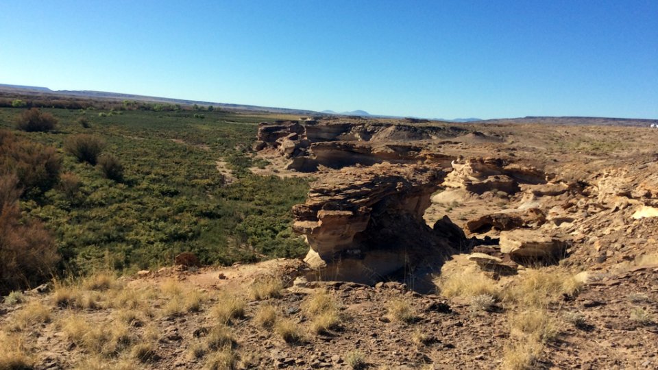
Charles Huskon No. 11 & 26 abandoned uranium mine site.
-
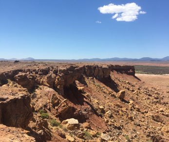
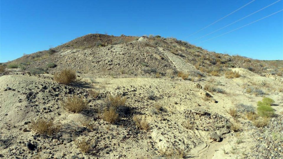
Charles Huskon No. 14 is one of the El Paso Natural Gas priority mines.
-
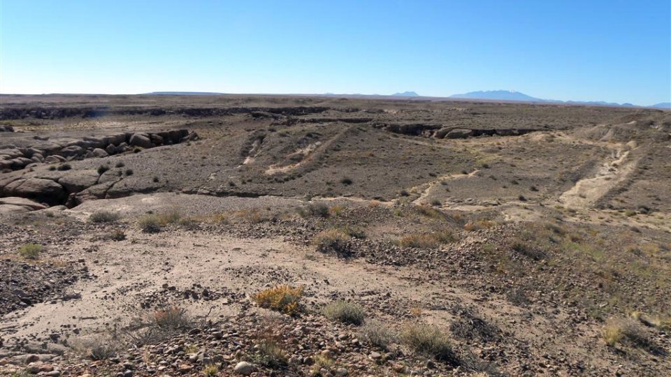
Charles Huskon No. 14 is one of the El Paso Natural Gas priority mines.